Weather in North Carolina can be a rollercoaster… that’s an understatement! Spring is a transitional season when we see all types of weather: cold, warmth, rain and even severe potential.
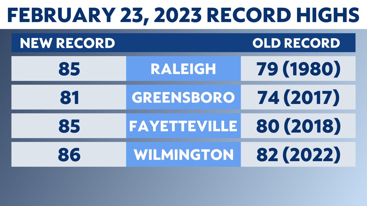
February brought above-average temperatures across the state. Some record highs were absolutely shattered. So it’s no surprise that flowers bloomed and pollen covered our cars. It felt like spring, and, minus the pollen, most people were loving it!
The past week provided an unwelcome reality check. Cooler-than-average temperatures and wintry precipitation swept back in like they belonged.
Technically, they did belong–it is still winter! While climatological spring began on March 1, astronomical spring and the vernal equinox haven't yet arrived.
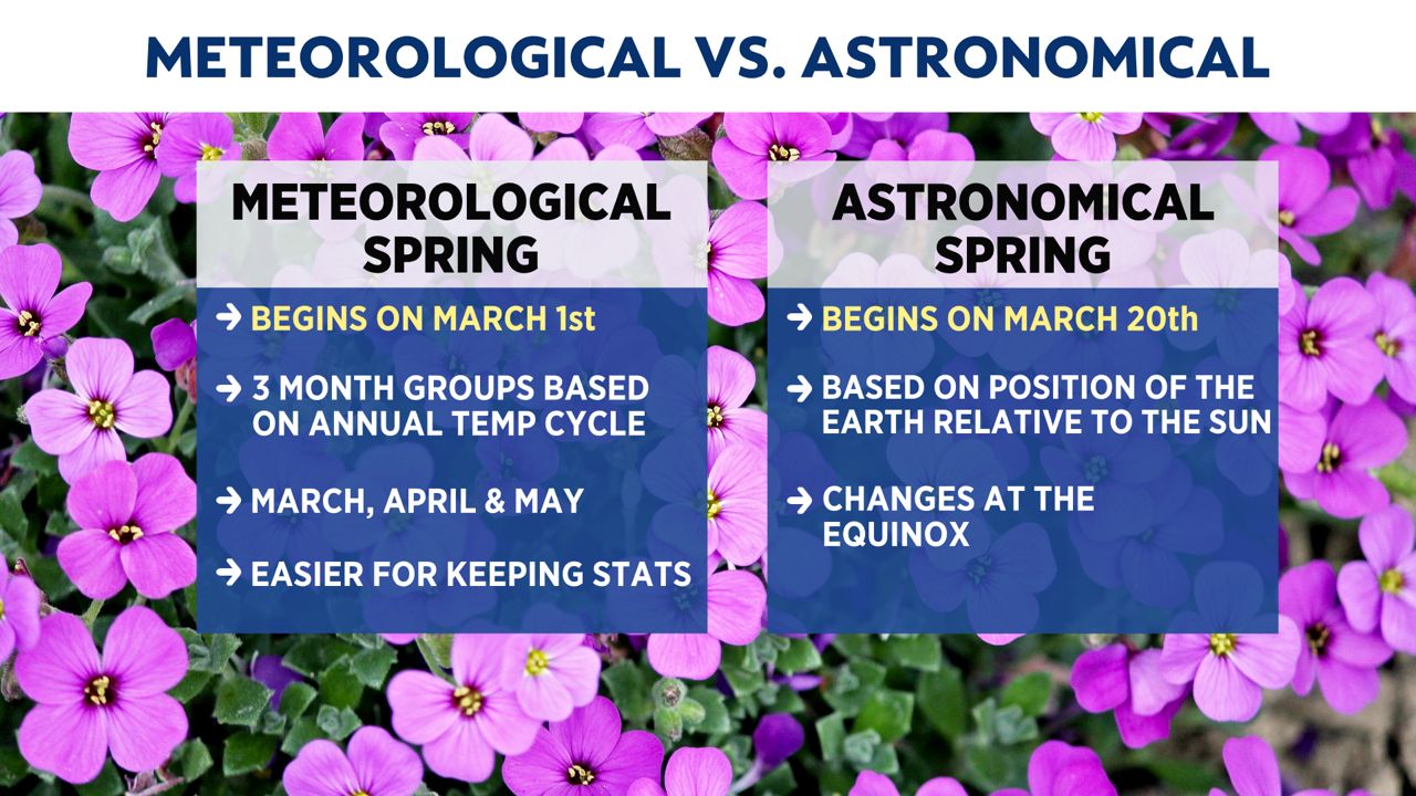
There are two equinoxes within the year: one in the spring and the other in the fall. This year, spring equinox occurs at 5:24 p.m. EDT on Monday, March 20.
You can think of the equinox as “equal”: day and night are approximately the same length. In Raleigh, sunrise is around 7:19 a.m. and sunset is around 7:26 a.m. on the first day of spring.
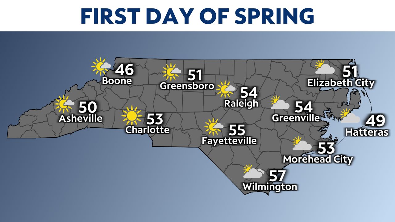
The weather is looking cooler than average to kick off spring, but conditions remain dry across the state.
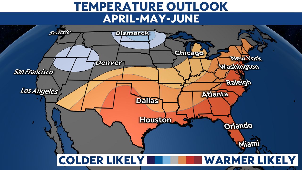
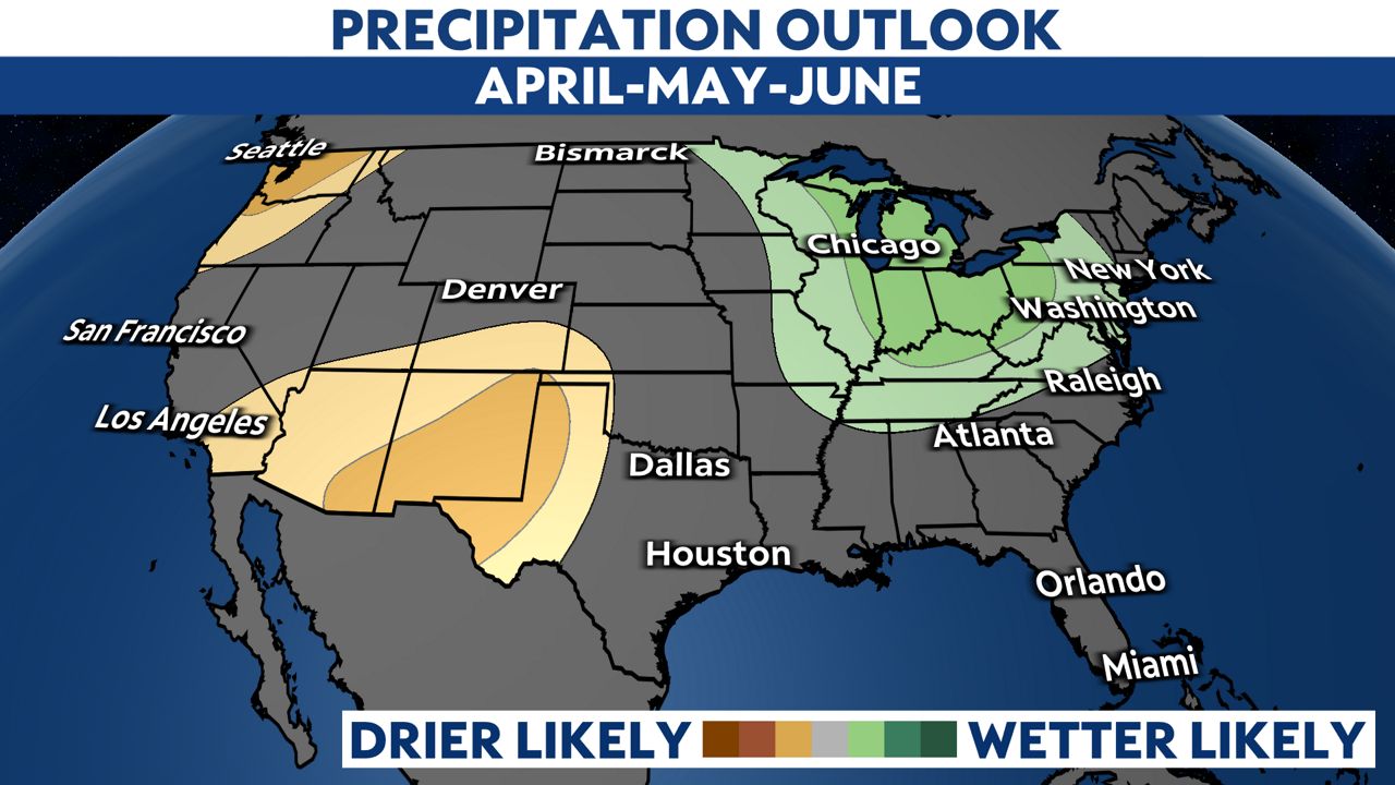
What can we expect for spring as a whole? The Climate Prediction Center three-month temperature outlook shows that warmer-than-average weather is likely across North Carolina and much of the Southeast. The precipitation outlook shows equal chances of wet, dry or normal for April through June.
Enjoy the first day of spring and the months to come!
Our team of meteorologists dives deep into the science of weather and breaks down timely weather data and information. To view more weather and climate stories, check out our weather blogs section.


