Recently, Punxsutawney Phil saw his shadow, predicting six more weeks of winter with more cold and snow for much of the nation.
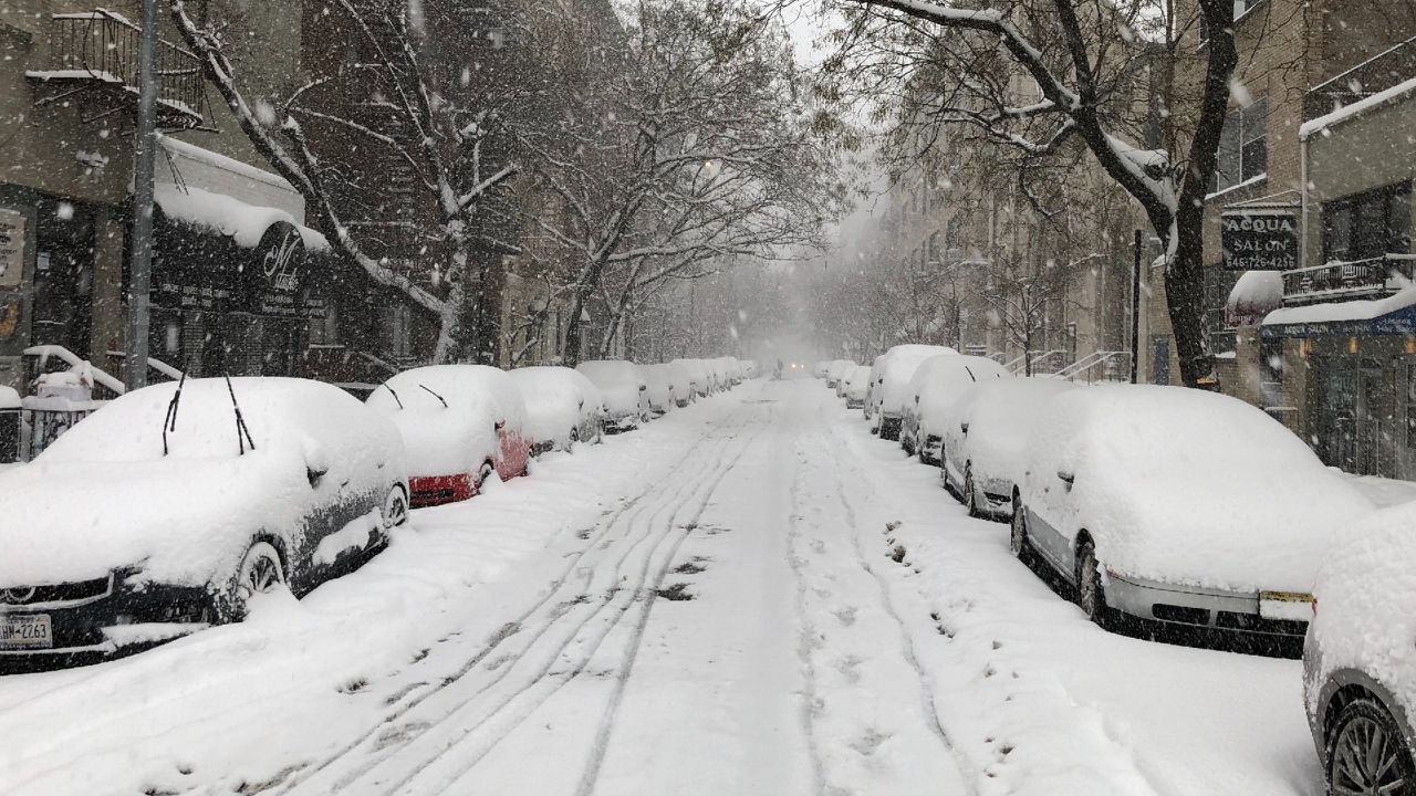
It appears he may have been correct given the recent snowstorms and very cold temperatures much of the country has endured so far this February.
Has he been studying the weather patterns deep in his burrow, or maybe even the polar vortex?
Meteorologists correctly predicted back in January that very cold arctic air would plunge into the Lower 48. So, what exactly is the polar vortex, and how does it affect our winter weather here in the U.S.?
The polar vortex gained notoriety a few years ago when the media caught wind of its existence. They described it as some new and strange phenomenon that was causing wacky winter weather.
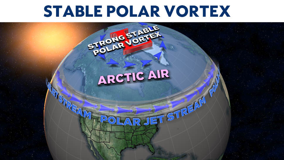
However, scientists have known of its existence for a long time. The polar vortex is an upper-level low pressure circulation of cold air that resides, you guessed it, over polar regions of the earth.
Often, this circulation is stable and moves very little over the same region during the winter months as long nights allow this cold air to become colder.
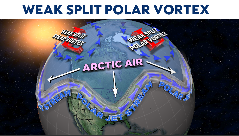
However, this feature can, on occasions, become dislodged from the North Pole or even split up into two distinct circulations.
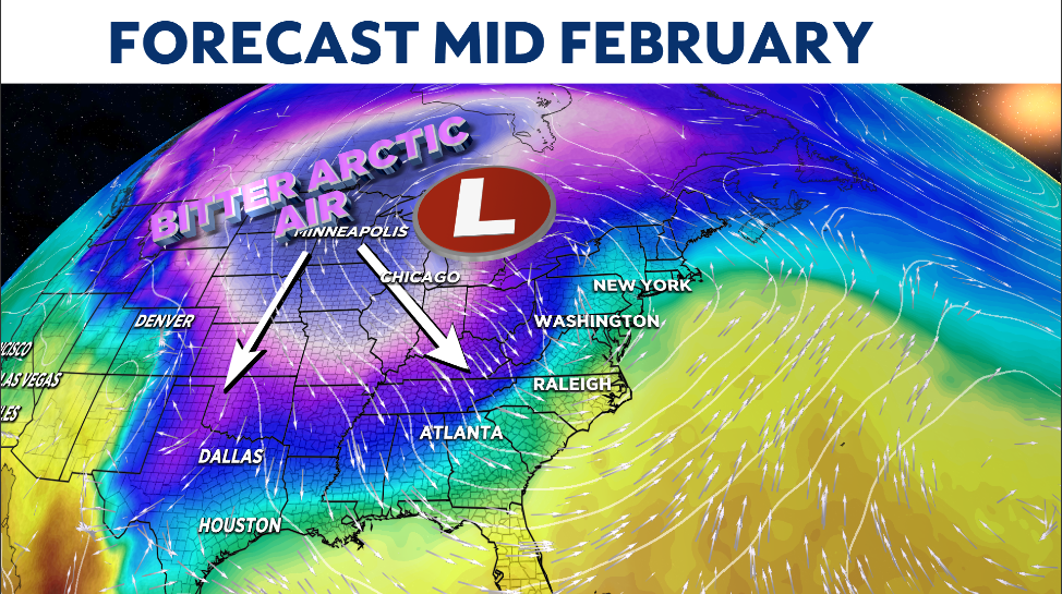
When this happens, it can cause the polar jet stream (the river of fast upper-level winds that separates cold air from warm air) to become amplified, with large dips and rises in its flow.
This type of jet stream pattern allows bitterly cold Arctic air to plummet south into the U.S. and also provide the fuel to produce powerful winter storms like the Midwest and Northeast have recently experienced.
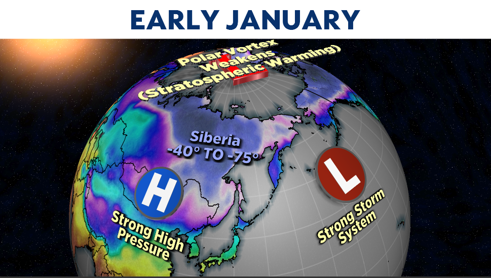
So, what happened back in early January that tipped scientists off that our winter was going to change?
The atmosphere has different layers. The lowest layer is the troposphere, where 90% of all weather occurs and is quite turbulent. The stratosphere just above it is very quiet and stable.
In early January, a very strong high pressure system formed over Asia, producing extreme bone-chilling temperatures in Siberia, where temperatures dipped as low as -73 degrees and stayed below -40 degrees for over a month!
This feature combined with an intense North Pacific storm and sent atmospheric waves upwards into the stratosphere, disrupting the polar vortex.
This is a “stratospheric warming event” and can often affect the polar vortex by weakening it and causing it to become unstable, allowing it to wobble and even split. When this happens, it allows the polar jet stream to bend and causes large troughs and ridges in its flow, dislodging the arctic air in the high latitudes and sending it southward into the U.S.
This cycle, from the beginning of the upper-level warming event to the cold surface air plunging south, can take weeks to occur.
So, back in January, some meteorologists predicted the tranquil winter weather would end by early-to-mid-February.
Because this event happened so late in the winter season, scientists believe the polar vortex will remain unstable for the rest of the season and maybe into early spring.
This means the odds for more severe winter conditions could persist. We’ll have to wait and see what Mother Nature has in store for us. Maybe Phil knows more than we may think.