Regions of North Carolina could be at very high risk for fire danger on Jan. 15 lasting through the rest of the week, according to a National Fire Danger Rating System.
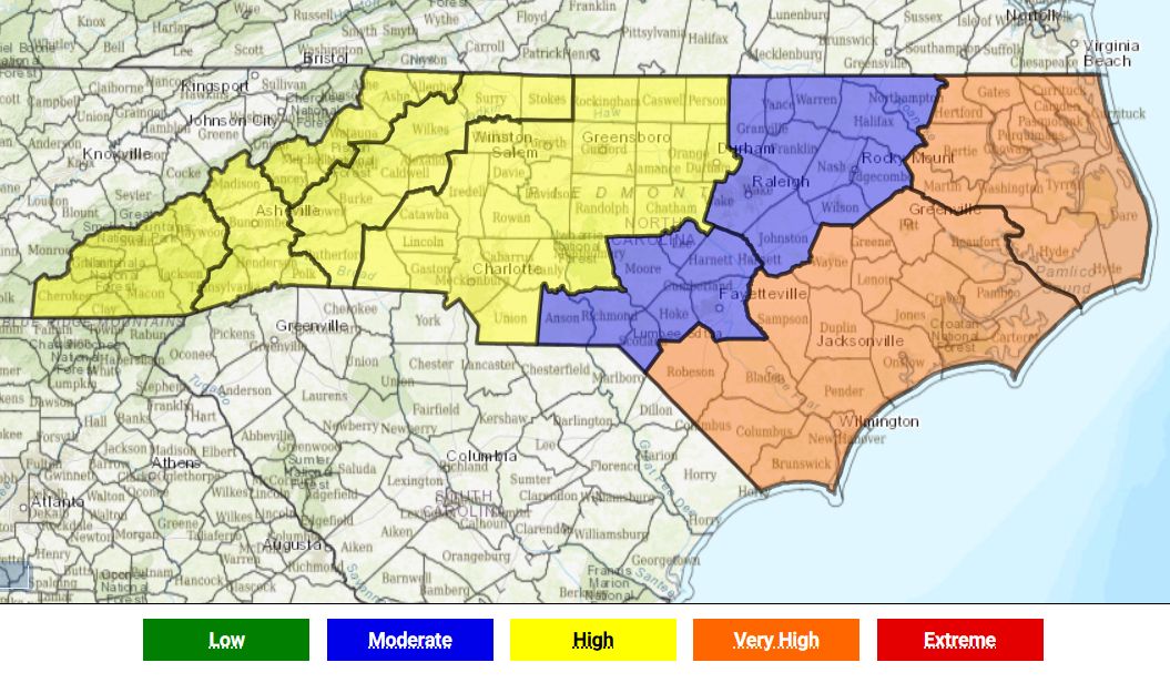
The map provided by the North Carolina State Climate Office shows the Southern and Northern Coastal regions at a very high risk for fire danger on Jan. 15, while the Northern and Southern Highlands, Western Piedmont and Blue Ridge Escarpment remain at a high risk for danger.

On Jan. 16, the state remains at the high risk overall, including the sandhills region. The following day has the same high risk, with the Central Mountain region becoming very high risk for fire danger.
On Jan. 18, the risk for fire danger begins to calm, with the eastern part of the state dropping to moderate risk for fire danger, and the western part remaining high. By Sunday, Jan. 19, the risk for fire danger drops significantly, with the state having no risk, low risk or moderate risk.
The N.C. Forest Service reported 5,101 fires for a total of 18,748 acres in 2023, a slight decline from 2022, which brought 6,099 fires for a total of 20,126 acres.
The North Carolina State Climate Office map shows the forecasted fire danger as assessed by the Adjective Rating, a National Fire Danger Rating System “parameter describing environmental conditions that could cause fires to ignite and spread.” Each region of the state has similar topography, vegetation and climate.
The N.C. Forest Service warns residents about these conditions and safe burning practices before participating in an outdoor fire.


