


This weekend, relatively quiet weather continues around the Carolinas. A few showers and storms are possible along the coast.... otherwise look for warm and dry weather around the region.
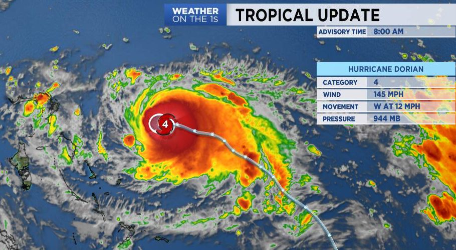
Dorian is a powerful Category 4 hurricane this morning and is moving a little north of due west at around 12mph.
The overnight computer models continued to slowly trend east with the eventual track of Dorian. As Dorian continues to approach the northern Bahamas, its forward speed will slow, and the system could even stall for a period of time. This looks pretty devastating for Grand Bahama Island and Great Abaco Island.
After slowing to a crawl, Dorian will head generally north while weakening and eventually bend NE and out to sea. The extremely tricky part is that the result will be a track that somewhat closely mirrors the shape of the coast of the Southeast from Florida up through the Carolinas.
In general, I am leaning toward a track northward a little off the Florida coast and then a turn to the northeast a little off or very near the Carolina coast.
Assuming this track idea is correct, the Charlotte metro would have very little impact from Dorian whatsoever. For the coast, impacts will depend on whether the track is right along the coast vs. 50-100 miles offshore. It is far too soon to know those details.
Greatest coastal impacts right now look to be later Wednesday into Thursday.
One final note..... this does *NOT* look like a Florence situation regarding flooding. Some quite significant rain totals could occur in eastern NC, but it appears the system will be moving along at a pretty good clip by the time it gets to the latitude of the Carolinas. This would prevent the insane rain totals that occurred with Florence from happening with this one.
Get instant severe weather alerts to your phone and email. Click here to sign up!