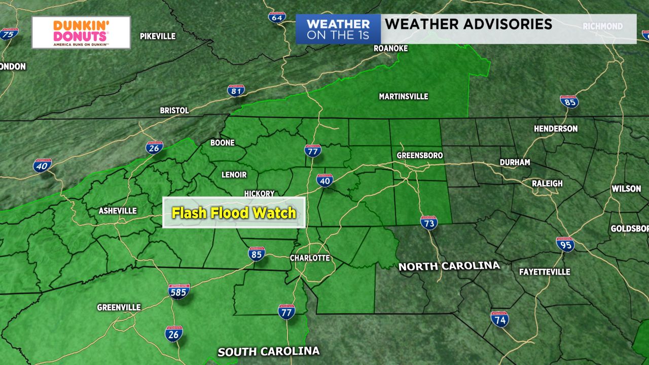
A deep flux of Gulf of Mexico moisture will continue to infiltrate the Carolinas through the end of the work week. As soils become increasingly saturated day after day, localized flash flooding will become a threat region-wide.
- Flash flooding will be a threat region-wide.
- A few storm cells could reach severe.
- Heaviest rainfall expected in mountains and foothills.
A moist, southerly flow will strengthen Tuesday, leading to additional rounds of showers and storms. While heavy rainy will be the main threat, a few storm cells could reach severe criteria and be capable of producing damaging winds. The heaviest of rainfall today is expected in the mountains and foothills, where some areas will have the potential to pick up an inch or more of precipitation just through Thursday morning. Temperatures will remain cooler thanks to the abundant cloud cover with highs in the low to mid 80s.
This same weather pattern will persist at through at least the end of the work week as Bermuda High off the East Coast essentially "blocks" the upper-level pattern from changing. Over the next five days, we'll have the potential to pick up anywhere between 3" to 5" across the Charlotte metro and eastern Piedmont with heavier amounts in the 3" to 7" range for the mountains, foothills, and western Piedmont. Flooding will likely become an issue in some areas. Stay tuned for your latest weather alerts, and remember, "turn around, don't drown!"
Get the latest news, sports and weather delivered straight to your inbox. Click here to sign up for email and text alerts.