After a rather pleasant and quiet holiday weekend, all eyes across the Carolinas and along both the Gulf and East coast will turn to Irma this week.
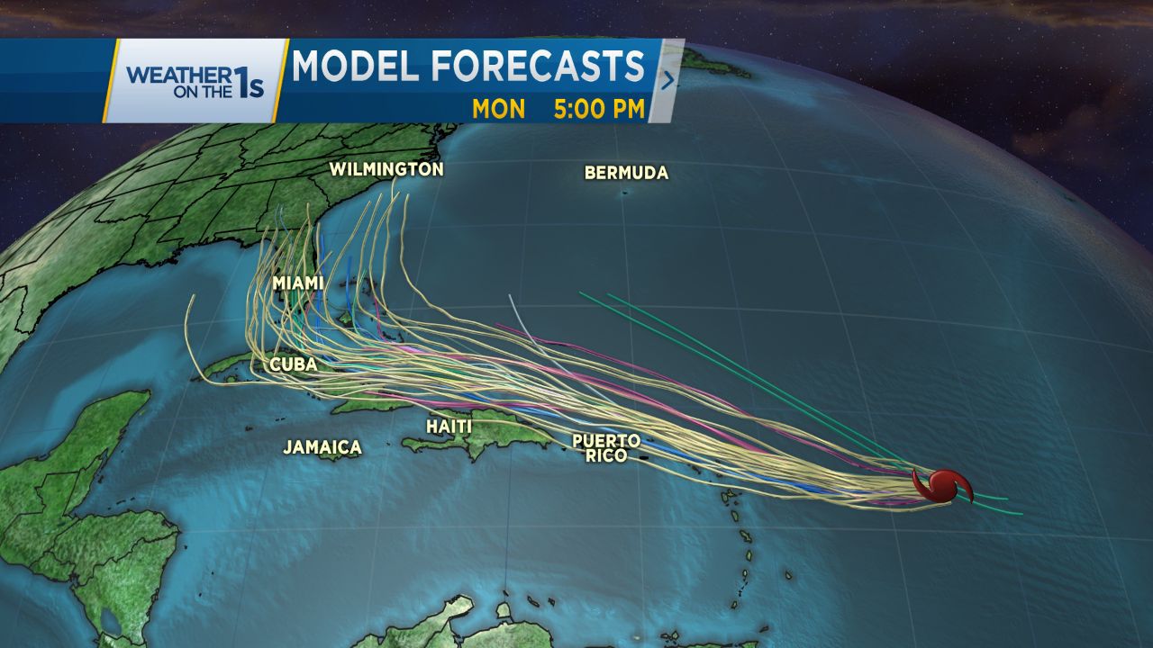
Now a Category 3 hurricane, Irma has the potential to strengthen as it pushes westward toward the Leeward Islands and will likely maintain its strength as it takes a track towards Hispaniola, the Turks and Caicos and the Bahamas late this week.
Although still days away, where a lot can still change regarding the forecasted track of Irma, the chances for direct continental U.S. impacts are increasing.
The final track will depend on the way several aspects of the weather actually end up playing out. Although confidence in any given track still remains extremely low for now, models should have a better grasp on the track of Irma by Tuesday and Wednesday.
Monitoring the forecast and having a hurricane plan at the ready will be important in the following week for all along the coast and even here across central North Carolina.


)