

HONOLULU — As of 10:03 Saturday morning, the National Weather Service continues to designate Calvin as a tropical cyclone that the agency expects will gradually weaken as it “passes very close to, and possibly over, the islands from Tuesday night through Wednesday night.”
The National Hurricane Center’s Saturday forecast indicated Calvin weakening as it moved over cooler water with winds dropping below hurricane strength in its approach to Hawaii Island on Tuesday.
With both predictions by the NWS and National Hurricane Center, officials said residents can expect breezy tradewinds and showers over the weekend, but there is still potential for locally strong winds up to 40 mph or greater that could generate high surf and dangerous rip currents.
The hurricane center said it’s too early to determine the exact location of contact and magnitude of potential impacts. They urge residents to monitor the latest forecast updates.
“We’re still hopeful that Calvin won’t cause any major problems, but after three quiet hurricane seasons, we don’t want people to be complacent about this hazard,” said James Barros in a news release. Barros is the administrator of the Hawaii Emergency Management Agency.
“Even if it weakens as expected, the storm still poses potential threats from heavy rain, high wind and coastal waves and rip currents,” he said. “Don’t be caught unprepared.”
On Friday, Honolulu’s Department of Emergency Management coordinated a call with city departments that included a weather briefing by NWS Warning Coordination Meteorologist John Bravender and planning led by DEM Director Hiro Toiya, according to a news release.
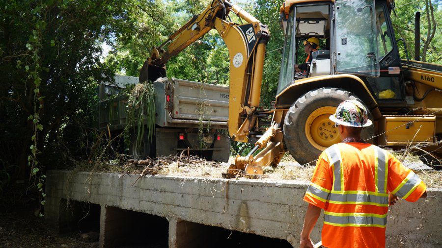
Crews with the city’s Department of Facility Maintenance also began work to prepare for the possibility of heavy rain and flooding.
DFM crews spent part of Friday removing tree branches and other debris blocking a drainage culvert along Ahiki Street near the intersection of Hihimanu Street in Waimanalo.
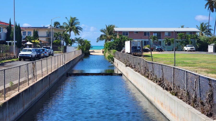
Along the Waianae coast, crews lowered the “sand plug” at Ulehawa Stream using an excavator.
Crews will continue to assess streams and drains requiring attention over the July 15 weekend into next week.
Hawaii Department of Transportation crews along with contractors are also preparing for Calvin across the state by routinely checking on drains and bridges, areas susceptible to rockfalls, and low-lying spots along freeways, highways and roads.
In a news release, the Hawaii Tourism Authority is also monitoring Calvin and urges all visitors and residents to be vigilant and heed official updates and advice from local emergency management agencies.
They also urge swimmers to stay informed about ocean conditions by talking to on-duty lifeguards and sign up for text alerts via each island’s respective emergency management agency.
County of Hawaii officials encourage the public to remain vigilant and prepare for potential hazards related to heavy rains, flooding, high surf and high winds, according to a news release.
While the 2020, 2021 and 2022 hurricane seasons were below normal, the Central Pacific Hurricane Center has forecast a “slightly above-normal” season for the region that includes Hawaii.
“We call need to shake off the rust from those slow seasons to be sure we’re prepared for a hurricane,” said Barros. “We’re not sure what Calvin will bring, but it’s still a great reminder of what we need to do to get ready.”
HI-EMA recommends:
- Sign up for emergency alerts from your respective county.
- Be aware of hazards around your home or business — trim tree branches, check for and secure objects (big and small) that could become projectiles in high winds, clear obstructions in drainage areas, consider using sandbags to block water from flood-prone areas.
- Make a plan — discuss ways to meet up with household/family members in case of separation during the storm, know the routes to leave the area if it’s not safe to stay at home.
- Prepare at least 14 days of supplies — food, water, medicine, baby food, pet food and other essentials for each household member. Click for “2 Weeks Ready” information.
- Rely on authoritative sources of information, such as county emergency managers or the NWS.
Sarah Yamanaka covers events, environmental and community news for Spectrum News Hawaii. She can be reached at sarah.yamanaka@charter.com.