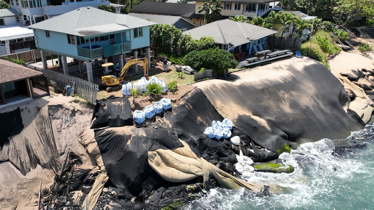


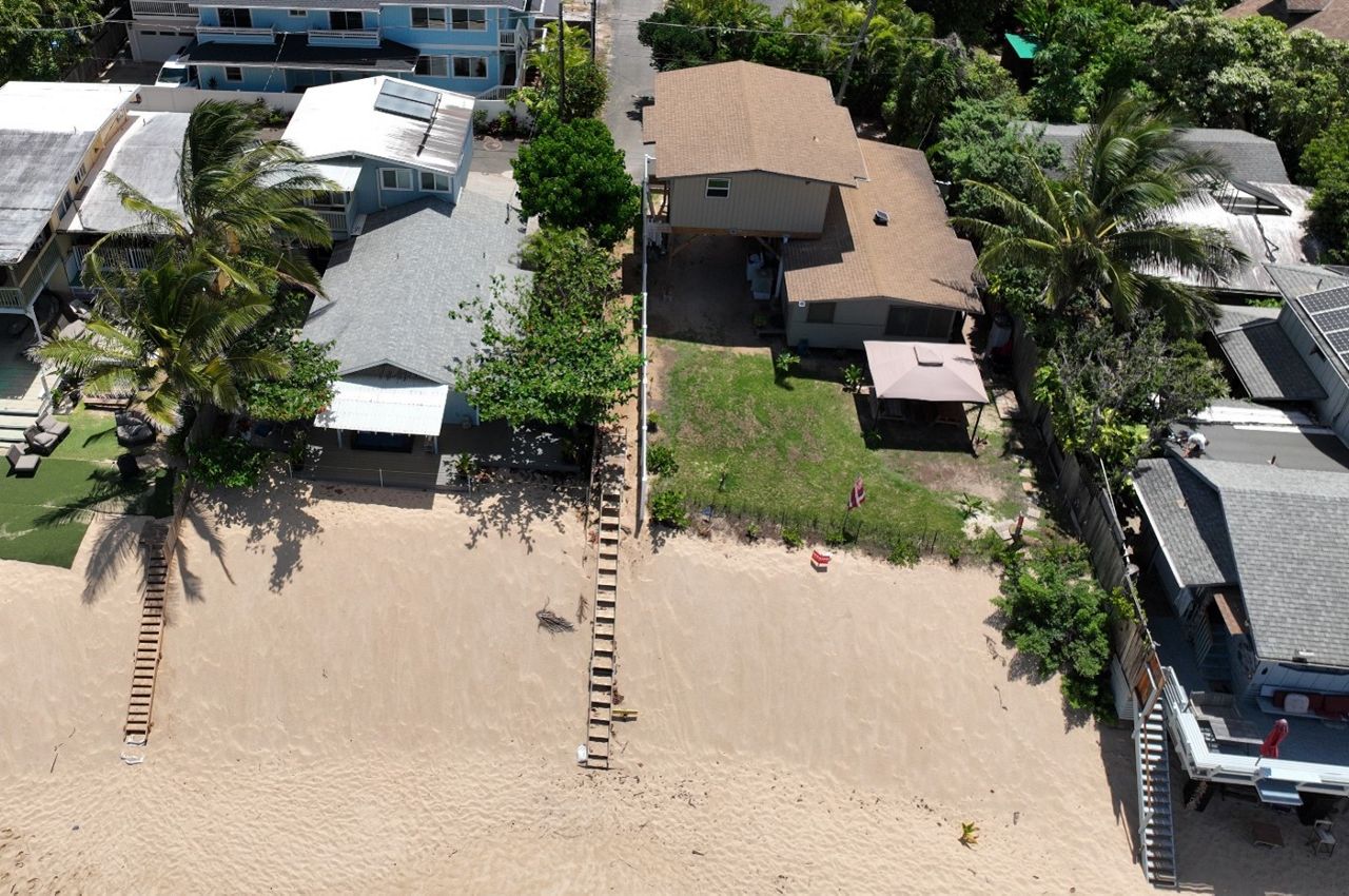
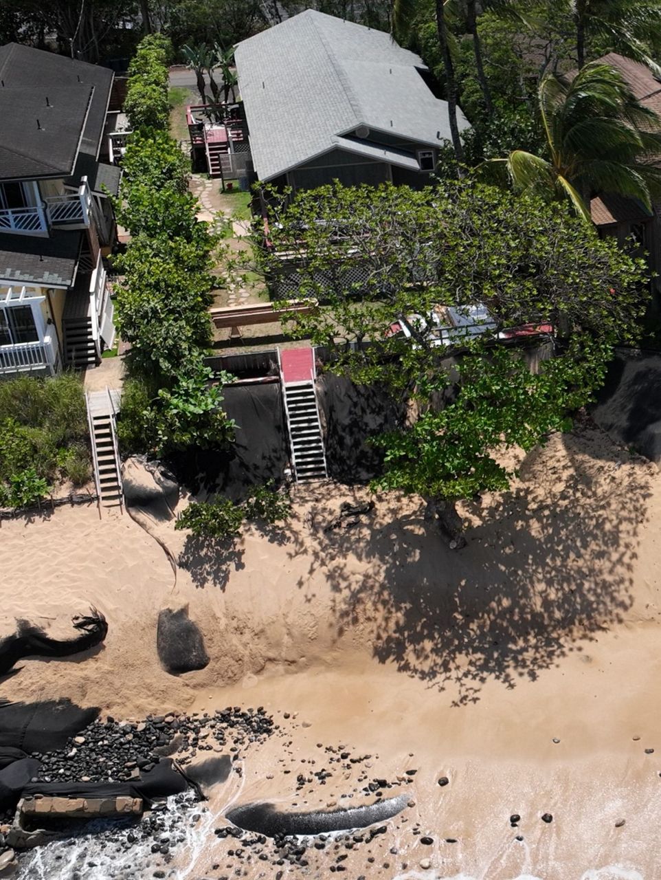
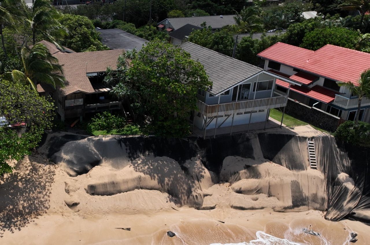
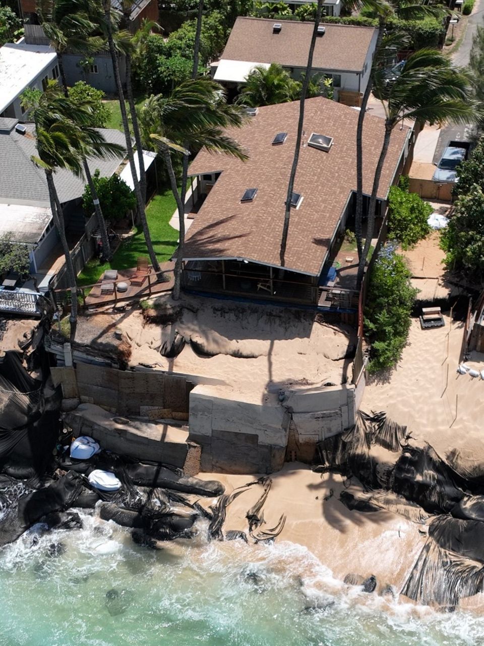
The Department of Natural Resources released aerial photos of 20 homes at the Paumalu ahupuaa on the north shore of Oahu that are close to falling into the ocean. This area is also known as Rocky Point and is adjacent to Sunset Beach Park.
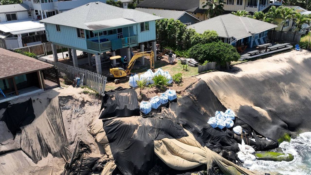
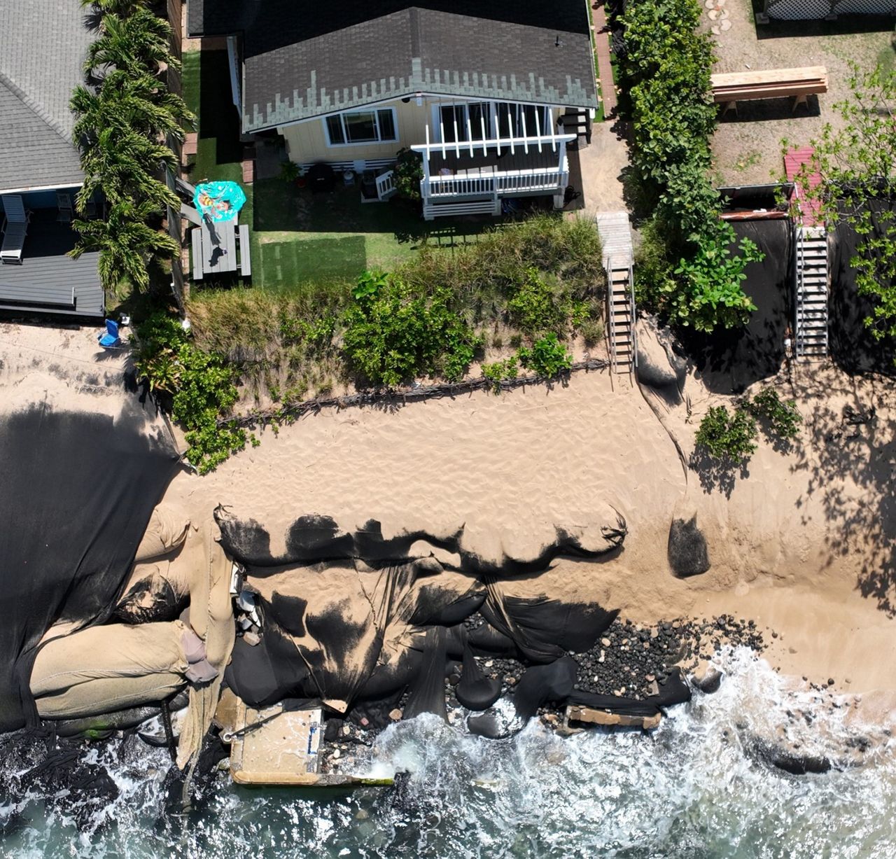
All the homeowners have illegally placed sand bags wrapped in geotextile fabrics or large, black fabric curtains on the public beach in front of their properties in an attempt to stop coastal erosion. Now, these temporary structures have been exposed by the waves and wind, and are littering the ocean, according to a DLNR news release.
About 10 years ago, erosion started to threaten the homes in this part of the north shore and DLNR issued emergency permits to “shore” up the land under their foundations with the idea that this would buy the property owners time to move their homes and cesspools. However, all the permits have expired, but few have made any moves.
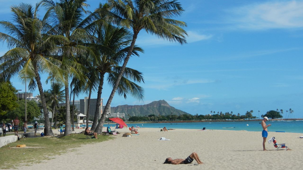
The shoreline is meant to change, widening and narrowing along with the seasons, and hardening the coast with temporary structures or sea walls is known to disrupt the natural movement of sand, leading to beach loss. At least 13 miles of beaches have been lost in Hawaii due to erosion and sea walls, according to DLNR.
DLNR said the Paumalu area is especially important to them, because it's their duty to protect public trust resources, and all the homes border public beaches and are within a State Conservation District.
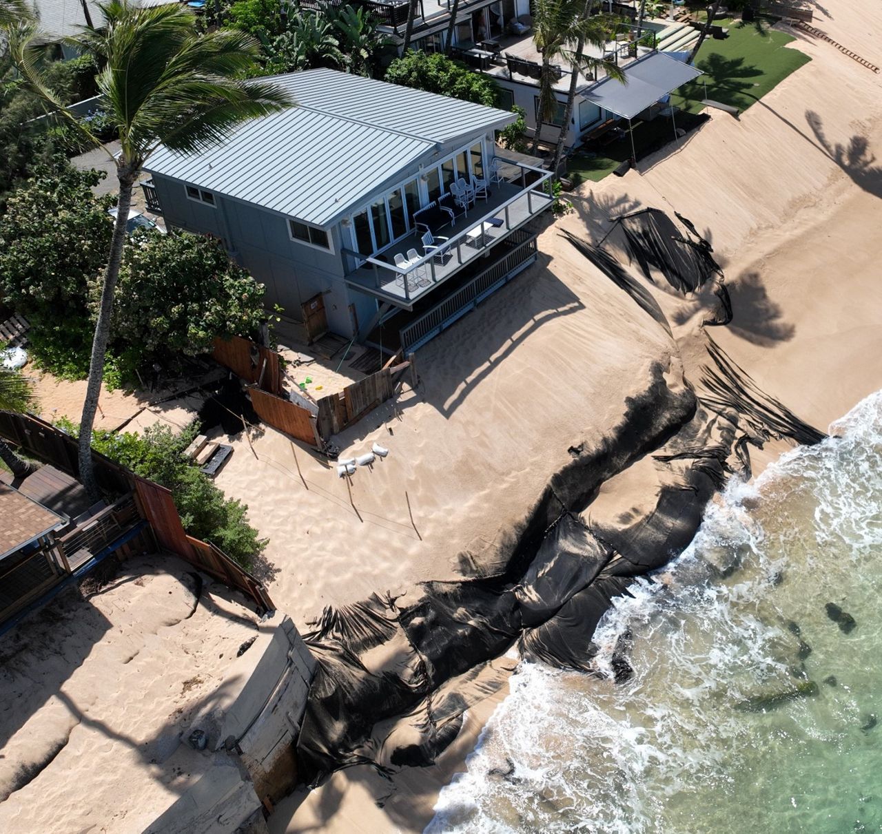
Earlier in September, DLNR used a drone to survey the homes. The photos show the homes sitting atop sandy soil just above what remains of the public beach, looking as if they are about to fall into the sea. They also reveal that many of the homes continue to create temporary structures to harden the shoreline without permits and in violation of Conservation District rules.
“It’s a real mess and the photographs clearly show it,” Michael Cain, who is the administrator of the DLNR Office of Conservation and Coastal Lands (OCCL), said in the news release.
The drone footage revealed that underneath and around the large, black geotextile tarps are sand bags, large boulders, polyurethane bags and cement.
“We don’t always know what’s beneath the tarp,” Cain said.
Cain said the temporary structures were only meant to last a year or two — not a decade — and now they’re ripping apart.
“We’re finding plastic in the shorelines. We’re finding debris up on the rocks and on the reef that is from these unauthorized structures,” Cain said.
DLNR officials have created an 18-page document that details the permit history of each home, shows the expired erosion control methods still in use, any enforcement actions, and whether the temporary structures fronting the homes are blocking beach access.
The document notes that the house at 59-181 H Ke Nui Road, which collapsed onto the beach on Feb. 8, has been pushed back onto dry land and an artificial berm was built in front of the property without authorization.
The home at 59-157 Ke Nui Road was sold on May 31, 2022, for $2,650,000, despite being issued a Notice of Alleged Violation in Aug. 2021 for work done without authorization, including installation of erosion control materials on state land and the installation of stairs.
Cain said that the temporary permits came with a set of criteria to minimize the environmental impact, and their investigation has shown that none of the property owners has complied with all the conditions of the permits.
“The current system of bringing enforcement actions to the Board of Land and Natural Resources, working our way through the process for contested cases requested by landowners on alleged violations, and then following up when cases are appealed in court, is slow and inefficient. Unfortunately, this process is the only enforcement tool OCCL currently has available,” Cain said.
While the temporary structures are impacting the beach, Cain said if they are removed, houses and cesspools will fall into the ocean.
“We fix one environmental disaster; we create a new one,” Cain said.
He said his team has been talking with the state legislature and county officials to come up with a solution for managed retreat. According to Cain, the county planning department is working on a program to transfer development rights that would allow property owners to relocate inland. He said land would still need to be assessed to determine what would be appropriate for new developmental rights, and financial resources would be needed to restore the dune ecosystem once the beachfront homes were removed.
“We talk about ‘retreat,’ but no one has successfully implemented retreat in a densely populated area like we have with little room to move inland. We don’t have many role models to follow, and Hawaii is going to have to take the lead in finding solutions,” Cain added.
Michelle Broder Van Dyke covers the Hawaiian Islands for Spectrum News Hawaii.