


A low pressure system and cold front will bring extremely high winds and rain with the potential for some severe storms to parts of Texas today.
There is a marginal risk of severe storms from Dallas/Fort Worth south through Waco into Austin. A slight risk for severe storms exists for areas east of I-35 and southeast portions of the state with all types of severe storms possible, including damaging winds, hail and a tornado or two.
The highest threat area will be for southeast and coastal Texas, where the Storm Prediction Center has highlighted this region as having a level 3 out of 5 risk of severe weather, or a "enhanced" risk.
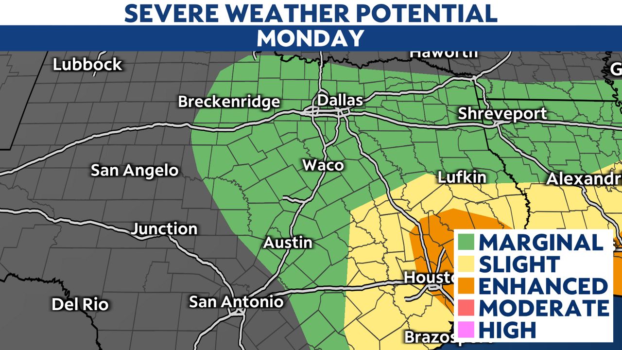
North Texas and Central Texas will see scattered storms through midday. Damaging straight line winds, periods of heavy rain and cloud-to-ground lighting are the primary threats.
Please exercise caution driving and if you have a high-profile vehicle, drive slower than normal with extra breaking distance as high winds pull hard from the west and northwest.
We could see thunderstorms still rounding through the metroplex down the I-35 corridor through the early afternoon.
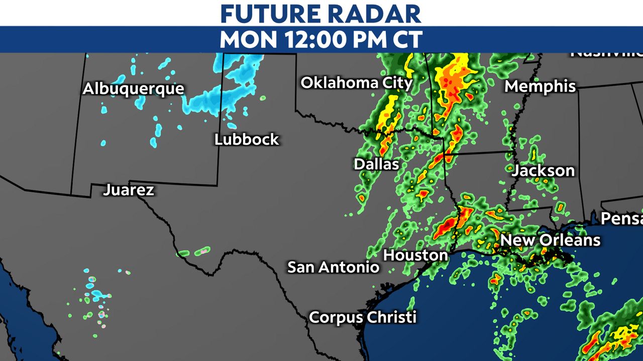
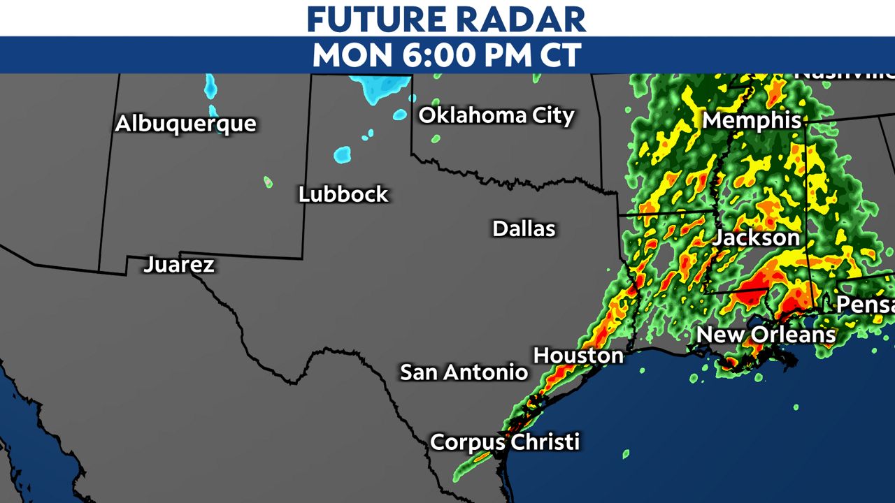
Coastal Texas, especially into Houston, will get the heaviest brunt of severe weather activity from midday until 8 p.m. Isolated, smaller scale tornadoes, hail and damaging winds are the primary threats. Please stay weather aware throughout the day.
After the cold front passes on Monday, gusty northwest winds will pick up across the Lone Star State as much colder air sweeps in.
Wind Advisories and High Wind Warnings are already in effect for much of the state.
Sustained winds will pick up to 25 to 35 mph with gusts as high as 50 mph. Areas under High Wind Warnings in higher elevations could see wind gusts up to 70 mph.
The combination of high winds and low relative humidity will lead to elevated fire danger. Any fires that develop can spread rapidly, so outdoor burning is strongly discouraged.
Our team of meteorologists dives deep into the science of weather and breaks down timely weather data and information. To view more weather and climate stories, check out our weather blogs section.