


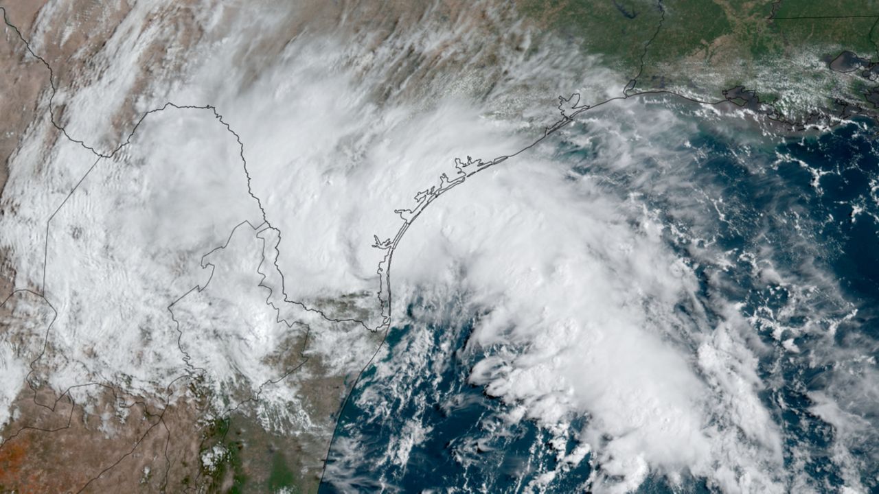
Tropical Storm Harold has officially made landfall on Padre Island. Heavy rains and gusty winds have buffeted areas from Port A south to Kenedy County all morning Tuesday. Tropical Storm Warnings remain in effect from the mouth of the Rio Grande northward to Port O'Connor.
As of 10 a.m. Tuesday, the storm's center crossed the coast bringing with it observed wind gusts as high as 52 mph at Corpus Christi Naval Station. A 58 mph wind gust was recorded at a buoy just offshore. Torrential downpours have also been observed, dropping as much as 4 inches of rain in some localized areas with another 2 to 4 inches of rain possible.
What You Need To Know
- Tropical Storm Harold has officially made landfall
- Harold will begin to weaken rapidly
- Flash flooding is the primary concern through Tuesday afternoon
- Isolated tornadoes will also be possible
Harold is caught up in the strong easterly flow around a mega-ridge of high pressure that is responsible for the searing heat over the last few months across Texas. Because of this, the tropical storm will continue to push through South Texas quickly, and will weaken rapidly after landfall.

Expect squally conditions to last through the late afternoon hours of Tuesday before becoming a bit more tranquil after sunset and into the overnight. We'll continue to see a chance of showers and thunderstorms for South Texas through Wednesday afternoon as the remnants pull away to the west.
Unfortunately, the answer is a resounding “NO!” Even areas near the landfall zone, despite the heavy rain, are going to need more than 2 or 3 inches of rain to relieve the drought, even though something is better than nothing.
For San Antonio, we are expecting several rounds of heavy rain to push through Tuesday afternoon, but rain amounts should be generally a quarter inch or less.
For Austin, about the best that can be hoped for is a few scattered showers extinguishing the record stretch of 100-degree weather, even if only for the day. Widespread heavy rain in the Austin area does not appear likely.
For Dallas-Fort Worth and all of North-Central Texas, the long stretch of hot, sunny weather with temperatures sizzling in the hundreds will continue for the foreseeable future with little to no rain expected over the next 10 days.
Our team of meteorologists dives deep into the science of weather and breaks down timely weather data and information. To view more weather and climate stories, check out our weather blogs section.