Widespread severe weather across all the Dallas/Fort Worth Metroplex is now expected as we head into Saturday afternoon. As you make your plans for the weekend, please make sure you stay weather aware.
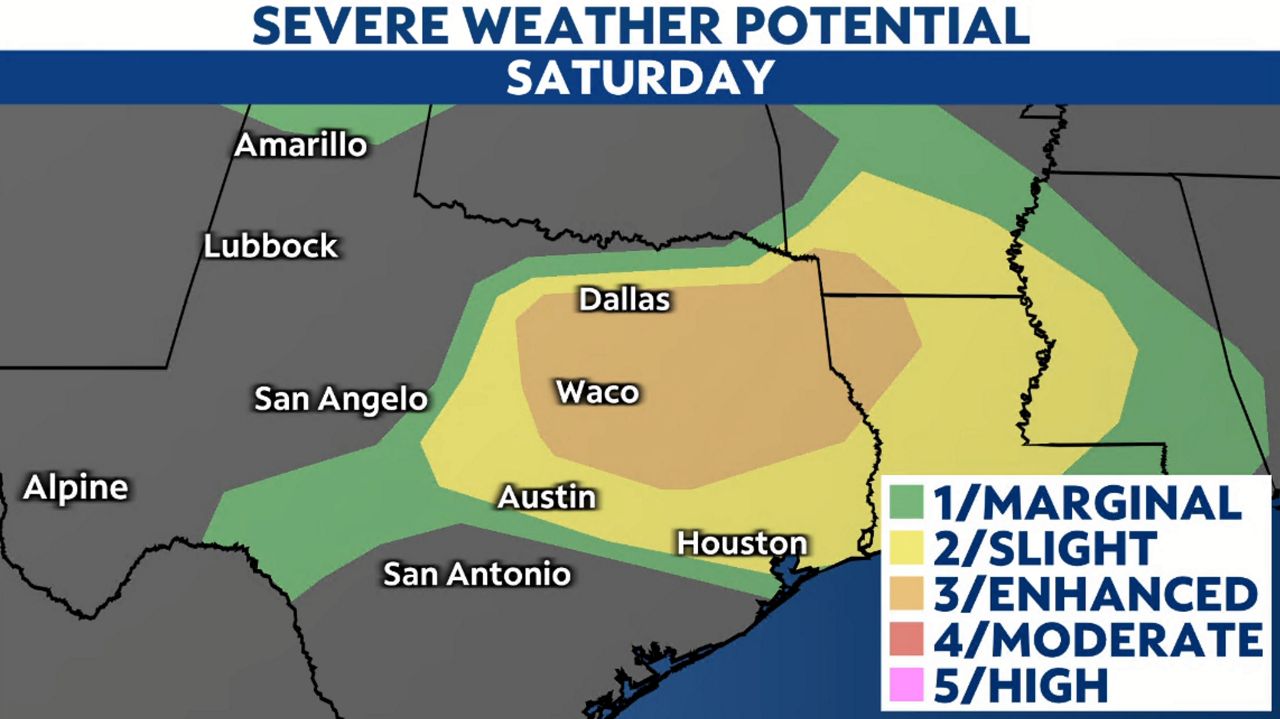
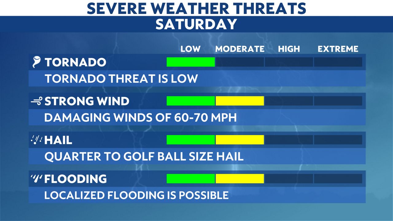
The Storm Prediction Center (SPC) has placed all of North Texas at an enhanced risk (level 3 of 5) of severe weather. With this comes a buffet of hazards, including strong, damaging winds over 70 mph, along with large hail greater than one inch in diameter.

While the tornado risk is “low,” there is still a chance a few tornadoes could spin up.

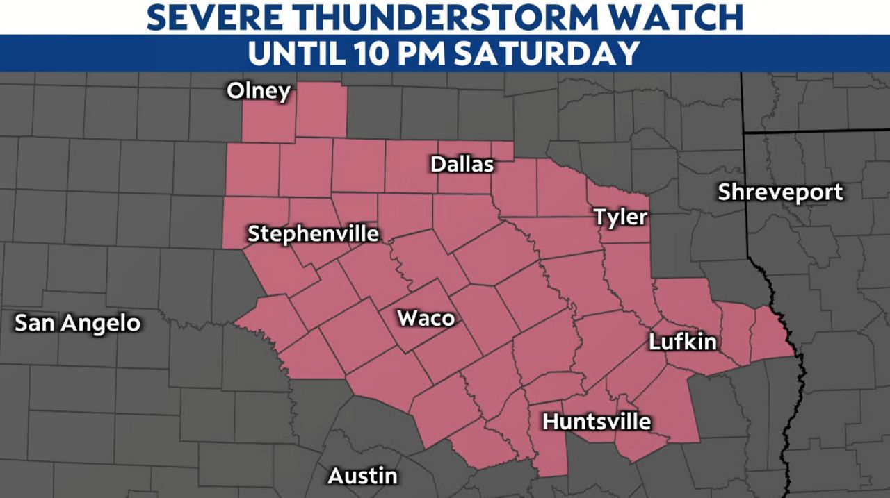
A Severe Thunderstorm Watch has also been issued for North Texas until 10 p.m.

Even though Saturday looks to start off dandy for most, storms moving in out of Oklahoma will arrive between 5:00 and 8:00 p.m. in the evening. Blinding rainfall rates as high as 1 inch per hour or greater can be expected in the most robust storms.
The good news here is that this appears to be a progressive system, which means it’s going to blow through pretty quick, leaving behind quiet conditions after 10:00 p.m.
By Sunday, our attention will focus on intense heat headed for Texas beginning Sunday. Even here in the Dallas/Fort Worth area, temperatures could approach 100 degrees Sunday afternoon.
Our staff of meteorologists will be on hand all day Saturday to bring you the very latest updates as necessary.

Stay weather aware throughout Saturday and prepare ahead of time before the storms arrive. Sign up for weather notifications to receive the latest weather updates, and keep up with this article for the latest details on this event.
Our team of meteorologists dives deep into the science of weather and breaks down timely weather data and information. To view more weather and climate stories, check out our weather blogs section.


