One advantages of spending 30+ years forecasting in Texas is recognizing local weather patterns in the forecast area. As a meteorologist who has seen hundreds of storm events unfold across the region over time, you begin to recognize patterns that storms often follow, even if there’s no obvious reason for that outcome.
In Central Texas, even amateur weather watchers have noticed one pattern in particular: the Invisible Austin Rain Dome.
The scenario is this: Raging thunderstorms approach Travis County–with the city of Austin at the center–from the west, dropping heavy rain and producing severe weather. But as the convective line moves across the county, the storms suddenly weaken, sometimes nearly dissipating.
Then, as the line moves into eastern Travis County, the storms quickly re-intensify and rage again as they push eastward. The result is that heavy rain falls both west and east of the city, but little or none in the central part of Austin.
This radar display from April 5 is an excellent example.
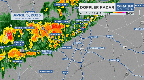
Strong storms suddenly lost intensity as they emerged from the hills west of Austin, only to fire again across the eastern edge of the city.
The Invisible Austin Rain Dome strikes again.
It’s the kind of thing that drives this forecaster crazy, and sometimes it seems like a dome actually exists. But I have a theory for why this occurs.
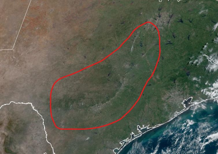
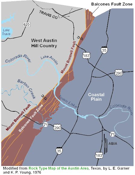
The Balcones Fault line extends from the Dallas/Fort Worth region southwestward through Waco, Temple, Austin and then westward through San Antonio to Del Rio. It's the path that I-35 takes through Central Texas.
The fault is easily seen in this true color visible satellite image and is circled in red. It forms the eastern boundary of the Texas Hill Country and the western boundary of the Texas Coastal Plain.
To the west, the land is a much higher elevation and quickly drops lower, as illustrated in this geographic cross-section.
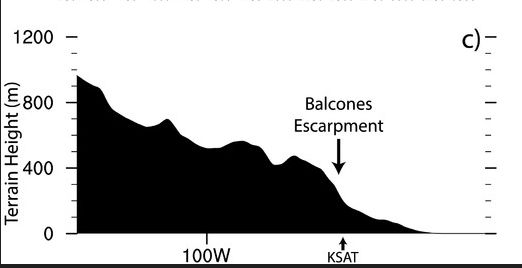
The elevation change is most pronounced in Travis County along the Colorado River.
So what is happening with storms here?
In most cases, strong and severe thunderstorms are rooted at the surface. That is, storm inflow is established at ground level and lifts into the storm. But as storms move across western Travis County, the bottom drops out as the line reaches the fault zone.
This results in a sudden disruption to the storm inflow and storms quickly weaken. But as the squall line reaches the eastern part of the county, they re-establish the surface inflow and quickly intensify.
It’s not an Invisible Rain Dome but a microscale geographic phenomenon.
And it drives me nuts.
Our team of meteorologists dives deep into the science of weather and breaks down timely weather data and information. To view more weather and climate stories, check out our weather blogs section.