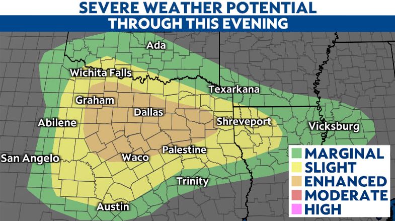
There is now an enhanced risk (level 3 of 5) for severe storms in North Texas on Sunday. Central Texas is under a slight risk (level 2 of 5).
All types of severe weather will be possible beginning this afternoon through tonight. Storms will move through North Texas between 4 to 8 p.m., and Central Texas between 5 to 9 p.m.
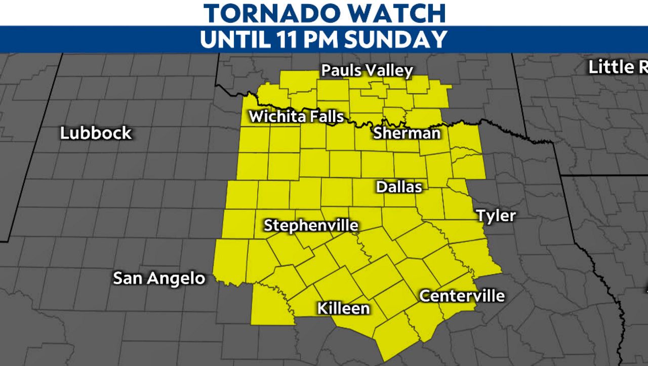
A Tornado Watch has been issued for parts of north Texas, including Dallas-Forth Worth, until 11 p.m. Sunday.

An enhanced risk of severe weather is possible for North Texas later today.
As a potent upper-level disturbance approaches, a surge Gulf moisture will overspread North Texas by midday with dew points climbing into the mid-60s.

This will create a warm sector that will act as a breeding ground for severe storms.
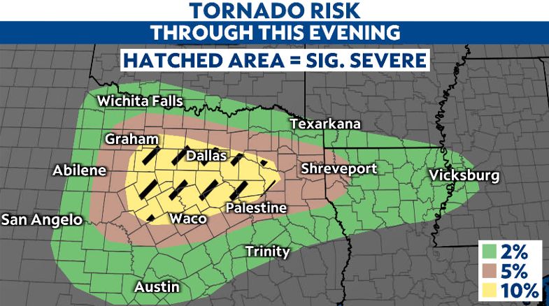
Though the main threats are large hail and damaging winds, all of North Texas, including the Dallas-Fort Worth metroplex, will be under a risk for tornadoes as well.
From 4 p.m. to 8 p.m., we'll have the most favorable window for tornadoes, thanks to added moisture and wind shear values. In the early afternoon, that risk window will mainly sit north of Waco. Although as this system progresses, we'll see that region shift to the north, encompassing the majority of North Texas.

The collision of moisture and instability will likely result in large hail and straight-line winds up to 40 to 50 mph, with isolated 55 to 60 mph gusts across the region. Again, a few spin up tornadoes cannot be ruled out.
Areas north of I-20 could see localized rainfall between one and three inches, which could result in isolated instances of flash flooding. If training of storm cells occurs, there will be a greater chance of flooding.
All activity will be moving to the east and exit our area later this evening.
Stay weather aware and have multiple ways to receive warnings later today.
Download the Spectrum News App and turn on severe weather alerts for the latest watches and warnings.
Our team of meteorologists dives deep into the science of weather and breaks down timely weather data and information. To view more weather and climate stories, check out our weather blogs section.


