


After a rough morning commute in Dallas, Austin and San Antonio, the threat for showers and strong to severe thunderstorms shifts to the Texas coast.
What You Need To Know
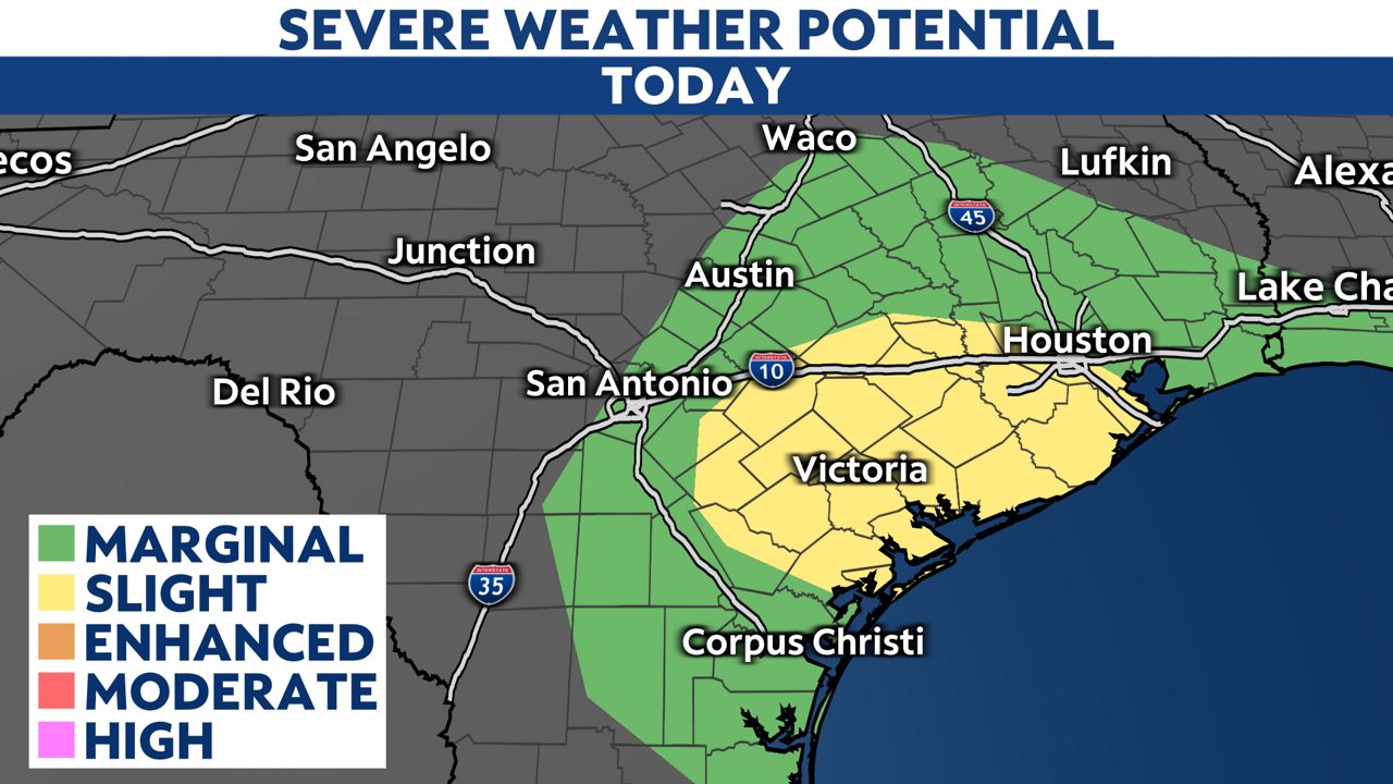
- Large hail and damaging wind gusts are the primary threats
- Scattered showers will continue across North Texas through the first part of Saturday
- Temperatures will trend cooler than normal for many this weekend
The Storm Prediction Center (SPC) has now highlighted a level two risk for severe storms from Houston south to the Victoria Crosswords. The biggest threats will be damaging wind gusts, as well as hail one-inch in diameter or greater. There is a low tornado risk as the storms push east.
Scattered showers will continue for North Texas through mid-morning Saturday as an upper-level low pressure system pulls out of the state. Until that happens, widely scattered showers will continue. Rain could be heavy at times, but I don't expect flooding.
Once the rain clears, temperatures will fall into the 30s and 40s across the the Rolling Plains and the Texas Panhandle. Otherwise, widespread 40s and 50s is expected statewide Saturday morning.
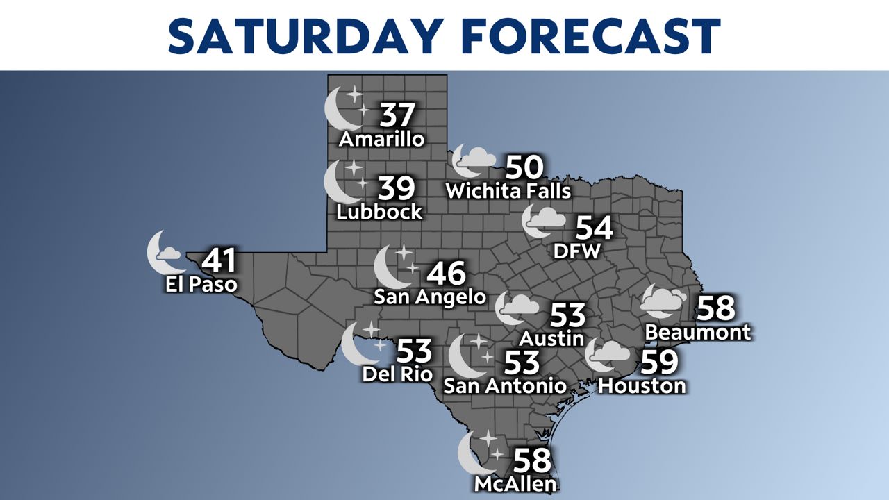
Saturday will feature abundant sunshine west of I-35. East of the interstate, clouds will stick around with some lingering showers around the coast and in North Texas.
Temperatures will trend cooler than seasonal normal high temperatures.
The threat for any active weather will diminish through the afternoon.

Stay alert
Have multiple ways of getting severe weather alerts. You can get notifications from the Spectrum News app–turn them on here.