


Our first severe weather threat of the calendar year will take place tonight across North Texas.
Breezy south winds today will continue to stream in abundant moisture from the Gulf of Mexico. It will be windy at times with gusts up to 35 mph and a high fire danger across the region.
The influx of moisture and higher dew points will help prime the atmosphere for strong storms to develop late tonight as a disturbance moves into Texas.
The Storm Prediction Center (SPC) has painted an area in North Texas with a slight risk of severe weather.
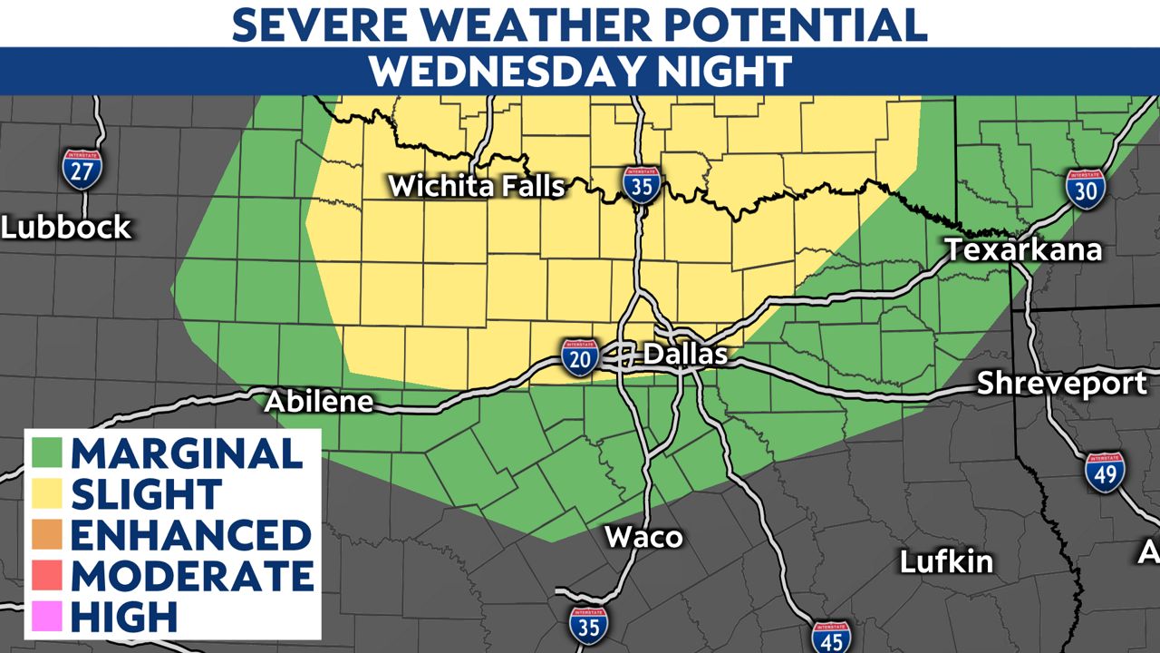
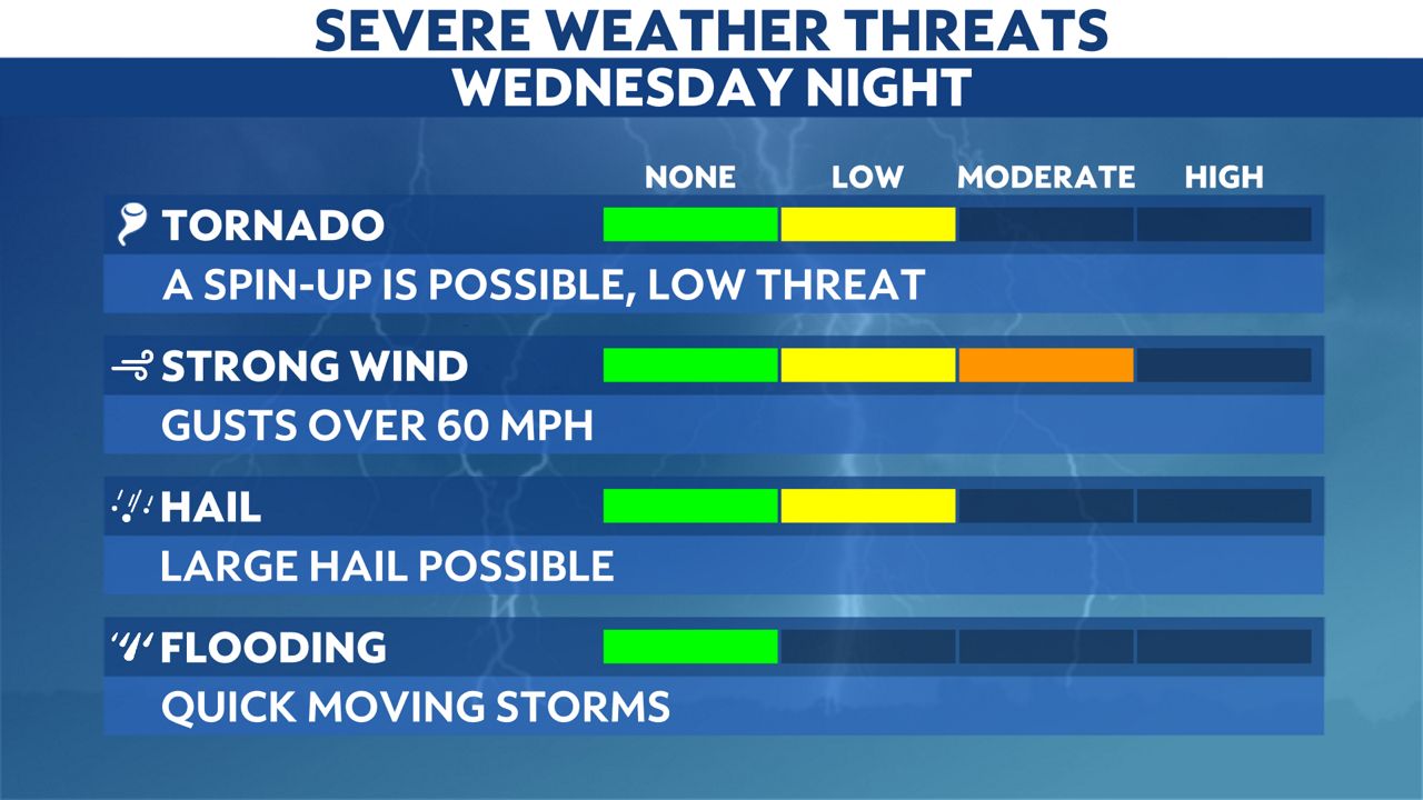
Stronger storms will likely produce damaging winds along with large hail and isolated tornadoes.
Throughout the day, expect mostly cloudy skies, breezy winds and scattered rain and storms after 3:00 p.m.
Stronger thunderstorms will develop in the Panhandle and West Texas along a dry line around 9:00 p.m. The low pressure system and cold front will head east overnight, where a complex of strong to severe storms could fire up.
These storms will arrive in Wichita Falls around or after midnight before making it into the Dallas and Fort Worth area around daybreak. The storms will exit the region with cooler air filtering in Thursday afternoon.
This forecast continues to evolve with each model run. Check back often for the latest updates.
You can also follow Spectrum News 1 or myself on Twitter for up-to-the-minute updates.