After another warm and humid day Tuesday, a cold front overnight will bring strong to potentially severe storms to Texas.
Behind that front, an increased risk for fire danger as winds shift for the northwest.
What You Need To Know
- Severe storms possible after midnight, early Wednesday morning
- Main storm threats will be large hail. damaging winds and isolated tornadoes
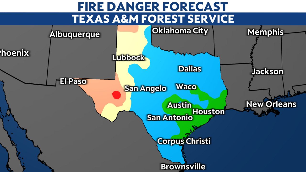
- Increased fire danger Wednesday and Thursday as winds gust up to 30-50 mph
A massive west coast storm will move east into the Central Plains on Tuesday and this will bring a cold front into the Lone Star State during the overnight hours.
However, earlier in the evening the West Texas dry line will fire up with the front catching up to those storms around midnight. This could intensify the storms as they move toward the I-35 corridor.
The Storm Prediction Center has parts of North Texas under a moderate threat of severe weather, especially area east of Dallas.
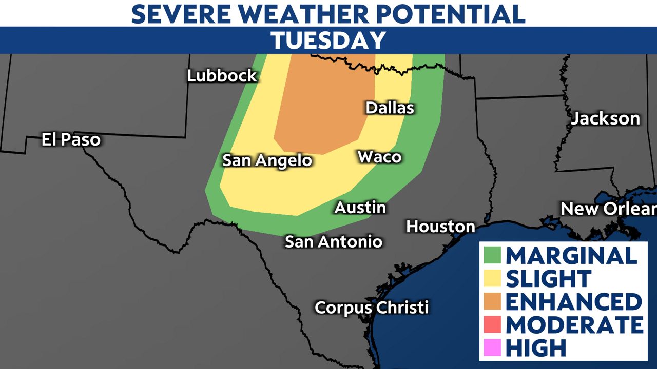
Make sure you have a way to receive severe weather warnings while you are asleep, such as turning on your warning notifications on your phone and having a NOAA weather radio programmed for your county.
The main storm threats will be strong gusty winds up to 60 mph and large hail, but we can't rule out a few isolated tornadoes.
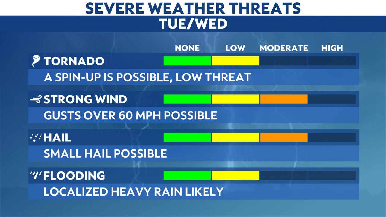
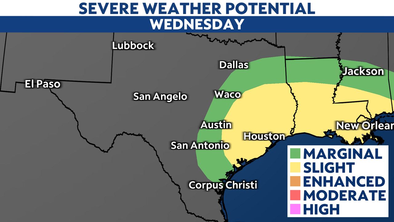
This storm complex will move east toward the upper Texas coast on Wednesday with the ongoing threat of severe weather for Houston and Beaumont.
Behind the front, winds will gust up to 30-50 mph. This will create some fire weather conerns for south Texas and the Rio Grande Valley.


)
)
