Summer is officially here and Mother Nature is wasting no time reminding us that the dog days of summer are as well.
What You Need To Know
- Heat advisories in effect for much of Central and South Texas
- Cold front arrives this afternoon/evening, bringing showers and storms
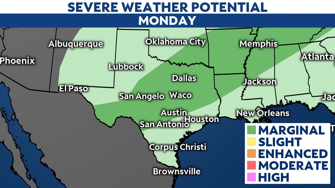
- Marginal severe weather risk for much of Texas
- Cooler, more comfortable weather arrives by Tuesday afternoon
Monday features extreme heat in Central and South Texas.
A Heat Advisory is in effect through 8 p.m., for Williamson, Val Verde, Hays, Travis, Bastrop, Lee, Kinney, Uvalde, Medina, Bexar, Comal, Guadalupe, Caldwell, Fayette, Maverick, Zavala, Frio, Atascosa, Wilson, Karnes, Gonzales, De Witt, Lavaca and Dimmit counties.
This is where heat index values are expected to reach 110°F Monday afternoon.
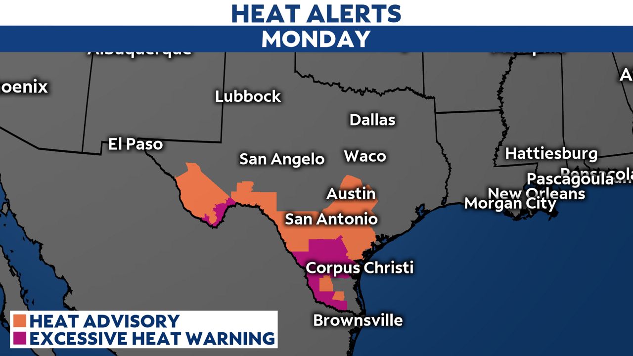
An Excessive Heat Warning is in effect for La Salle, McMullen, Live Oak, Webb, Duval, Jim Wells and Inland Kleberg counties through 7 p.m. this evening.
These are the areas where heat index values are expected to exceed 115°F Monday afternoon.
The National Weather Service suggests drinking plenty of fluids, staying in an air-conditioned rooms, staying out of the sun and checking up on relatives and neighbors.
Young children and pets should never be left unattended in vehicles under any circumstances.
Late-Season Cold Front
There is relief on the way! A strong, late-season cold front will move through North Texas by midday, Central Texas this evening and South Texas late tonight/early Tuesday morning.
There will be a chance for strong to severe storms as the front passes, although the overall severe weather risk is low at this time. Sixty mph winds and small hail can expected with some of the stronger storms.
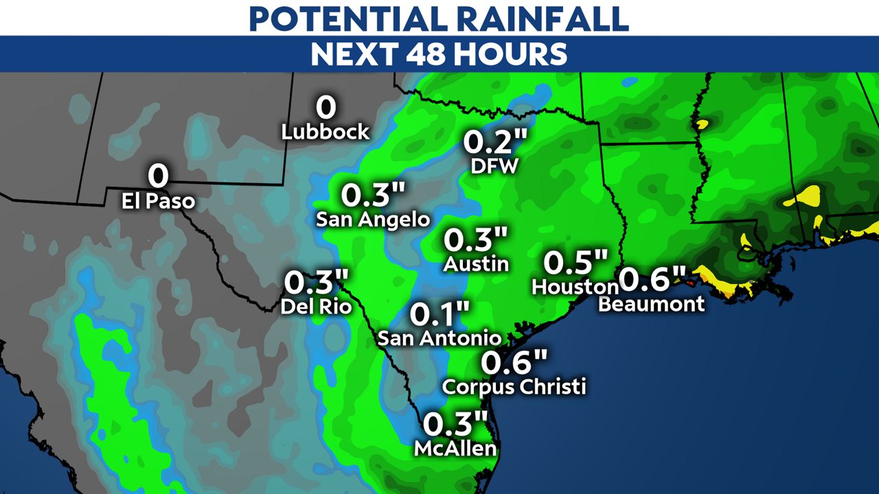
They may also be heavy downpours, too. The atmosphere is very saturated which supports heavy rainfall events.
Short-range models suggest parts of the state could collect more than a 1/2" of rain over the next 48 hours with locally higher totals.
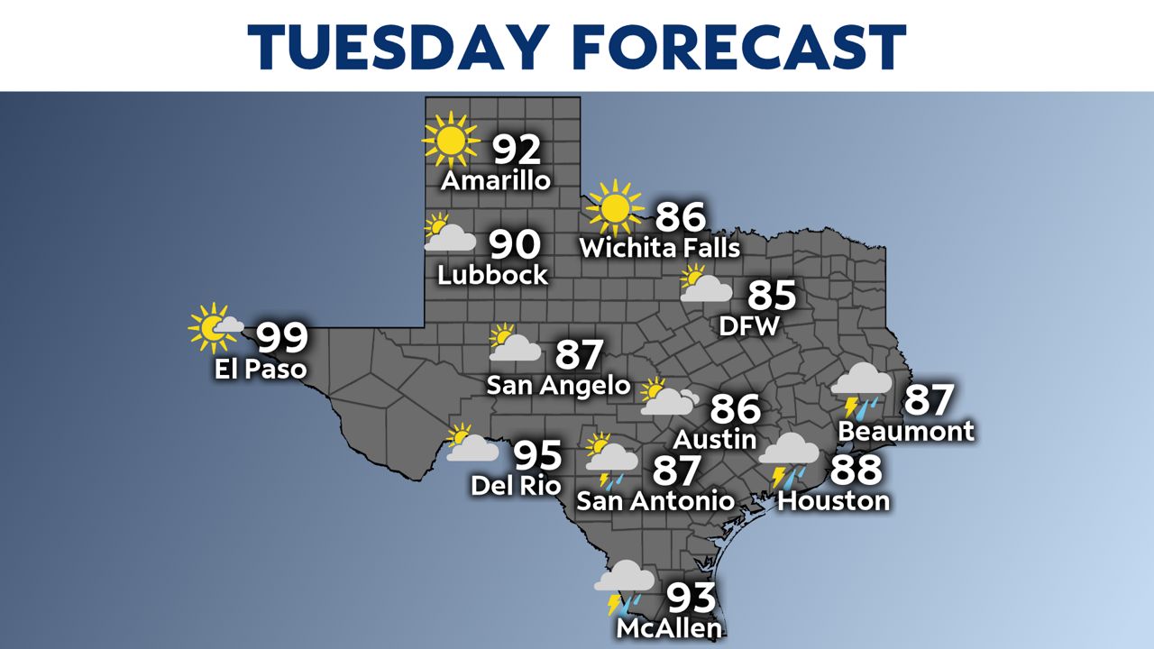
Once the front is through the state, clouds will hang tight Tuesday and that will help keep temperatures cooler. Many locations will drop by 10°F or more Tuesday compared to Monday.
The relief Tuesday is short-lived. By Wednesday, forecast highs are back into the 90s and most of the state will be back in the upper 90s close to 100F by the end of the week.