


“It was supposed to be a quiet, sunny, and simply hot and humid day. There had been storms the day before but a ridge was setting up and a very solid cap was in place,” says Matt Ritter, a meteorologist who worked in Waco.
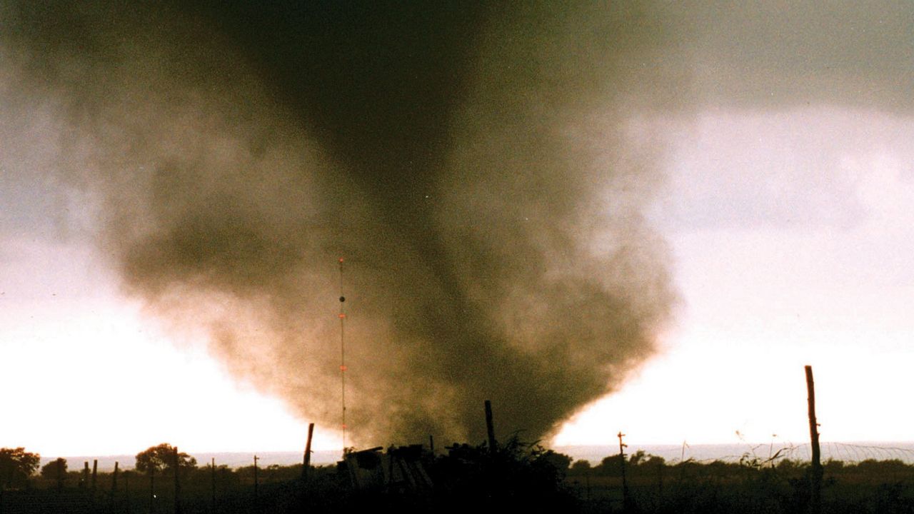
The day Matt's referring to was May 27, 1997. This was when an F-5 tornado developed and devastated the city of Jarrell, killing 27 people and injuring 12 others.
He went on to say that at one point, he saw a dew point reading of 82 degrees. That's extraordinarily high, especially during the morning hours.
What You Need To Know
- The Jarrell tornado was one of the most violent tornadoes in modern U.S. history
- It took an unusual track from northeast to southwest
- It was slow-moving at only 15 mph but tracked for almost 8 miles
- Its top estimated wind gust was 261 mph
The environment that produced the Jarrell tornado (and 20 others that day) was far from textbook. Typically, Texas severe weather occurs from a strong trough of low pressure, a cold front or along a dry line.
This particular day, nothing like that was in place. The closest disturbance was in Nebraska, so that did not play a role. In addition, the upper-level winds across the state were weak and streaming from west to east and a strong cap was in place, which inhibits storms from developing.
However, despite all the weak upper-level severe parameters, the atmosphere near the surface was very unstable. We had several days of onshore wind flow from the Gulf of Mexico, providing ample moisture, hence the dew points in the 80s.
A measure of the energy for storms, known as convective available potential energy (CAPE) was off the charts, which was a concern if storms could break through the strong cap.
It is worth noting that a very slow-moving cold front draped almost parallel to the dry line and near several leftover boundaries from previous storms merging over the region. These small-scale features were enough to produce one of the strongest tornadoes on record.
The Storm Prediction Center placed a moderate risk over the area.

The National Weather Service issued a Tornado Watch around noon that day, with the first tornado touching down at 1:21 p.m. and the last one at 7:23 p.m. The Jarrell tornado touched down at 3:35 p.m.
All of these supercells took a wild southwest track and rotated clockwise (opposite of what often happens), which caught many people off guard.

Spectrum News Meteorologist Mike Clay was working at a radio station in Waco and recalls the way he felt that day. “It all happened very fast with the first storm around Moody, Texas. The movement to the south was puzzling at first, but some later analysis by Lon Curtis in Temple showed other examples of storms in Central Texas moving south to southwest in times of extreme instability. In other words, it had happened before.”
In fact, the Austin twin tornadoes from 1922 took a similar track.
He went on to say, “although initially it was ‘just another Tornado Watch’ when the tornadoes started in Bell County, they were very visible, so everyone was talking about them. I was live on the radio for several hours.”
The tornado slowly tracked through the Double Creek Estates subdivision as a 3/4-mile-wide multi-vortex monster just west of downtown.
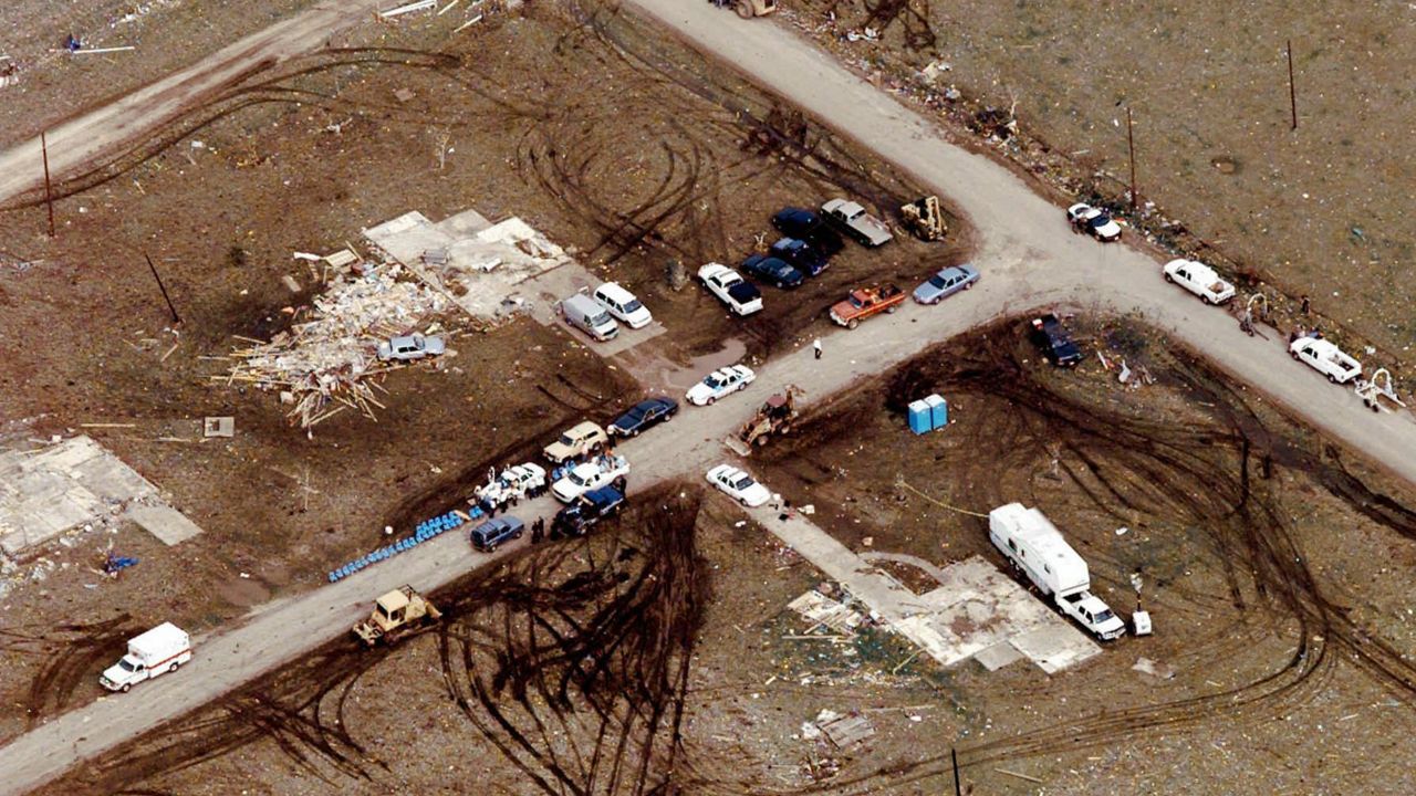
Only slab foundations of the 38 homes remained with small and unrecognizable debris. The sheer power of the twister tore up anything in its path with the resulting rubble lacking any large items.
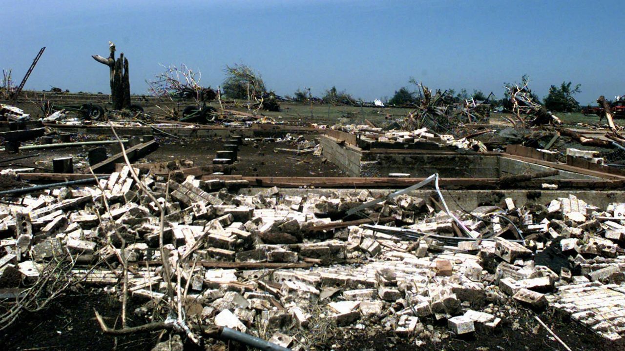

Homes near the center of its path experienced tornadic winds for about three minutes because the tornado moved so slowly. There were also reports of the ground scoured out to a depth of 18 inches, trees debarked and cows dismembered and skinned.
The 1997 tornado outbreak still has meteorologists scratching their heads on how it all played out and what we learned from it. Since this event, radar data comes in much faster, and National Weather Service warnings have increased to almost 15 minutes before a tornado.
We continue to make improvements in forecasting and our knowledge of severe weather across Texas.
Ritter says, “It was definitely a life-changing event, but also a career-defining event. Because the outbreak was unexpected, we consider ourselves lucky in the cases in which we were able to help anyone get out of the way of the supercell. When we heard the first ham radio report of the size of the tornado, you could feel a chill take over the news set; we knew we had to keep on keeping on.”
Do you remember this day? The National Weather Service has spent the last year compiling photos, videos and eyewitness accounts to produce an amazing webpage dedicated to this tornado.
Come connect with me on Facebook, Twitter and Instagram and let's chat about this historic day in weather history.