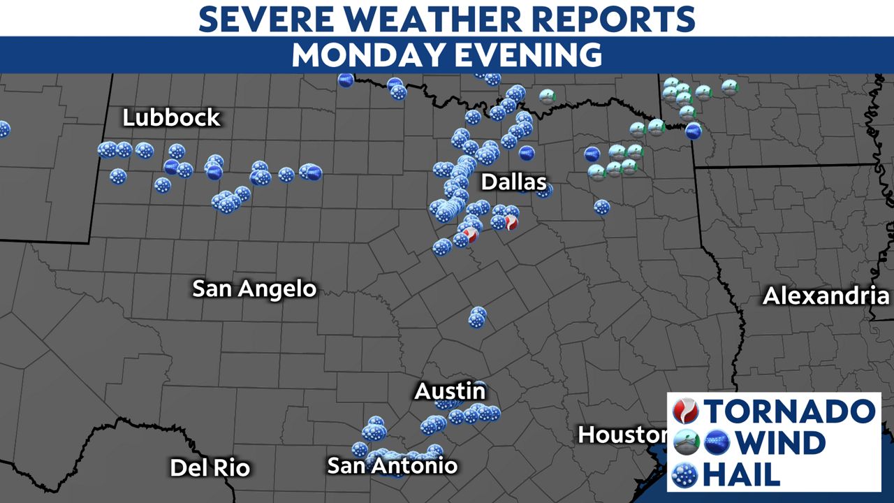
For the second time in less than a week, severe thunderstorms dropped big hail and damaged property.
A National Weather Service storm survey crew determined that a tornado caused the damage northwest of Blum in Hill County around 7:25 p.m. Monday evening. They rated it as an EF-2 with estimated winds of 130 mph.

Storm survey crews rated the tornado south of Waxahachie in Ellis County as an EF-2 with estimated winds of 120 mph. It caused eight injuries.
Three other tornadoes were rated EF-0: east of Granbury in Hood County, south of Weston in Collin County and east of Grandview in Johnson County.
In addition to tornadoes, the storms produced strong wind gusts. The weather station at the Sulphur Springs Airport measured a wind gust of 87 mph, and several other locations had winds top 60 mph.
The state also had about 100 hail reports. The largest was a whopping 5.5 inches wide in China Grove, near San Antonio. A couple others were about three inches wide, larger than a baseball. People in San Antonio and near Rio Vista in Johnson County saw those large hailstones. Hail was common around San Antonio and the Dallas-Fort Worth Metroplex, including some of the same areas rocked by hail last week.

Below is a map of the preliminary storm reports.