


A recent study published in the scientific journal Nature shows that tropical cyclones, the general term for hurricanes and tropical storms, move more slowly than they used to.
Combined with the increase in rainfall already occurring as the seas and air temperatures warm, this paints a troubling picture for future storms, especially in Texas.
National Oceanic and Atmospheric Administration scientists examined storm track data from around the world from 1949 to 2016 and found a statistically significant decrease in storm forward speed.
There are two ways to get more rain out of a tropical system: Higher rainfall rates and slower-moving storms. Increased ocean heat content is supercharging the rainfall potential of such storms, making them more dangerous rain producers than they otherwise would be. The combined result is more intense, wetter and slower hurricanes like Harvey.
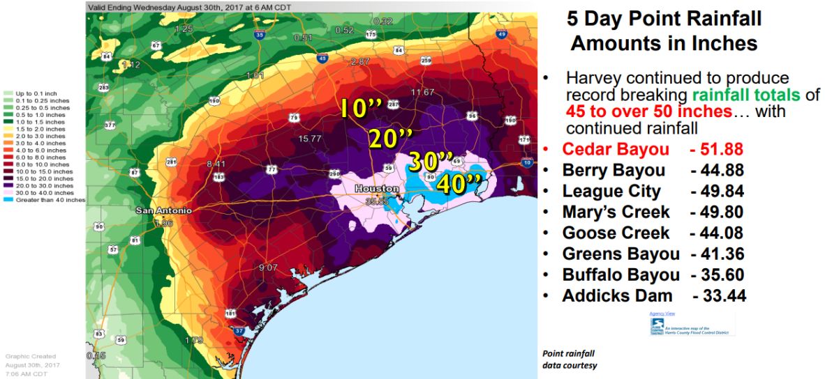
Another study published in the journal Earth’s Future found that Hurricane Harvey’s devastating rainfall totals were directly related to record high ocean heat content in the western Gulf of Mexico. The oceans are absorbing the vast majority of extra heat from human-caused greenhouse gas emissions, with temperatures increasing in the process.
This results in higher levels of water vapor, which storms use as fuel and then wring out like a wet sponge. If their forward speed slows to a crawl, as Harvey and Imelda did, they can produce rainfall totals measured in feet rather than inches.
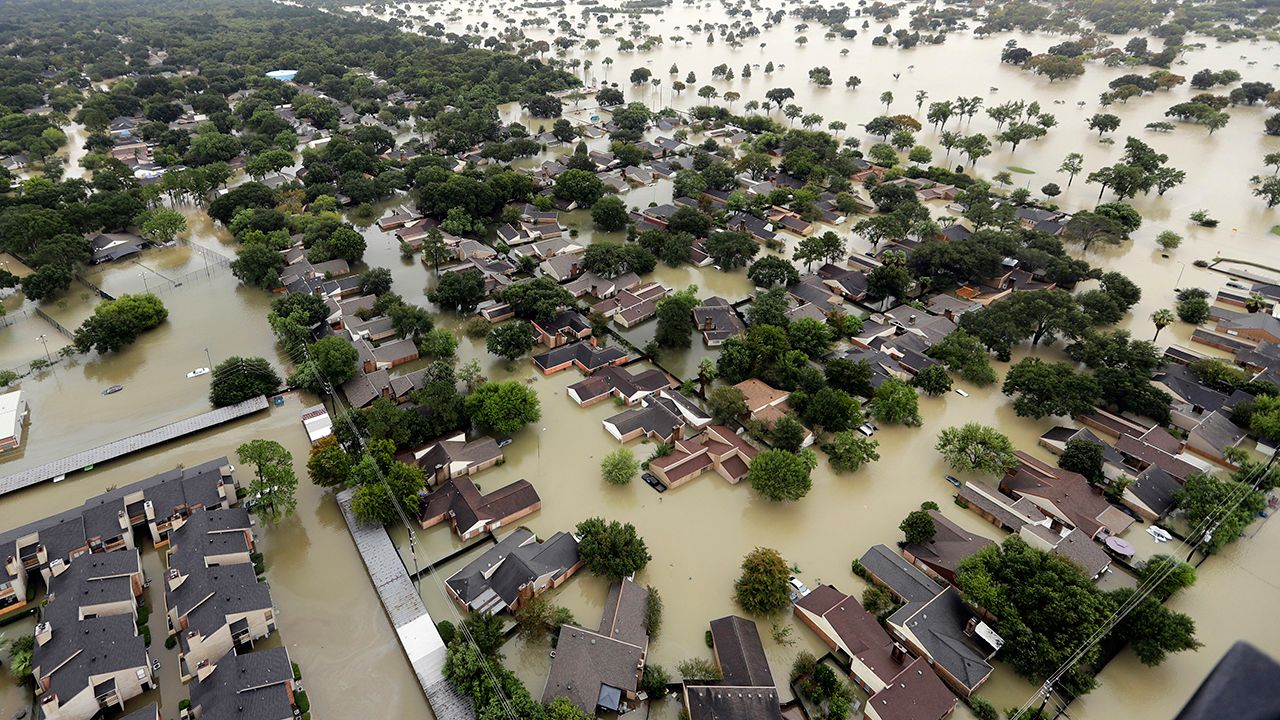
The Texas coast is now one of the top spots in the country for these heavy rainfall events, which is problematic considering decades of land-use decisions, especially in the Houston metro area. These decisions have favored development in ways that make the region more susceptible to flash flooding.