


Severe thunderstorms hit parts of Texas late Wednesday into early Thursday. Strong winds caused localized damage and big hail fell near San Antonio and Fort Worth.
More than 50 reports of hail came in across the state, mostly from two areas of storms. One was near San Antonio, while the other was near Fort Worth.
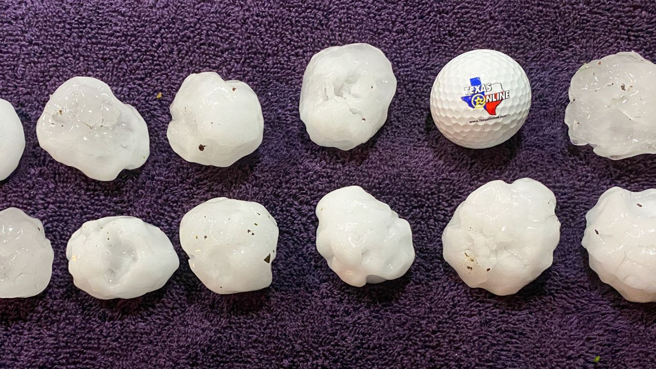
Some hailstones were larger than 3" in diameter, which is larger than a baseball. The biggest hailstone reported was in Keller, north of Fort Worth, at 3.25". This giant hail damaged cars and homes.
Numerous other places had golf ball-sized hail.
Wind damage was much more isolated. However, a National Weather Service damage survey team found evidence of straight-line winds of 60 to 80 mph in northeastern Bexar County and southern Comal County. Their report says that those winds damaged and uprooted trees there. Power lines were also damaged in that area.
Trained weather spotters reported a tornado near Hondo, west of San Antonio, before 7:30 p.m. Thursday. However, an official damage report hasn't come out from that area yet.
Storms produced torrential rain. Localized flash flooding occurred Wednesday evening into early Thursday morning. Thursday's official rainfall total for San Antonio was 2.55", a tie for the seventh-wettest April day on record. Parts of the Dallas-Fort Worth Metroplex had more than 3" of rain.
Zoom into the interactive map to view the storm reports of wind, hail and tornadoes. Tap on an icon to get more information.