


Accumulating snow has come to an end, but we'll feel the impacts even after it ends. Here's a feed of the latest information.
This storm has brought a one-two punch of dangerous weather. First, it was the snow yesterday into early this morning. Now, it's all about the major cold.
Many temperature records could fall through Tuesday, both for morning lows and afternoon highs.
To give some context, the normal high in Dallas in mid-February is nearly 60 degrees, while the normal low is in the upper 30s.
We're forecasting Monday into Monday night as the coldest part of this arctic blast. Monday afternoon's high will only reach the middle teens, followed by lows in the lower single digits going into Tuesday morning. That would obliterate those records.
When it's this cold, you absolutely must remember the four Ps: People, Plants, Pets, and Pipes.
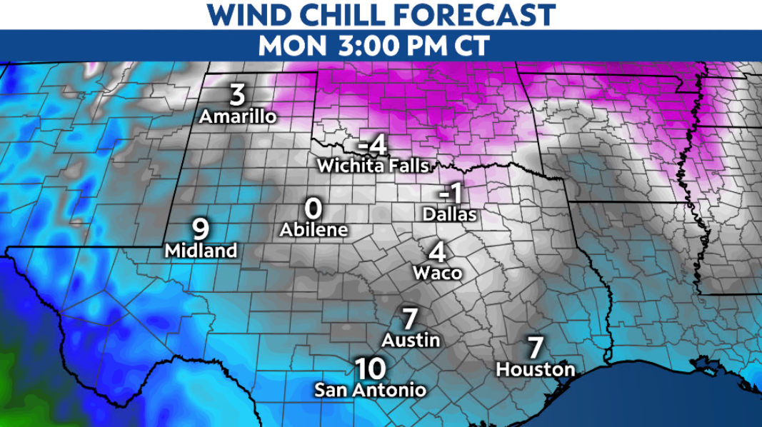
Wind chills stay in the single digits above and below zero even this afternoon, which is dangerously cold.
Aside from that, the cold temperatures mean that the fresh snowfall won't go away right away. Road crews will have their work cut out for them trying to clear the roads, since treatments aren't as effective when temperatures drop.
Many in the area picked up 3-5" of snow. Passing clouds may squeeze out a scattered flurry, but we'll see more sunshine than snowflakes the rest of the day.
Just because the snow is essentially over doesn't mean everything is back to normal. Snow has made road conditions dangerous. Please avoid travel if at all possible.