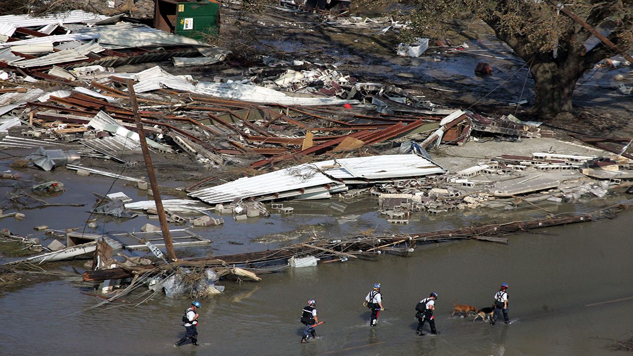
September is the peak of the Atlantic hurricane season.
This is because wind shear, the change of speed and/or direction of the wind with height, is weaker, and the ocean waters are extremely warm.
Sept. 10 is typically the last day for peak tropical activity. From then on out, activity declines, but this doesn't mean we won't see powerful storms.
Let’s look back in recorded history to some of the strongest storms that occurred during September.
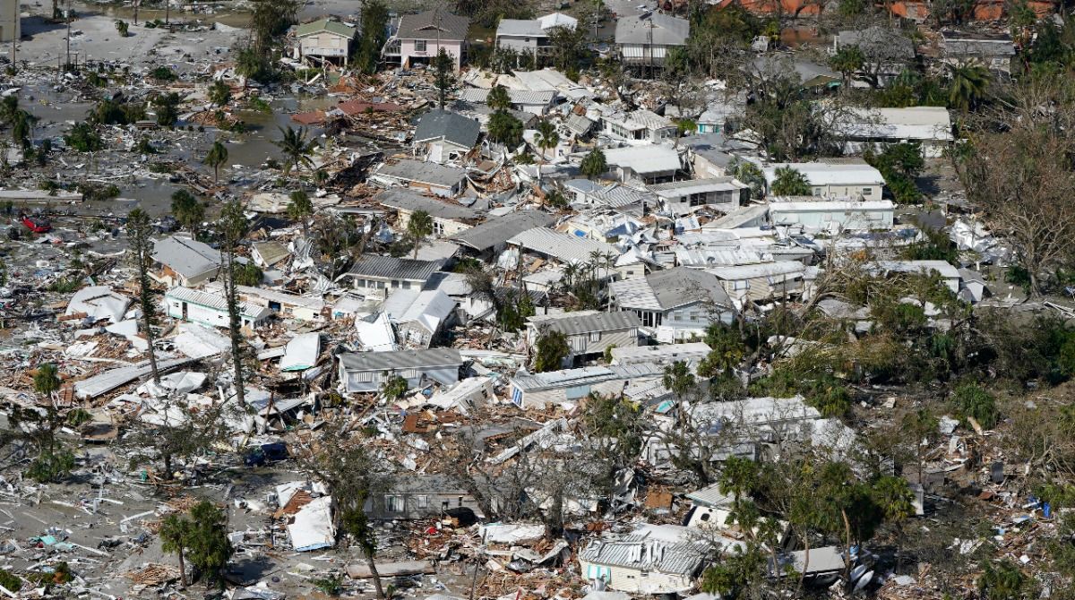
Hurricane Ian in 2022: First forming on Sept. 24, Ian traveled through the Caribbean Sea, the Gulf and the Atlantic, making five total landfalls.
Ian made its first and second landfall in Cuba and Dry Tortugas, Fla. as a Category 3 hurricane, a third and fourth landfall in Cayo Costa, Fla. and near Punta Gorda, Fla. as a Category 4 hurricane and a final landfall in Georgetown, S.C. as a Category 1.
The hurricane affected Florida severely, with tens of thousands of structures damaged or destroyed. Catastrophic storm surge occurred on Florida's west coast, reaching 10 to 15 feet near Fort Myers.
Historic flooding occurred in some areas, getting over 20 inches of rain. The highest total was 26.95 inches in Grove City, Fla.
Ian was responsible for 156 deaths, and became the third costliest hurricane on record, causing $112.9 billion in damage.
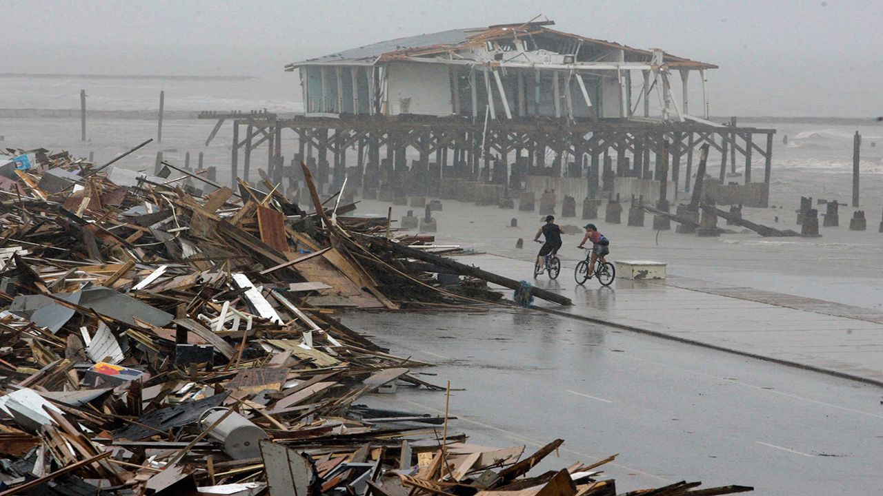
Hurricane Ike in 2008: Our next hurricane takes us back to 2008 when a tropical wave slid off the coast of Africa at the end of August. It developed into a tropical depression on Sept. 1, and on the same day, became a tropical storm.
Ike became a hurricane on Sept. 3, underwent rapid intensification, and became a major hurricane later that same day. By the morning of Sept. 4, it reached a maximum intensity of 145 mph.
Ike first made landfall in Cuba as a Category 4 hurricane, bringing devastating impacts then weakening.
After, it moved into the Gulf of Mexico and regained strength, reaching Category 2 status before making landfall near Galveston, Texas on Sept. 13.
Ike’s slow movement and large wind field led to a storm surge up to 20 feet. It destroyed all homes on the Bolivar Peninsula, submerged roads with floodwaters and blocked roads with fallen debris.
Ike killed 74 people in the state of Texas, alone.
Its northeast movement brought impacts far north to the upper Midwest and Northeast, causing extensive wind damage and leaving millions of people without power for over a week.
Hurricane Rita in 2005: The 2005 Atlantic hurricane season will forever be a memorable one, with many powerful storms impacting the U.S. that year.
Only a few weeks after Hurricane Katrina, Rita developed into a tropical depression near Turks and Caicos on Sept. 18.
It tracked west for several days and underwent rapid intensification in the Gulf of Mexico, becoming a major Category 5 hurricane on Sept. 21. Rita weakened to a Category 3 hurricane right before making landfall in southwest Louisiana on Sept. 24.
Rita caused $18.5 billion in damage, bringing up to 15 feet of storm surge to the coast of Louisiana and Texas. It destroyed or damaged most homes.
Rita’s storm surge overtopped the levees that were newly repaired from Hurricane Katrina's destruction the month prior, worsening the devastation across the city of New Orleans.
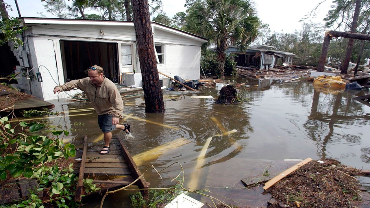
Hurricane Ivan in 2004: Ivan formed in the central Atlantic on Sept. 2, tracking west-northwest for a week while intensifying.
It first brushed by Jamaica, Cuba and the Cayman Islands, fluctuating between a Category 4 and Category 5 hurricane before weakening to a Category 3 hurricane in the Gulf of Mexico.
Ivan then made landfall near Gulf Shores, Ala. as a major Category 3 hurricane on Sept. 16.
Once again, the storm surge was the primary cause of damage, destroying and washing away many homes.
Ivan also produced over 100 tornadoes throughout 9 different states and dumped heavy rainfall along its path, racking up $20.5 billion in damage.
Ivan then moved eastward back toward the Atlantic Ocean, curved back toward Florida, moved over the Gulf of Mexico for a second time, and made a second landfall in Louisiana as a tropical depression.
Luckily, it weakened quickly and didn’t produce any big impacts the second time around.
Hurricane Floyd in 1999: Floyd first originated as a tropical wave that moved off the coast of Africa on Sept. 2.
It traveled west and intensified to a major Category 4 hurricane while traveling through the Bahamas.
Floyd then turned north and paralleled the Florida coast, weakening and making landfall at Cape Fear, N.C. as a Category 2 hurricane.
It brought heavy rain, tornadoes and a high storm surge.
The peak of the storm surge, which reached 10 feet, occurred at high tide, and devastated the state.
Nearly every river in eastern North Carolina reached flooding stage. Floyd dropped 17 inches of rain, which only added to the flooding.
The cyclone caught many people unprepared, and emergency crews had to make more than 1700 water rescues.
Floyd traveled up the east coast and also brought major flooding to northeastern cities, destroying many homes and businesses and leaving hundreds of thousands of people without power for days.
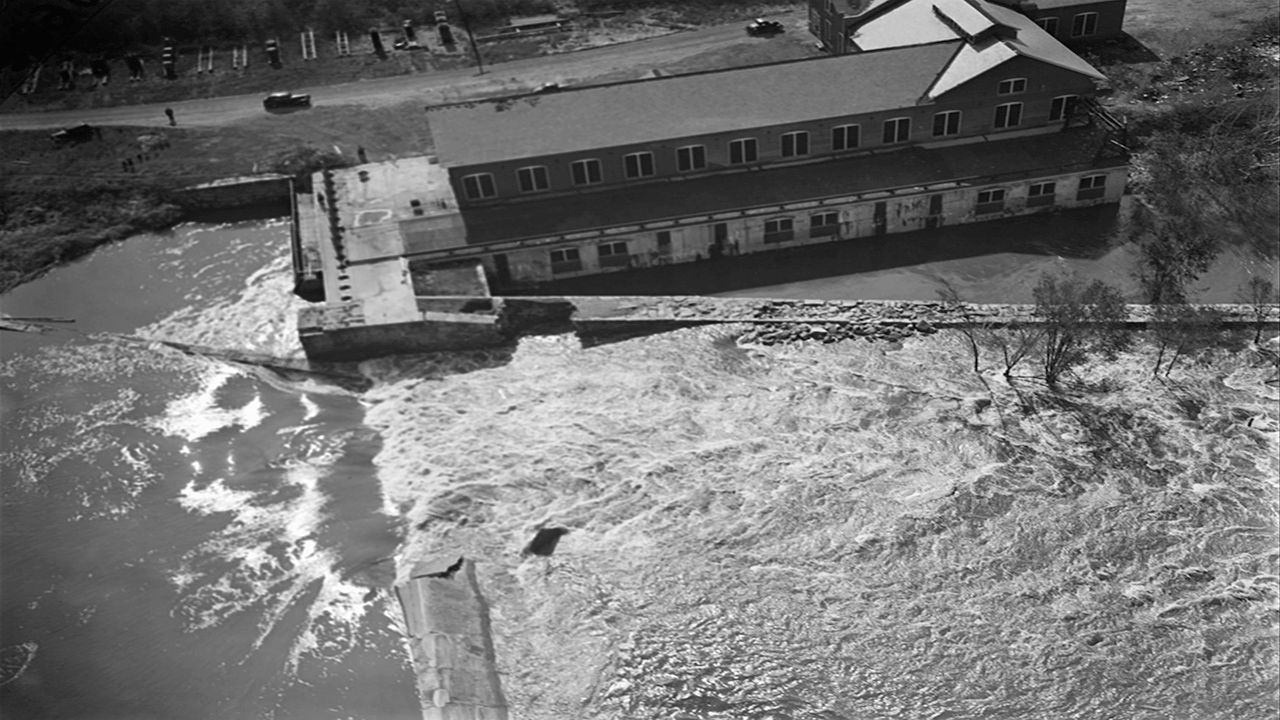
The 1938 New England Hurricane: The New England Hurricane of 1938 first developed near the Cape Verde Islands on Sept. 9 and tracked toward the U.S.
It continued up the east coast and eventually made landfall on Long Island, N.Y. as a major Category 3 hurricane on Sept. 21.
Further inland, on the same day, the hurricane made a second landfall as a Category 3 hurricane between Bridgeport and New Haven.
Storm tide reached close to 17 feet for areas, destroying many homes. Montauk temporarily became an Island.
Many residents received little warning about the hurricane, which led to a deadly outcome. Around 500 to 700 people died.
The Great Miami Hurricane of 1926: Back in 1926, the government centralized storm warnings from their D.C. office, then distributed those warnings to other weather offices.
However, on the morning of Sept. 17, less than 24 hours before Florida felt the hurricane’s effects, the state didn’t receive any warnings. It wasn’t until the afternoon when the Miami Weather Bureau Office got the go ahead to post-tropical storm warnings.
That same night, those warnings became hurricane warnings.
By the morning on Sept. 18, the hurricane that no one prepared for made landfall in Miami, Fla. as a major Category 4 hurricane.
The hurricane killed over 100 people in Miami.
Many people were unfamiliar with hurricanes at the time, and while the eye was passing, they thought the hurricane was over.
The calm lasted about 35 minutes before the wind battered the coast again, and a 10-foot storm surge quickly pushed water on land, leading to a massive amount of destruction.
The Cheniere Caminada Hurricane of 1893: Also known as The Great October Storm, it first developed in the Caribbean Sea, bringing impacts to the southern areas of Mexico.
It then moved into the Gulf of Mexico and intensified to a Category 4 hurricane before making landfall on Cheniere Caminada, La., completely wiping the town off the map.
Sixteen-foot storm surge flooded the entire town, and strong winds added to the destruction.
Overall, over 2000 people died, making this hurricane one of the deadliest weather events in history.
The 1875 Indianola Hurricane: Our last stop takes us to 1875 when a cyclone just started brewing off the coast of Africa on Sept. 1. It made its way west, intensifying, and first passing through the Caribbean.
It emerged in the Gulf of Mexico where it slowly made its way to Category 3 status and made landfall on Sept. 16 near Indianola, Texas.
The hurricane devastated the town, and wind gusts leveled many homes. Hundreds of people died when the storm surge washed everything away.
The town tried to rebuild, but 11 years later, another hurricane destroyed the town, leaving the city to be abandoned.
With the peak of hurricane season so close, we urge you to always stay prepared. This is when we see activity ramp up.
96% of Category 3, 4 and 5 hurricanes occur from mid-August to mid-October. This isn't to say that all hurricanes that develop will make landfall in the U.S., but it is always best to stay prepared for any scenario.
Our team of meteorologists dive deep into the science of weather and break down timely weather data and information. To view more weather and climate stories, check out our weather blogs section.


