


WEATHER HEADLINES:
→ Very Muggy Through Saturday
→ Thundery Downpours Saturday PM with Localized Flash Flooding Possible
→ Drier and Comfier for Sunday but with Lakeshore Flooding and Erosion
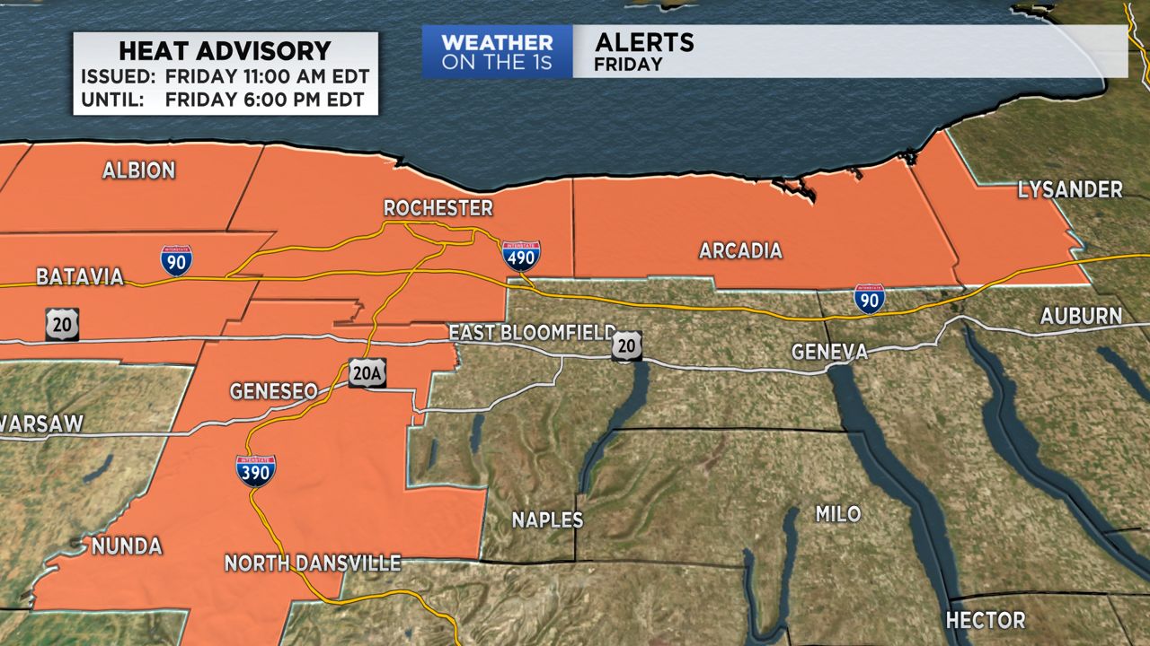
A heat advisory will be in effect from 11 a.m. until 6 p.m. Friday for Monroe, Wayne, Livingston, and northern Cayuga counties.
Track showers and storms anytime with our interactive radar!
Remaining warm and quite muggy tonight with a few hit and miss showers, and lows in the 70s.
After a mostly dry start Saturday, showers and heavy rain producing thunderstorms will pop up with the potential for localized flash flooding. This activity will end Saturday evening with cooler and much less air settling in for Sunday.
Gusty northerly winds will create a sizeable chop on Lake Ontario with shoreline flooding and erosion likely. This will settle going into Monday.
Nice summer weather will continue through Wednesday of next week with temps heating up Tuesday and Wednesday. An isolated shower will be possible Wednesday pm with more numerous showers and storms looking likely Wednesday night.
A few spotty showers then look likely for Thursday, but Thursday does look pretty nice overall followed by a great looking Friday.
Have a great weekend!
Stay tuned to Spectrum News for updates!