


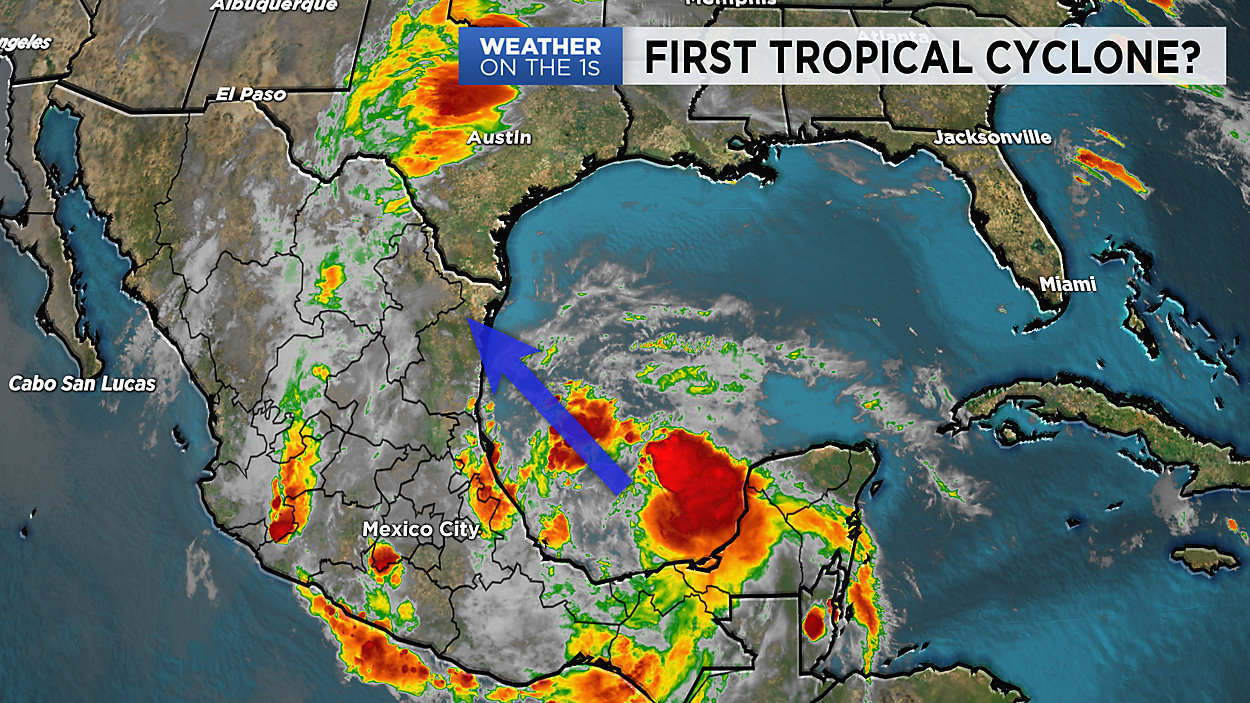
As luck would have it, the very first tropical cyclone of the 2019 Atlantic Hurricane Season might be developing right off the coast of Texas.
Looking towards the southwest Gulf of Mexico, satellite images show a large, disorganized cluster of storms moving north into the Bay of Campeche and they're starting to grow.
NOAA's National Hurricane Center calls for a 60 percent chance that this entity will organize into a true Tropical Depression or Tropical Storm within the next 48 hours.
Latest computer models show the system moving towards the northern coast of Mexico by Tuesday night, potentially making landfall somewhere between Tampico and Brownsville.
Whether or not the storm organizes, there will be quite a bit of tropical moisture and energy coming from the south into Texas, and we think it'll bring our heaviest rain of the week on Wednesday.
In the above video, Chief Meteorologist Burton Fitzsimmons gives us a look at computer models as of early Monday morning.
For updates, be sure to watch 'Weather on the 1s' or check out the latest forecast on the main weather homepage.