


It will be sunny each day this weekend.
High pressure controls our weather this weekend. That means we will have sunny, dry weather.
On Sunday afternoon, it will start to feel a little hot and humid, but moreso early next week.
Weekend forecast
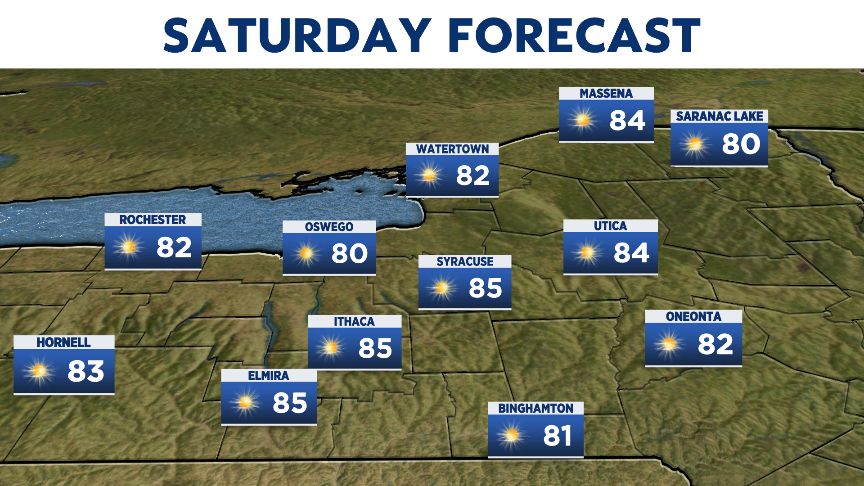
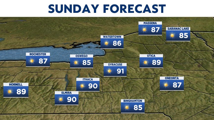
It will be sunny each day this weekend.
High pressure controls our weather this weekend. That means we will have sunny, dry weather.
On Sunday afternoon, it will start to feel a little hot and humid, but moreso early next week.