


WEATHER HEADLINES:
→ Snow Persists Through Monday
→ Widespread Accumulation by the End of Monday
→ Staying Chilly the Next Several Days
*A winter weather advisory and winter storm warning is in effect for the entire region.*
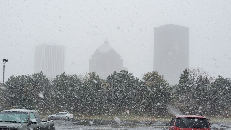
After the first half of Sunday contended with snow and a wintry mix of freezing rain and sleet, the second round of snow will continue to stick around heading into Monday.
^^For full details on these winter weather alerts, click here.
By the time you wake up Monday morning, areas like Rochester will see about 1-3" of snow on the ground, with areas to the southeast, like Penn Yan, closer already to half a foot, if not a little more.
Otherwise, temperatures will fall into the 20s and low 30s by Monday morning. Slick, icy spots will still be a concern through Monday.
So, as you get ready to get out the door Monday morning, make sure you give yourself extra time, plan for less than ideal road conditions, and even brace yourself for reduced visibility as the snow is coming down.
Track rain and snow anytime with our interactive radar!
The snow sticks around through the vast majority of Monday. As it gets further past sunset, the snow chance will start to settle along the 90 and push farther south as the evening progresses. The snow will finally come to an end across the entire region after midnight on Tuesday.
Lesser amounts to the west are expected, with Rochester in the middle with about 4-8" of snow in total. The heaviest snow will fall to the east and southeast of Rochester, extending into parts of the Finger Lakes. By the time the snow is all said and done, some spots will be pushing close to a foot in total. However, locally higher amounts will be possible.
Besides the snow, Monday will be a bit on the cold side as temperatures don't budge much with highs in the low 30s. Most will feel like the 20s, and even the upper teens, in terms of wind chills for Monday due to a north wind at 10 to 15 mph.
Quieter weather returns for Tuesday, but high temperatures will still be trapped in the 30s that day and through the next several days. There will be some dry time in the mix through the new week, but there is a chance of a rain/snow mix Wednesday before changing over to some lingering snow showers to start Thursday.
Stay tuned to Spectrum News for more updates!
Make sure to follow Meteorologist Christina Reis over on Facebook, Instagram, and Twitter!
RELATED: