Winter weather is no joke, and New York residents understand this. Throughout the snowy season, you'll often hear terms like "blizzard," "lake effect," and "Nor'Easter," but what do these terms really mean, and what can you expect when they come? This guide, with some helpful information from the National Weather Service, will help you break down common winter weather myths as well as enhance your understanding of key meteorological terms:
What is Lake Effect Snow?
Lake effect snow is common across the Great Lakes region during the late fall and winter. Lake effect snow occurs when cold air, often originating from Canada, moves across the open waters of the Great Lakes. As the cold air passes over the unfrozen and relatively warm waters of the Great Lakes, warmth and moisture are transferred into the lowest portion of the atmosphere. The air rises, clouds form and grow into narrow band that produces two to three inches of snow per hour, or more.
Wind direction is a key component in determining which areas will receive lake effect snow. Heavy snow may be falling in one location, while the sun may be shining just a mile or two away in either direction. The physical geography of the land and water is also important and our meteorologists consider these factors as well as others when forecasting lake effect snow.
What is Wind Chill?
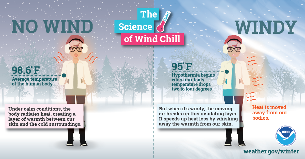
You'll hear meteorologists talk about wind chill often in the winter time? By definition, it's a quantity that expressed the effective lowering of air temperature caused by the wind, especially as affecting the rate of heat loss from an object or human body as perceived by an exposed person. In common terms, it's a calculation that uses the wind's speed combined with the outdoor temperature to more accurately predict the "feels like" condition.
Essentially, wind chill is how cold it actually feels on your skin with the wind factored in. Wind chill occurs when the wind strips away the thin layer of warm air around your body. The stronger the wind, the more heat lost from your body and the colder it will feel. When winds are light, it will feel closer to the actual air temperature.
When is a Blizzard Actually a Blizzard?
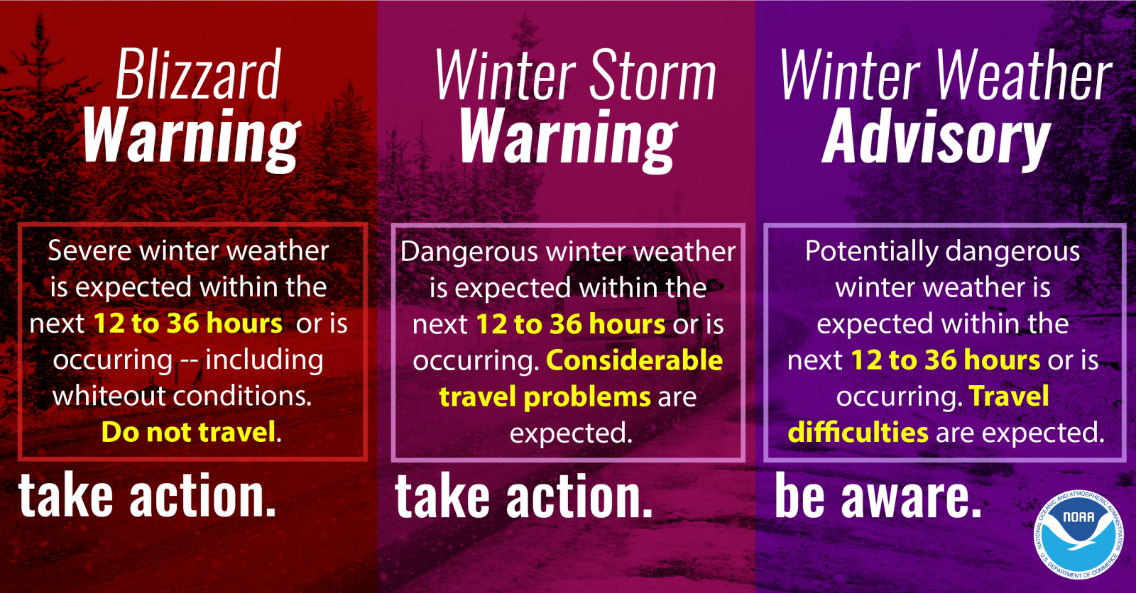
The most well-known blizzards are winter storms that produce several inches of frozen precipitation with strong winds that cause blowing snow and whiteout conditions. Such heavy snow can immobilize a region and paralyze a city by stranding commuters, closing airports, stopping the flow of supplies and disrupting emergency and medical services.
On a technically-defined level, blizzards have sustained winds of frequent gusts of 35 mph or more with blowing snow frequently reducing visibility to less than a quarter mile for three hours or more. Such heavy snow can cause roofs to collapse, as well as knock down trees and power lines. Blizzards can leave homes and farms in isolation for days and unprotected livestock may be lost. The cost of snow removal, repairing damages and the loss of business can have severe economic impacts on cities and towns as well.
The Danger of Ice Storms
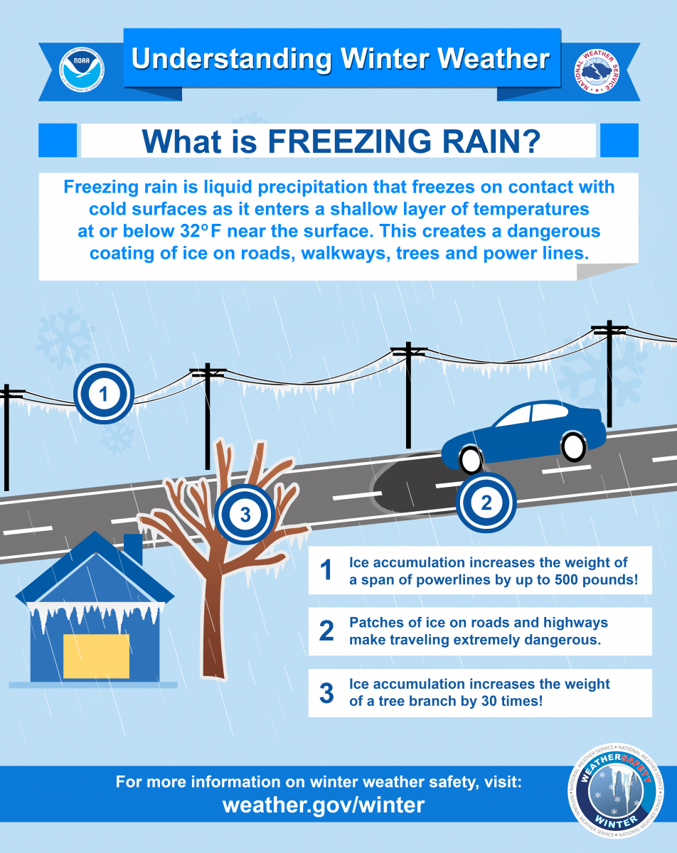
Heavy accumulation of ice can bring down trees, utility poles and communication towers. Ice storms can disrupt communications and power for days while utility companies repair extensive damage. Even small accumulations of ice can be extremely dangerous to motorists and pedestrians. Bridges and overpasses are particularly dangerous because they freeze before other surfaces. There are a handful of specific conditions that can occur during an ice storm:
- Black Ice — Black ice is a deadly driving hazard defined as patchy ice on roadways or other transportation surfaces that cannot easily be seen. Although it's called black ice, it's often clear, with the black road surface visible underneath. Black ice is most prevalent during the coldest parts of the day, typically the early morning hours, and especially after snow melt on the roadways has a chance to refreeze overnight. Black ice can also form when roadways are slick from rain and temperatures dropping below freezing overnight.
- Ice Jams — Long cold spells can cause rivers and lakes to freeze. A rise int he water level or a thaw breaks the ice into large chunks which become jammed at both man-made and natural obstructions of flow. Ice jams can act as a dam, which can result in severe flooding.
Ice Recreation — Yes, People Pursue Ice For Fun
Ice on lakes can be deadly. Before fishing, skiing, snowmobiling, playing pond hockey, or engaging in any other activities on ice, check with local officials who monitor the body of water. If you notice any of the following conditions, do not go out on the ice:
- Cracks, holes or breaks int he ice.
- Flowing water around the edges, just below the surface , or over the top of the ice.
- Ice that appears to have thawed and refrozen.
If you decided to venture out on the ice, remember the following guidelines:
- Stay off the ice if it is less than two inches thick.
- For ice fishing, ice skating and walking, you need four inches or more of ice.
- For snowmobiles and ATVs, you need at least five inches of ice.
- To drive a car or small pickup on ice you need at least eight to 12 inches of ice.
- For medium-sized trucks, there must be at least 12-15 inches of ice.
White ice or "snow ice" is only about half as strong as clear ice. Double the aforementioned thickness guidelines when traveling on white ice.
Frost Defined and What Its Presence Means
Frost describes the formation of thin ice crystals on the ground or other surfaces in the form of scales, needles, feathers or fans. Frost develops under conditions similar to dew, except the temperatures of the Earth's surface and earthbound precipitation falls below the freezing point.
As with the term "freeze," this condition is primarily significant during the growing season. If a frost period is sufficiently severe to end the growing season or delay its beginning, it is commonly refereed to as a "killing frost." Because frost is primarily an event that occurs as the result of radiational cooling, it frequently occurs with a thermometer level temperature in the mid-30s.
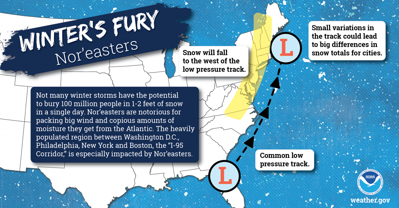
Nor'easter?
A Nor'easter is a type of storm along the east coast of North America, so called because the winds over the coastal areas are typically from the northeast. These storms can develop at any time of the year, but are most frequent and most violent between September and April. Past Nor'easters have been responsible for billions of dollars in damage, severe economic, transportation and human disruption and in some cases, can cause disastrous coastal flooding. Nor'easeters nearly always bring precipitation in the form of heavy rain or snow, as well as winds of gale force, rough seas and, occasionally, severe flooding to the affected regions.
Squalls and Showers
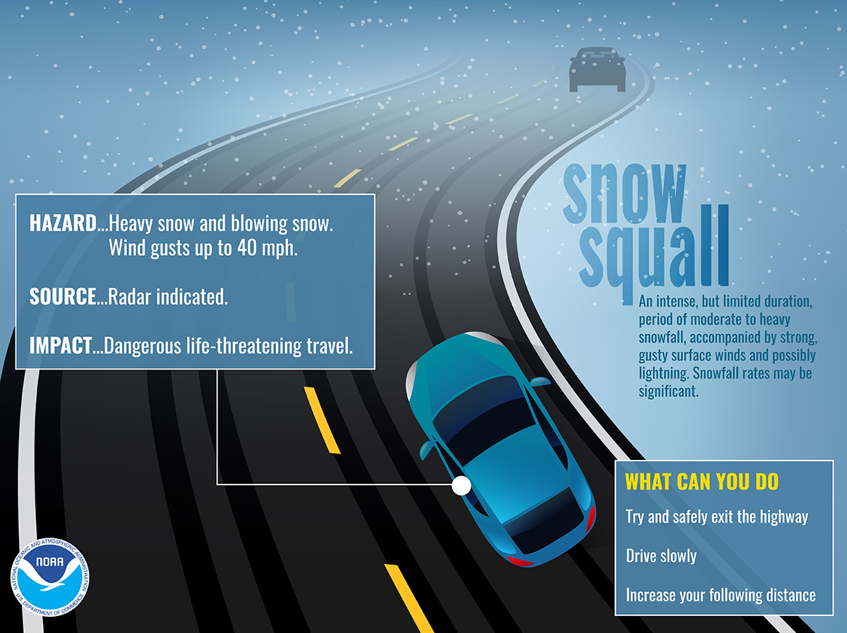
- Snow squalls are brief, intense snow showers accompanied by strong, gusty winds. Accumulation may be significant.
- Snow showers are when snow is falling at varying intensities for brief periods of time. Some accumulation is possible.
Avalanches
A mass of tumbling snow. More than 80 percent of midwinter avalanches are triggered by rapid accumulation of snow and 90 percent of those avalanches occur within 24 hours of snowfall. An avalanche may reach a mass of a million tons and travel at speeds up to 200 mph.
Although avalanches are more common in regions with mountains of higher elevations than in New York, they still happen in the Empire State. Review the state DEC's guidelines for avalanche facts and safety tips.
Now you know your stuff. So when you hear our meteorologists calling for lake effect snow or a blizzard, you'll be ready and informed.


