If this month were to end today, it would be the fourth-warmest in Syracuse recorded weather history.
When you take all the high and low temperatures so far this month and average them together, you arrive at a figure of 71.1 degrees.
The average June temperature is 67 degrees when considering data for the whole month.
We can credit above-average highs in recent weeks, including three days in the 90s, for this unseasonably warm statistic.
Because these three 90+ degree days were consecutive, we added the first heatwave of the year to the record books earlier this month.
This June has also featured eight days with highs in the 80s so far.
Keep in mind, the average highs as of this writing are still only in the upper 70s. That should provide some perspective in terms of just how warm it has been.
Looking ahead, there may be a bit of a cooldown in store over the next six to ten days.
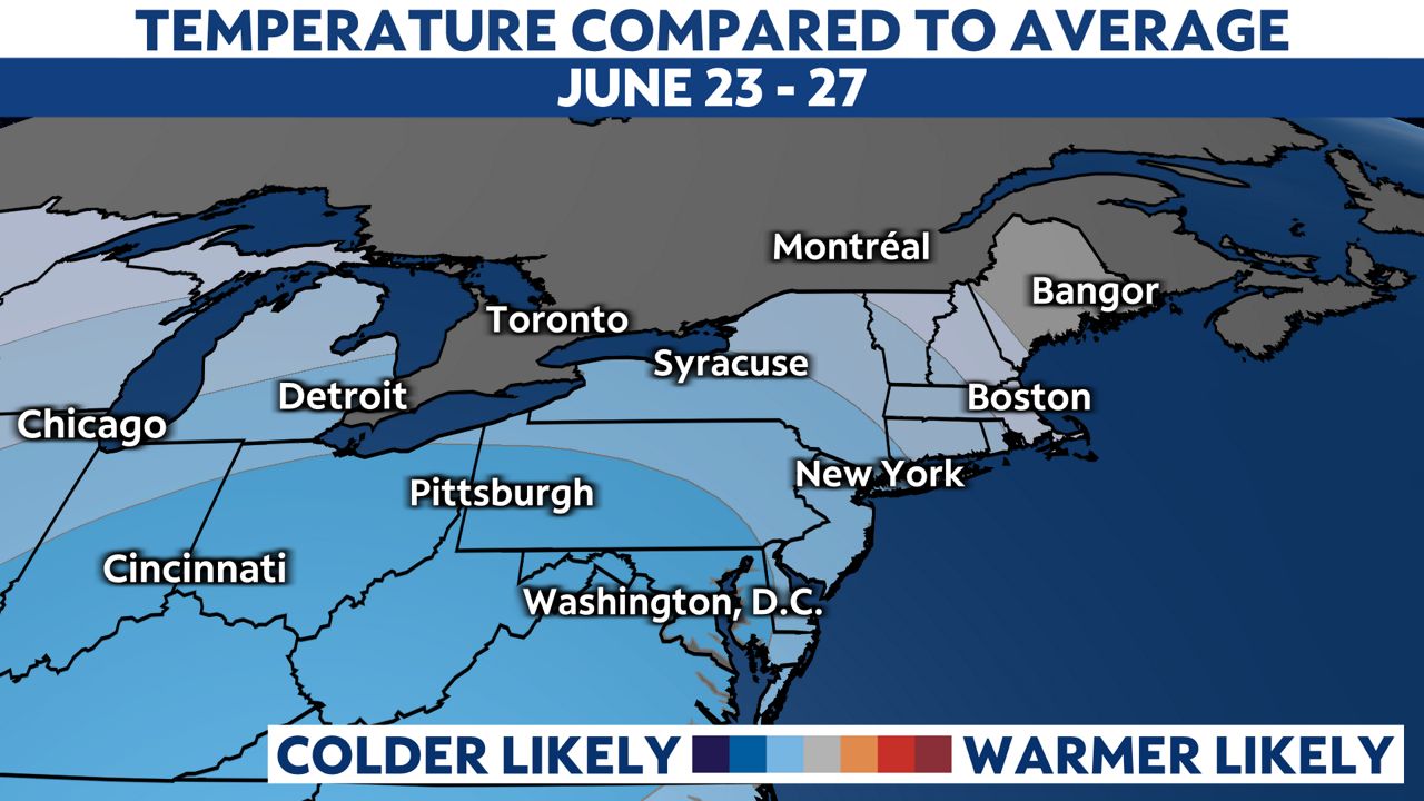
Even though temperatures may trend a bit cooler just beyond the seven-day forecast, there is some indication that temperatures may be at or a little above average heading toward the end of the month.

We're still not certain if this June will go down as one of the warmest on record, but given how warm it got so early this year and the climatological averages on the rise here in the Salt City, it is a possibility.