


Strong to severe thunderstorms are developing ahead of a cold front moving through New York State today.
A Severe Thunderstorm Watch has been issued for parts of the North Country, Central New York, Finger Lakes and Southern Tier this afternoon.
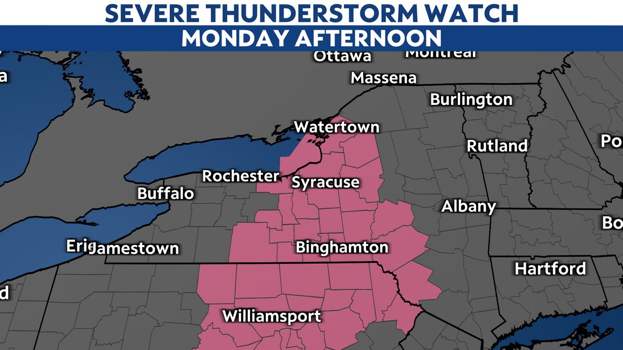
The watch area is in line with Storm Prediction Center thinking on where the elevated risk of severe weather is expected.

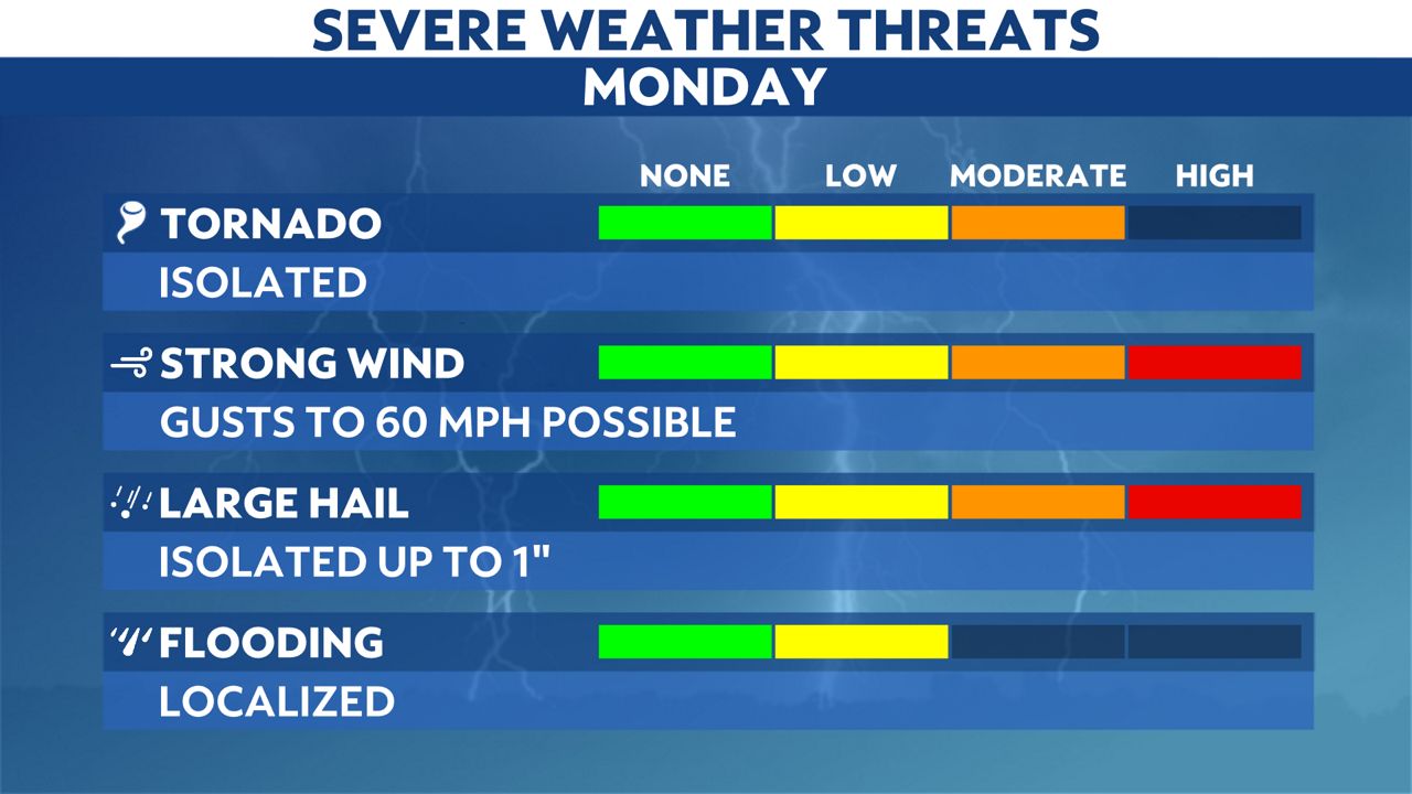
Ingredients will be in place for many across the state to have to deal with multiple severe weather impacts.
Within any stronger storm that develops, torrential rainfall, damaging wind gusts, hail and even a few isolated tornadoes are possible.
To download our Spectrum News1 app and sign up for weather alerts, click here.
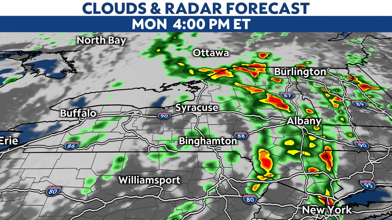
A line of thunderstorms will move through the Finger Lakes towards the I-81 corridor by late Monday morning into Monday afternoon.

The line of thunderstorms will continue to move eastward through the afternoon and into Monday evening for eastern New York.
Be sure to tune in to your local Spectrum News 1 forecast as we continue to track this severe weather potential. You can always download the Spectrum News 1 app for the latest interactive radar so you can be even more prepared with active weather strikes.