


As expected, most of our larger cities and communites didn't pick up much accumulation with the warmer ground this time of year.
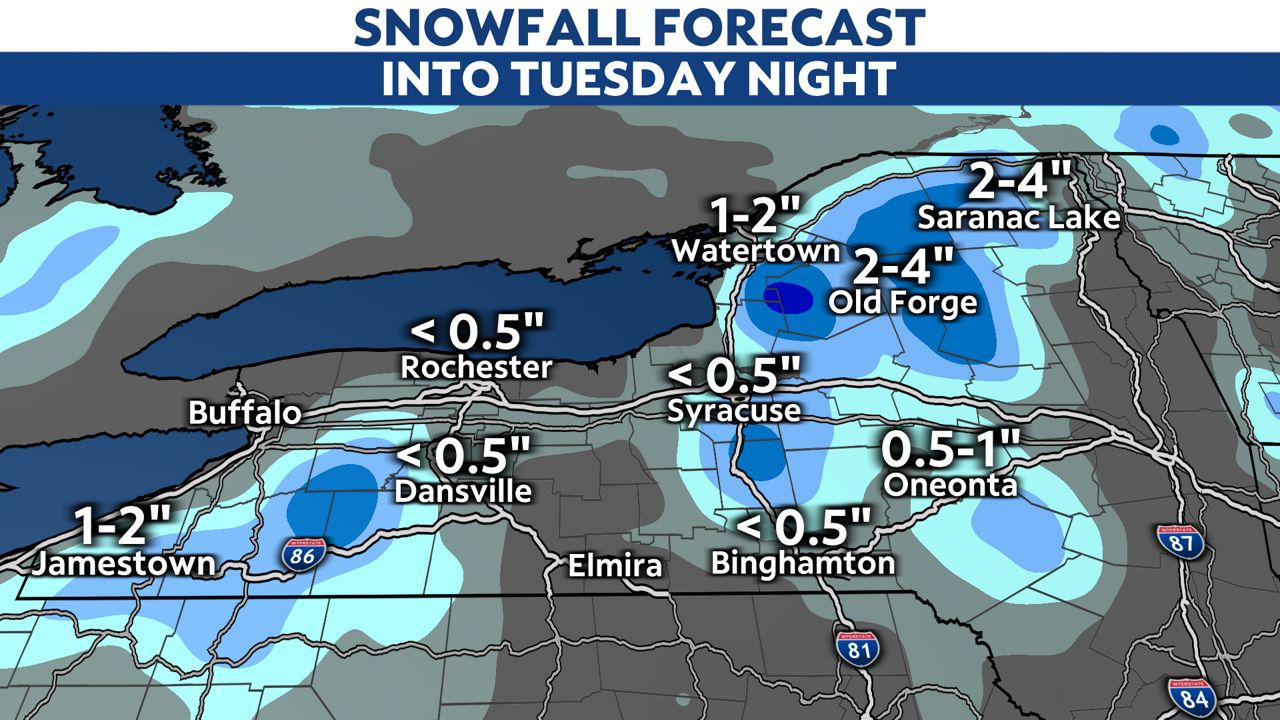
However, plenty of snow has fallen and will continue through sections of the Southern Tier, Central New York into the Adirondack Mountains. Elevation will continue to play a role in travel conditions as we move through Tuesday.
What You Need To Know
- Cold and blustery throughout the state
- The area-wide precipitation tapers to scattered mixed showers
- Additional accumulations come for some higher terrain areas
- Heavy, wet snow has caused some power outages
The areas between Binghamton and Syracuse have been especially hard hit with enough heavy, wet snow to cause widespread power outages for NYSEG and National Grid customers across the region.
The heaviest of the snow will be roughly east of Route 81 and west of the Hudson Valley into the Adirondack Mountains.
Check out the latest weather information for your local area here.
Elevation will continue to be a factor into tonight. Here is the potential snowfall for today into tonight. This is in addition to what already fell through 5 a.m. Tuesday.
Your 7-Day Forecast | Send us your weather photos