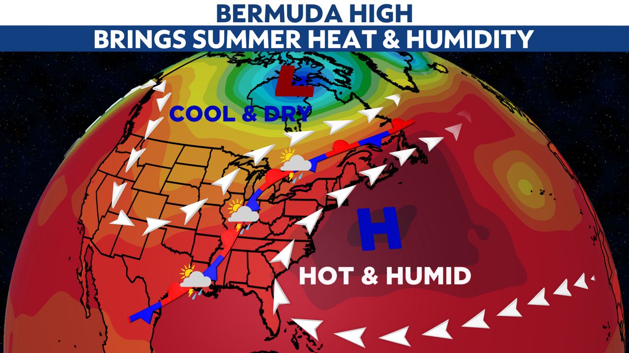
You have probably heard of the polar vortex and the cold it can bring to New York. There is another large-scale weather system, known as the Bermuda High, that brings us very warm, muggy, tropical-feeling weather.
A large area of high pressure will build in the Western Atlantic Ocean in the coming days.
This feature can influence our weather for a few days or dominate our weather pattern for months.

At the same time, a trough of low pressure will set up in the Northern Plains. Where the two air masses meet, a weather front will separate the cool, dry weather dropping in from Canada from the warm, moist air from the tropics.
This front will be the focal point for daily rounds of thunderstorms. There is still some uncertainty where this boundary sets up for the weekend and into next week.
As of now, we are going to be on the warm and muggy side of the front for at least several days. So, get ready for highs from the 80s to near 90 and lows from 65 to 70. #GoodPoolWeather!
Just watch out for the thunderstorm threat and lightning that comes with them.
It is also a good time to brush up on staying safe in the heat and humidity.
For a look at your local Spectrum News 1 weather forecast, click here.


