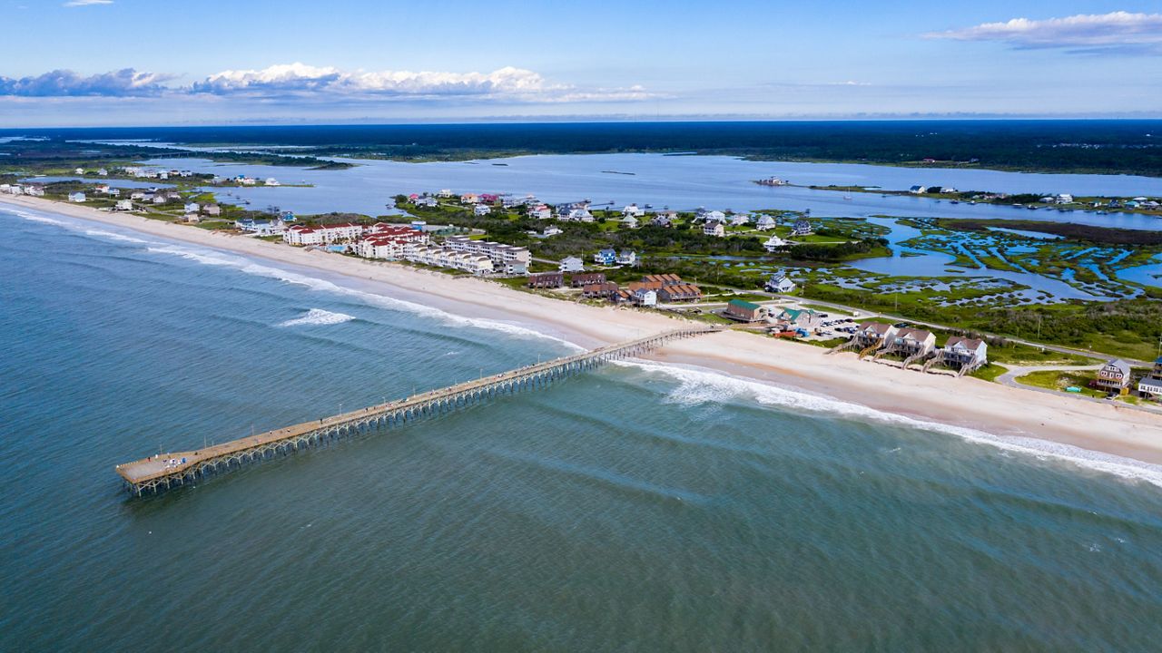
North Carolina enjoyed a break from this summer's very hot and humid weather early this week, but that is changing.
High temperatures will return to the 90s across most of the state for the Fourth of July with the exception of the 80s for parts of the mountains. The humidity will make it feel even hotter.
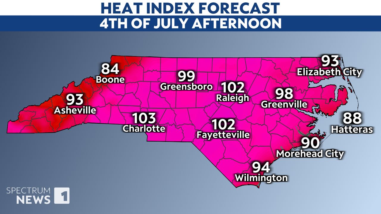
The heat index, or feels-like temperature, will be even hotter for Friday and Saturday.
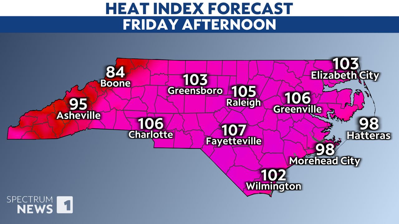
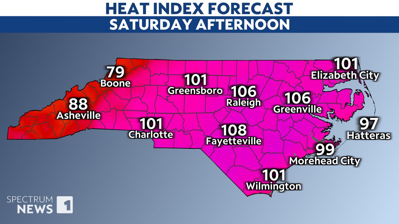
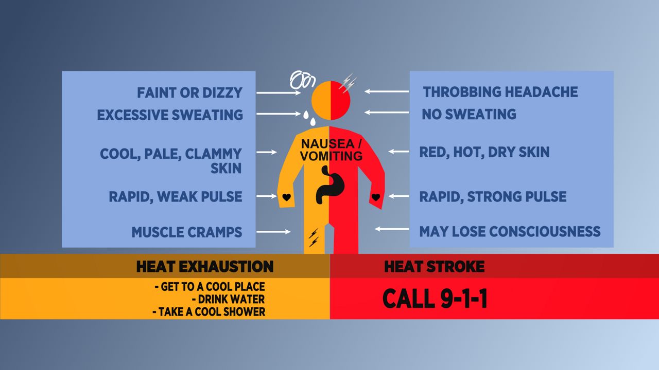
That will be dangerous heat for parts of North Carolina. Any time the heat index reaches near 105, we all become more susceptible to heat-related illnesses.
Be sure to stay hydrated and take frequent breaks in a cool location through the weekend to prevent heat exhaustion and heat stroke.
Most fireworks displays Thursday night should stay dry. However, locations near the Virginia border should keep a close eye on radar. Scattered storms are expected to develop in Virginia, and there's a slight chance a few could make it over the state line in the evening.
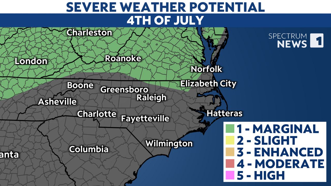
We'll see higher chances for afternoon and evening storms in North Carolina over the weekend. If you're making outdoor plans, be aware that some of the storms could produce locally heavy rain and frequent lightning.
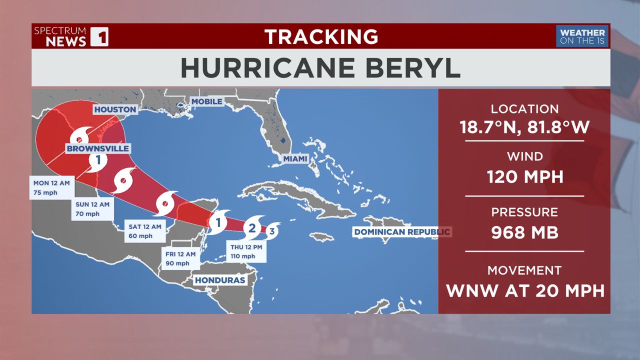
The tropics have been making headlines this week as Hurricane Beryl became the earliest Category 5 storm on record in the Atlantic basin. The storm continues through the Carribean today and will likely weaken a bit.
The storm is forecast to hit Mexico's Yucatan Peninsula Friday morning. It could then threaten northern Mexico or Texas by the end of the weekend. North Carolina should not experience any impacts from the storm.
The last time North Carolina was hit by a hurricane on Independence Day was ten years ago. Hurricane Arthur made landfall at Cape Lookout on July 4, 2014 becoming the earliest hurricane to hit the state on record.
Our team of meteorologists dives deep into the science of weather and breaks down timely weather data and information. To view more weather and climate stories, check out our weather blogs section.