Our Spectrum News 1 Weather Experts have broken down, by county, what to watch for as Tropical Storm Ophelia moves past the North Carolina coast. For the latest forecast updates, you can check here.
Main impact: Saturday
Tropical Storm Warning
Winds: 20 to 45 mph, gusts to 60
Rainfall: Additional 1 to 3 inches, locally higher amounts possible
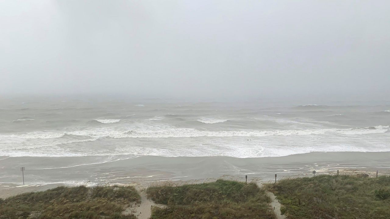
High Surf Advisory until 2 p.m.
Dangerous rip currents and large-breaking waves between 5 to 8 feet possible
Main impact: Saturday
Tropical Storm Warning
Winds (coastal): 20 to 30 mph, gusts to 45
Winds (inland): 40 to 50 mph, gusts to 65
Rainfall: Additional 1 to 3 inches, locally higher amounts possible
High Surf Advisory until 2 p.m.
Dangerous rip currents and large-breaking waves between 5 to 8 feet possible
Main impact: Saturday
Tropical Storm Warning
Winds: 30 to 40 mph, gusts to 55
Flood Watch in effect through this afternoon
Rainfall: Additional around 1 inch
Storm Surge Watch
Storm surge: Up to 2 to 4 feet above ground somewhere within surge prone areas
Main impact: Saturday
Tropical Storm Warning
Winds: 45 to 60 mph, gusts to 75
Flood Watch in effect through this afternoon
Rainfall: Additional 2 to 4 inches, with locally higher amounts possible
Storm Surge Warning
Storm surge: Up to 2 to 4 feet above ground somewhere within surge prone areas
Main impact: Saturday
Tropical Storm Warning
Winds: 35 to 45 mph, gusts to 55
Flood Watch in effect through this afternoon
Rainfall: Additional 2 to 4 inches, locally higher amounts possible
Storm Surge Watch
Storm surge: Up to 2 to 4 feet above ground somewhere within surge prone areas
High Surf Advisory until 8 p.m.
Dangerous rip currents and large-breaking waves between 7 to 12 feet possible
Tornado risk: Somewhat favorable
Main impact: Saturday
Tropical Storm Warning
Winds: 50 to 65 mph, gusts to 80
Flood Watch in effect through this afternoon
Rainfall: Additional 1 inch possible
Main impact: Saturday
Tropical Storm Warning
Winds: 45 to 60 mph, gusts to 75
Flood Watch in effect through this afternoon
Rainfall: Additional 1 inch possible
Storm Surge Warning
Storm surge: Up to 3 to 5 feet above ground somewhere within surge prone areas
Main impact: Through Saturday night
Tropical Storm Warning
Winds: 30 to 40 mph, gusts to 55
Flood Watch in effect until early Sunday morning
Rainfall: Additional 1 inch possible
Storm Surge Warning
Storm surge: Up to 2 to 4 feet above ground somewhere within surge prone areas
Tornado risk: Somewhat favorable
Main impact: Through Saturday night
Tropical Storm Warning
Winds (coastal): 35 to 45 mph, gusts to 60
Winds (inland): 30 to 40 mph, gusts to 60
Flood Watch in effect until early Sunday morning
Rainfall: Additional 1 inch possible
Storm Surge Warning
Storm surge: Up to 2 to 4 feet above ground somewhere within surge prone areas
Tornado risk: Somewhat favorable
Main impact: Saturday
Tropical Storm Warning
Winds: 45 to 55 mph, gusts to 70
Flood Watch in effect through this afternoon
Rainfall: Additional 1 inch possible
Tornado risk: Somewhat favorable
Main impact: Saturday
Tropical Storm Warning
Winds: 45 to 55 mph, gusts to 70
Flood Watch in effect through this afternoon
Rainfall: Additional 1 inch possible
Tornado risk: Somewhat favorable
Storm Surge Warning
Storm surge: Up to 3 to 5 feet above ground somewhere within surge prone areas
Tornado risk: Somewhat favorable
Main impact: Saturday
Tropical Storm Warning
Winds: 45 to 55 mph, gusts to 70
Flood Watch in effect through this afternoon
Rainfall: Additional 1 inch possible
Storm Surge Warning
Storm surge: Up to 3 to 5 feet above ground somewhere within surge prone areas
Tornado risk: Somewhat favorable
Main impact: Through Saturday night
Tropical Storm Warning
Winds: 20 to 30 mph, gusts to 45
Flood Watch in effect until early Sunday morning
Rainfall: Additional 1 inch possible
Storm Surge Warning
Storm surge: Up to 2 to 4 feet above ground somewhere within surge prone areas
Tornado risk: Somewhat favorable
Main impact: Though Saturday night
Tropical Storm Warning
Winds: 35 to 45 mph, gusts to 60
Flood Watch in effect until early Sunday morning
Rainfall: Additional 1 inch possible
Storm Surge Warning
Storm surge: Up to 2 to 4 feet above ground within surge prone areas
Tornado risk: Somewhat favorable
Main impact: Saturday
Tropical Storm Warning
Winds: 20 to 30 mph, gusts to 45
Flood Watch in effect through this afternoon
Rainfall: Additional 1 to 3 inches, locally higher amounts possible
Main impact: Through Saturday night
Tropical Storm Warning
Winds: 15 to 25 mph, gusts to 40
Flood Watch in effect until early Sunday morning
Rainfall: Additional 1 inch possible
Tornado risk: Somewhat favorable
Main impact: Saturday
Tropical Storm Warning
Winds: 30 to 40 mph, gusts to 55
Flood Watch in effect through this afternoon
Rainfall: Additional 1 to 3 inches, locally higher amounts possible
Main impact: Through Saturday night
Tropical Storm Warning
Winds: 15 to 25 mph, gusts to 40
Flood Watch in effect until early Sunday morning
Rainfall: Additional 1 inch possible
Tornado risk: Somewhat favorable
Main impact: Saturday
Tropical Storm Warning
Winds: 35 to 45 mph, gusts to 60
Flood Watch in effect through this afternoon
Rainfall: Additional 1 inch possible
Storm Surge Warning
Storm surge: Up to 2 to 4 feet above ground within surge prone areas
Tornado risk: Somewhat favorable
Main impact: Saturday
Tropical Storm Warning
Winds: 40 to 50 mph, gusts to 65
Flood Watch in effect through this afternoon
Rainfall: Additional 1 inch possible
Main impact: Saturday
Tropical Storm Warning
Winds: 40 to 50 mph, gusts to 65
Flood Watch in effect through this afternoon
Rainfall: Additional 1 inch possible
Tornado risk: Somewhat favorable
Main impact: Through Saturday night
Tropical Storm Warning
Winds: 30 to 40 mph, gusts to 55
Flood Watch in effect until early Sunday morning
Rainfall: Additional 1 inch possible
Storm Surge Warning
Storm surge: Up to 2 to 4 feet above ground within surge prone areas
Tornado risk: Somewhat favorable
Main impact: Saturday
Tropical Storm Warning
Winds: 25 to 35 mph, gusts to 45
Flood Watch in effect through this afternoon
Rainfall: Additional 1 inch possible
Storm Surge Watch
Storm surge: Up to 2 to 4 feet above ground within surge prone areas
Tornado risk: Somewhat favorable
Main impact: Saturday
Tropical Storm Warning
Winds: 30 to 40 mph, gusts to 55
Flood Watch in effect through this afternoon
Rainfall: Additional 1 inch possible
Storm Surge Watch
Storm surge: Up to 2 to 4 feet above ground within surge prone areas
Tornado risk: Somewhat favorable
Our team of meteorologists dives deep into the science of weather and breaks down timely weather data and information. To view more weather and climate stories, check out our weather blogs section.