


The remnants of what was once Hurricane Ida will track well north of North Carolina today. However, as the system combines with an approaching cold front, scattered storms are expected in central and eastern parts of the state.
Fortunately, the threat for flooding in and around the mountains of western North Carolina has ended.
Now our attention turns to scattered storms that are expected from midday into the early evening hours from the eastern Piedmont to the coast.
The Storm Prediction Center has already issued a Tornado Watch for a few counties in northeastern North Carolina.
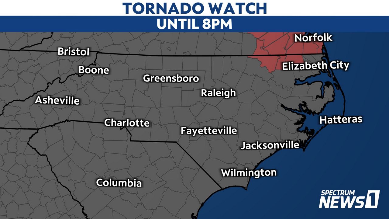
More watches may be needed later in the day as there is a marginal to slight risk for a severe storm across the eastern half of the state.
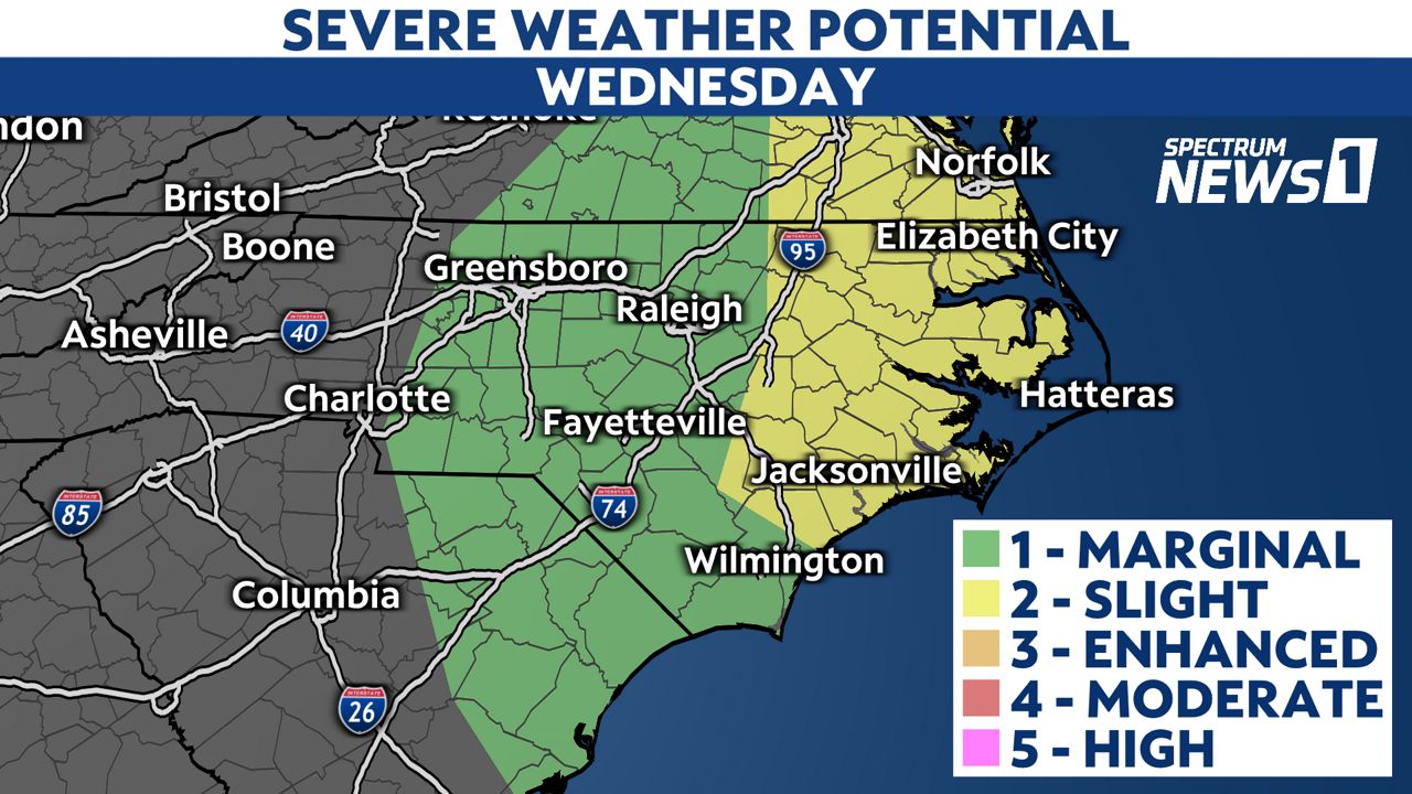
A few of the storms in the severe weather risk area could produce damaging wind gusts and even an isolated tornado.
If you are in this area, make sure you have a way to receive weather alerts. You can now receive those alerts on the Spectrum News app. Just check the settings in the app to ensure they are turned on.
If a Severe Thunderstorm or Tornado Warning is issued for your location, you should seek shelter in a small, interior room on the lowest floor of a sturdy building. A basement, closet, hallway, or windowless bathroom often offers the best protection during severe weather.
The threat for severe storms should be ending by 8 p.m. in central North Carolina and by 11 p.m. near the coast. Lingering showers will be possible into early Thursday morning.
Cooler air and lower humidity will spread across the state for the end of the week.
Stay tuned to Weather on the 1s on Spectrum News 1 for updates.