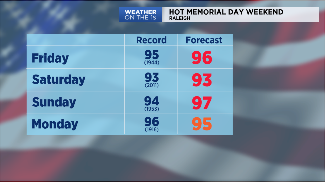
Wednesday will be the best day for any outdoor plans for at least the next one to two weeks. A heat wave will begin by Friday that will bring highs to the mid 90s through the Memorial Day weekend and into much of next week.
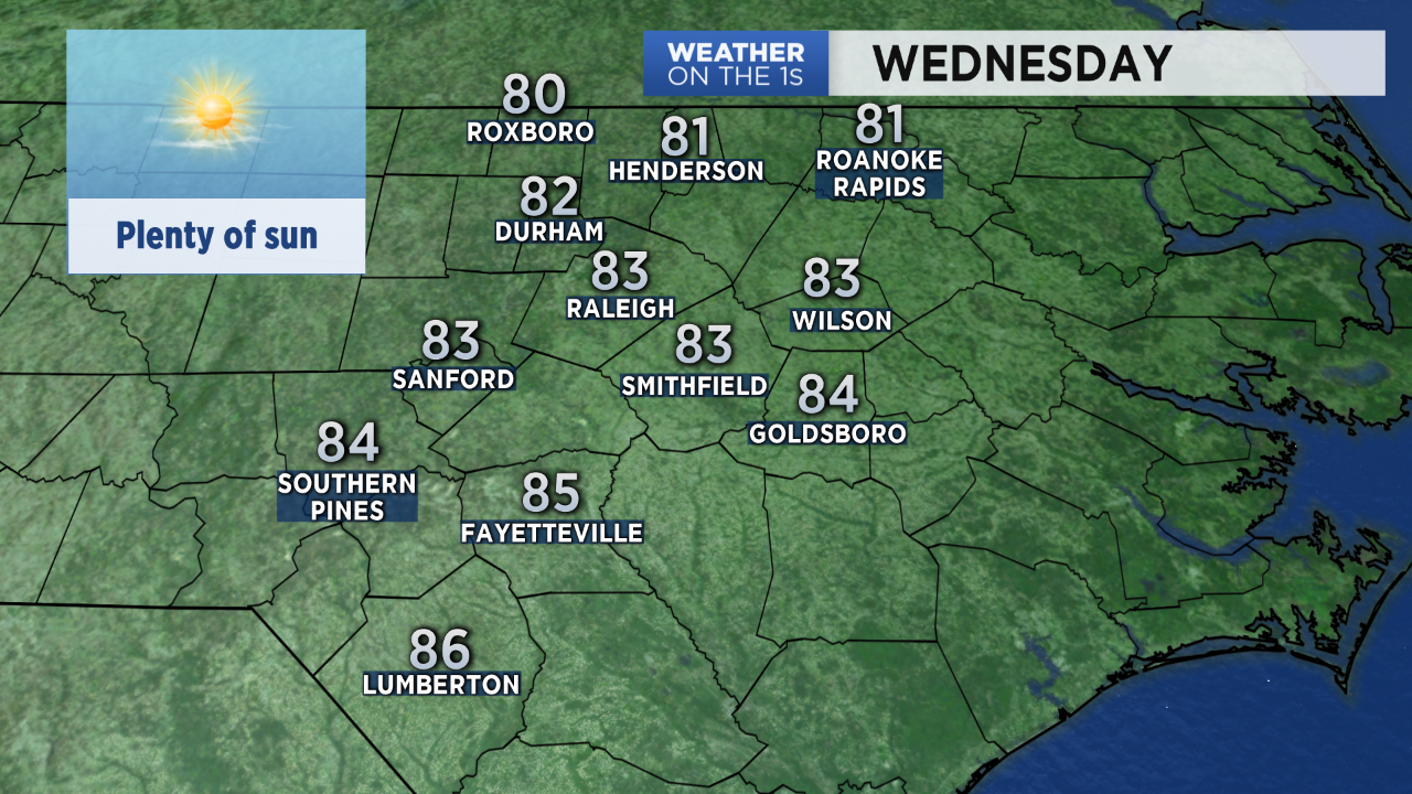
Wednesday's highs in the low to mid 80s are near to slightly above average for the second half of May in central North Carolina.
- Check the hourly forecast with our Spectrum News app
- Share your weather photos with Meteorologist Lee Ringer on Facebook
- 7-day forecast
Thursday will bring highs back to the upper 80s in the Triangle to near 90 in the Sandhills. The entire area should then see the mid 90s for Friday afternoon.
Record highs are possible almost each day from Friday through Memorial Day.
While it will be a bit muggy this weekend, the humidity will not be quite as high as we often see in the middle of summer. The heat index will be very close to the actualy temperature most days.
Rain chances will remain very limited over the next several days. However, a few isolated late day or evening storms are possible Thursday, Saturday, and Memorial Day.
)