


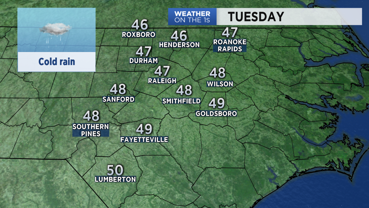
It feels like spring has taken a vacation in North Carolina and winter has returned for a day. A cold rain spreading into the state from the south could mix with snow briefly Tuesday morning in the portions of the Piedmont including the western Sandhills and the west side of the Triangle. Most locations will just see rain through the day with temperatures only warming to the mid and upper 40s in the afternoon.
- Interactive radar
- Report weather conditions from your part of North Carolina and share your weather photos with Meteorologist Lee Ringer on Facebook
Tuesday's rain is the result of a low pressure system moving up the Carolina coast. As the low pressure moves away from the coast, the rain should taper off from southwest to northeast between 3 and 7pm.


The coastal storm will be strengthening through the day. That will also create breezy conditions along with the cold rain. Wind gusts up to 25mph are expected in central North Carolina through the afternoon. Along the coast, gusts up to 45mph are forecast for the Outer Banks.
Clearing skies Tuesday night will allow temperatures to return to the mid 30s by sunrise Wednesday morning.

All day sunshine Wednesday will bring much warmer temperatures by the afternoon. Highs in the 60s and 70s are forecast for the rest of the week through the upcoming weekend.

After Tuesday, our next chance for rain will come Friday.
