


NORTH CAROLINA -- On Thursday, February 14, the Climate Prediction Center officially declared that El Niño is her and has a 55 percent chance of sticking around into spring.
- El Niño is a global climate pattern that occurs when there is a large area of warmer than normal ocean water in the equatorial Pacific Ocean
- El Niño generally brings wetter than average winters to the Southeast and North Carolina, and tends to bring cooler winters as well
- El Niño may also have an impact on the upcoming Hurricane Season, where it tends to result in a less active season in the Atlantic Basin and a more active season in the Eastern Pacific
Even though it is expected to be a weak El Niño, since developing pretty late in the game, forecasters note that it will still play some role in the weather across the United States over the next few months. Could this be the cause of our recent streak of wet weather here in North Carolina?
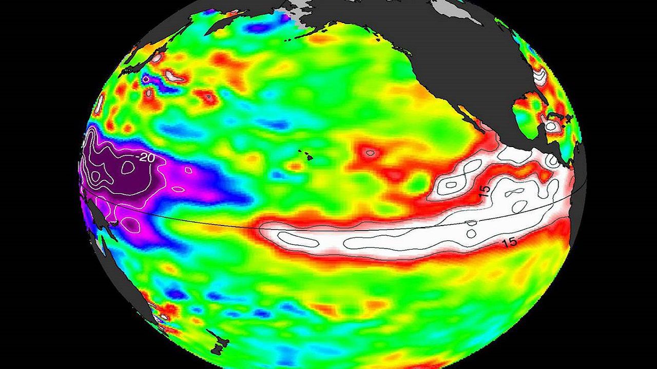
Well first, let’s break down what El Niño is. El Niño is a global climate pattern that occurs when there is a large area of warmer than normal ocean water in the equatorial Pacific Ocean. El Niño tends to peak during winter months. During El Niño, the jet stream splits into two separate streams, where one jet stream typically end up in the southern tier of the country, allowing for a constant “conveyer belt” of moisture across the region. This is why El Niño generally brings wetter than average winters to the Southeast and North Carolina, and tends to bring cooler winters as well.
After five days straight of measurable rainfall in Charlotte with more rain on the way, it seems we may already be feeling the impacts of El Niño, despite it’s weak nature.
El Niño may also have an impact on the upcoming Hurricane Season, where it tends to result in a less active season in the Atlantic Basin and a more active season in the Eastern Pacific.
Get the latest news, sports and weather delivered straight to your inbox. Click here to sign up for email and text alerts.