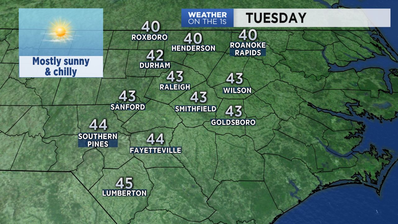
We will still need our sweaters, coats, and jackets all day Tuesday, but the afternoon will not be quite as cold as Monday. Much of the Triangle never made it above freezing Monday. The high was only 31 at the Raleigh-Durham Airport and at the National Weather Service office in southwest Raleigh. Fayetteville spent just four highs above freezing Monday afternoon with a high of 35.
All day sunshine should warm Tuesday afternoon's temperatures to the low and mid 40s around central North Carolina.
Look for increasing cloudiness late Tuesday night well ahead of the next storm system approaching the Carolinas. Temperatures will drop to the upper 20s to near 30 by around midnight and then could slowly warm through sunrise Wednesday.
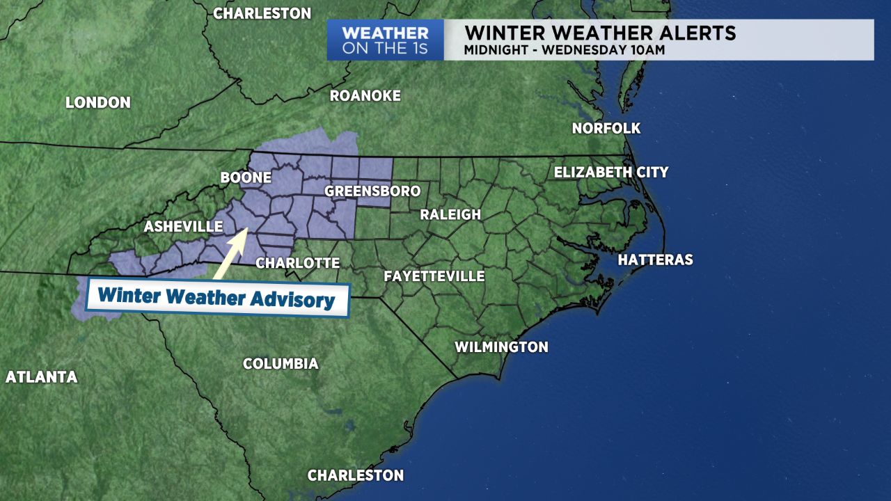
Patchy light freezing rain or freezing drizzle is expected to develop across the state's foothills and western Piedmont between midnight and sunrise. Most if not all of this precipitaiton should stay west of the Triangle and Sandhills.
A Winter Weather Advisory has been issued for locations in the state that could see the patchy freezing rain including Greensboro, Winston-Salem, and areas just north and west of Charlotte. Slick spots are possible on roads especially bridges and overpasses in this region early Wednsday.
- Interactive radar
- 7-day forecast
- Share your weather photos with Meteorologist Lee Ringer on Facebook
Despite mostly cloudy skies, temperatures should rise quickly through the day Wednesday here in central North Carolina. Late afternoon highs should range from the upper 50s in the Triangle to the low 60s in the Sandhills.
A few spotty showers are possible Wednesday, but our highest chance for rain this week should come late Wednesday night through Thursday morning. Around a half inch to inch of rain should fall during that time.