


The first weekend of spring will not feel much like spring for North Carolina. Much of the state is in for cool and wet weather. Some areas could even see snow!
Low pressure developing over the central U.S. Friday will track toward the Carolinas Saturday. Ahead of that low, precipitation will spread from west to east across North Carolina during the day Saturday. The precipitation will start as snow in the mountains and foothills Saturday morning, but it should just be rain as it arrives in central and eastern North Carolina around midday and into the afternoon.
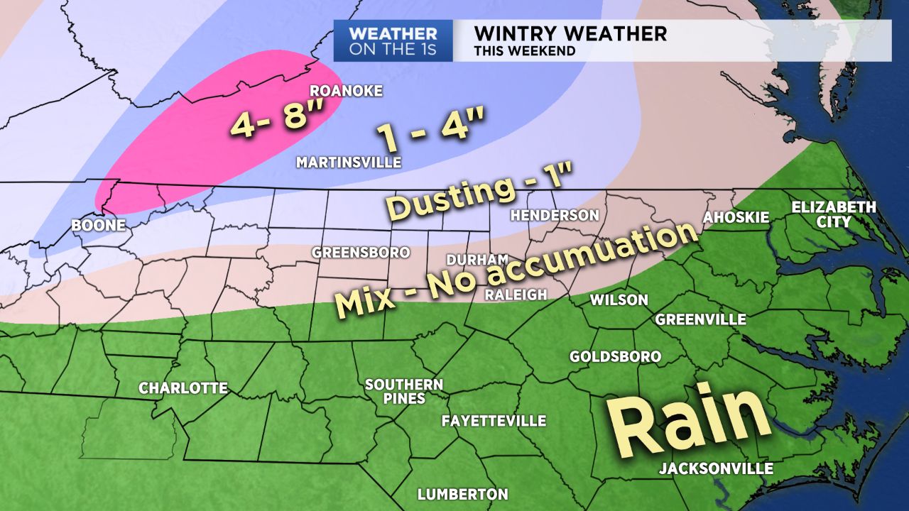
By Saturday night, locations from near the Triangle and Triad to the north will see the rain mix with and change to snow at times. Some sleet could also be mixed in with the rain or snow. The mix of precipitation will then continue into early Sunday morning. Locations south of Greensboro and Raleigh should see all rain through the night.
Due to a relatively warm and wet ground with temperatures hovering near or just above freezing, accumulation will be difficult for most locations. A dusting to one inch of snow could collect on grassy and elevated surfaces north of Greensboro and Durham. Higher amounts are expected north and west of Winston-Salem and into Virginia.
Rainfall amounts for much of central and eastern North Carolina will range between a half inch and one inch.
All of the precipitation should come to an end by mid to late morning Sunday. Dry conditions will return for Sunday afternoon through much of next week.
A warming trend by the middle of next will bring highs into the 70s for much of North Carolina by Thursday.
Get the latest news, sports and weather delivered straight to your inbox. Click here to sign up for email and text alerts.


