NORTH CAROLINA -- Hurricane hunter aircraft flying into Hurricane Irma early Tuesday found the storm rapidly strengthened overnight. It is now a category 5 storm with maximum sustained winds as of Tuesday morning at 175 mph.
The devastating storm is forecast to move over the Leeward Islands Tuesday. The eye of the storm is then expected to move just north of Puerto Rico bringing hurricane force winds to the island from Wednesday into early Thursday.
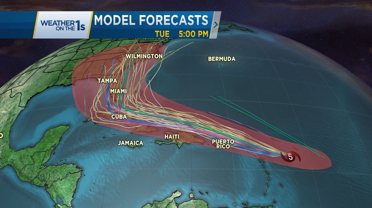
Irma will likely fluctuate between a category 5 and 4 hurricane through the end of the week as it approaches the southern Bahamas. The storm could be anywhere from from Cuba to the Florida Keys to south Florida by the weekend.
Most computer model forecasts still indicate the storm will take a northerly turn this weekend. However, it remains highly uncertain of just when that turn will happen. There are several different scenarios our meteorologists are watching:
1. The storm takes an early turn to the north and northeast taking the storm out to sea. This would be the best case scenario for the United States. Unfortunately, the latest weather data from Tuesday morning suggests that may be the least likely scenario.
2. The storm could turn north moving just off the east coast of Florida. This would be the worst case scenario for the Carolinas as the powerful hurricane would stay over warm waters and could eventually landfall early next week along the Carolina coast.
3. The storm tracks directly up the Florida peninsula or along Florida's west coast. This would be the worst case for Florida bringing destructive winds and flooding rains to almost the entire state. The storm would weaken over land but could still bring heavy rains to portions of the Carolinas early next week.
Model forecasts will likely shift back and forth from west to east and east to west over the coming days. While the threat appears to be increasing for Florida, the Carolinas should continue to make preparations in the event a major hurricane approaches at the end of this weekend and early next week.
A lot of false and unreliable information has been floating around social media about the storm. For reliable and responsible storm information, watch for updates from the National Hurricane Center and trusted media sources like Spectrum News.
A much clearer forecast is expected by the second half of this week.


