


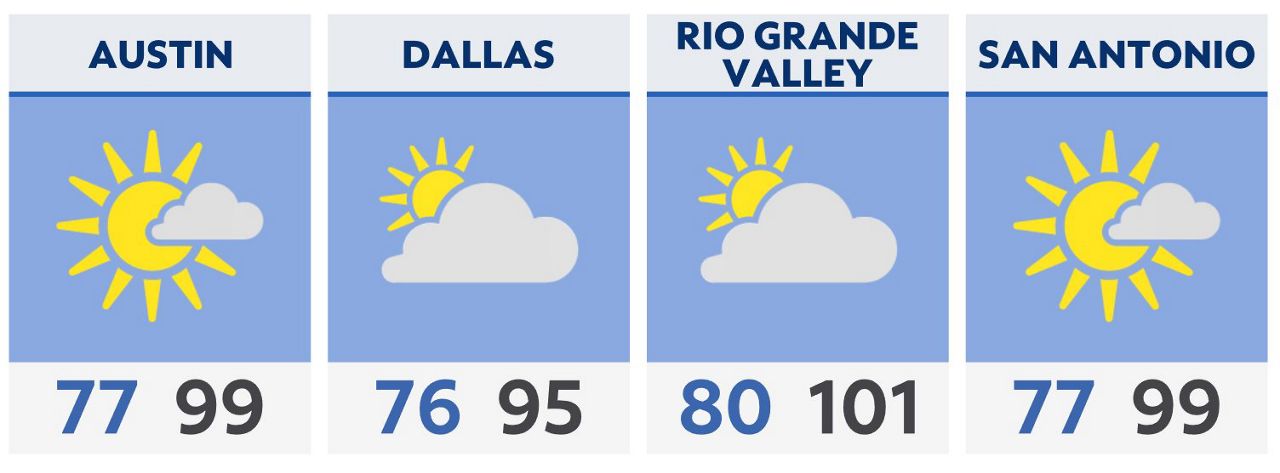
Our heat begins to peak going into our Sunday afternoon across Texas, with many locations seeing Heat Index values well into the 100s today. This is all due to a ridge of high pressure over the area.
By this evening, all that heat and humidity will be the fuel for significant severe weather across North Texas. Main timing for Dallas – Fort Worth looks to be between 8 p.m. to 2 a.m. this evening and tonight.
The line of storms that move in will be capable of extreme wind gusts upwards of 80 mph this could cause power outages and damage to property.
Central, south and west Texas stays mostly dry until Tuesday when the pattern changes to a more wet pattern.
Tropical Outlook: No development likely through the next five to seven days.
Click here for the latest 7 Day Forecast | Click here to share your weather photos