


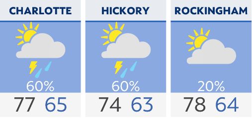
Ample moisture ahead of an approaching cold front brings rain to the region through the day. A few thunderstorms could mix in due to daytime heating, but the severe weather threat remains low. Highs today will warm into the low to upper 70s.
Another wave of showers and thunderstorms arrives early Monday morning. Storms are possible and could be severe from the mountains early in the day to the coast in the evening. The main threats include damaging wind gusts, isolated tornadoes, localized flooding and large hail.
Expect a brief cooldown Tuesday and Wednesday before a warm and moist air mass settles in. Temperatures will warm into the 80s for much of the state, plus daily rain chances return.
Check radar and the latest 7-day forecast | Share your weather photos