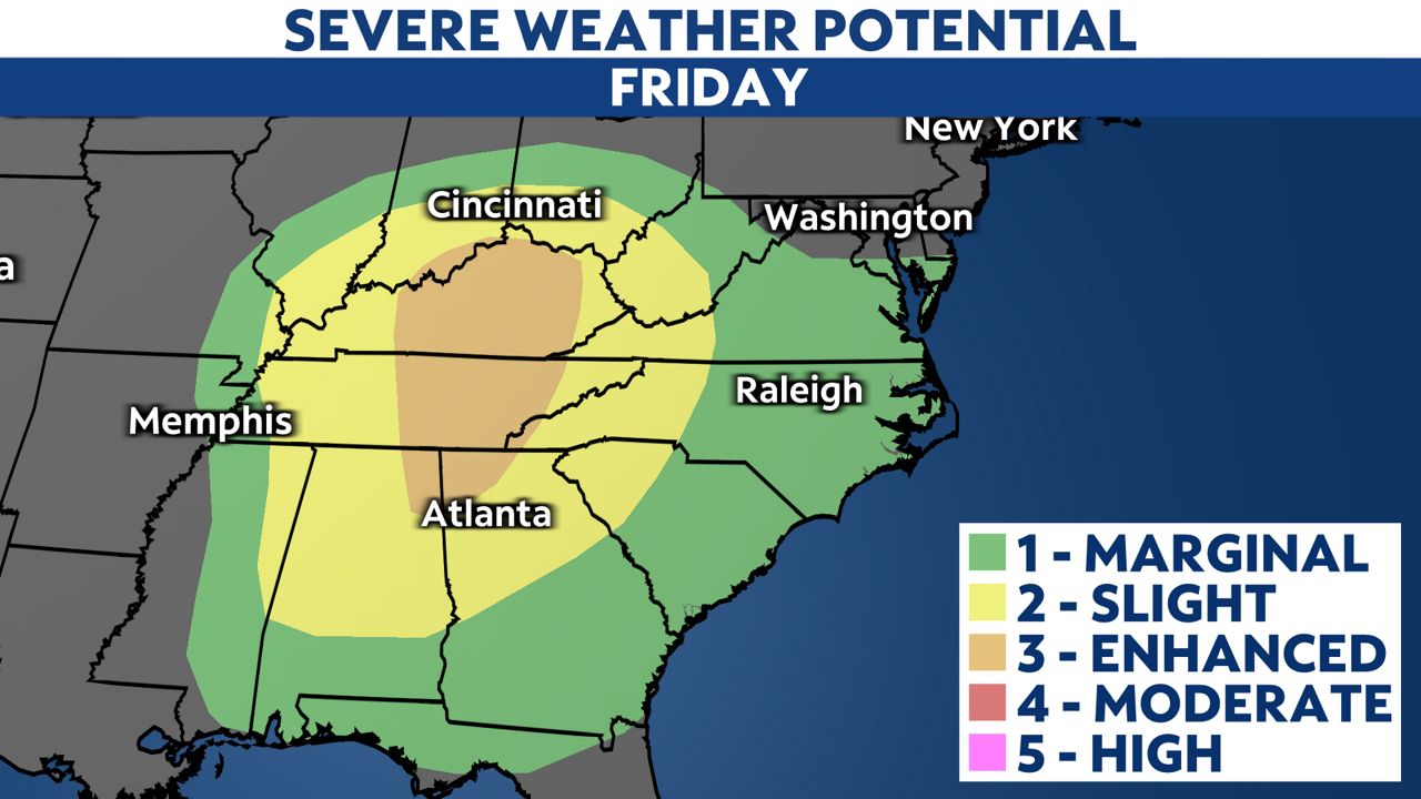
A storm system with a history of producing severe weather over the south-central United States late Thursday will bring storms to the Carolinas Friday afternoon through Friday night.
The greatest threat for severe weather Friday will remain just to our east from central Kentucky to parts of northern Georgia.

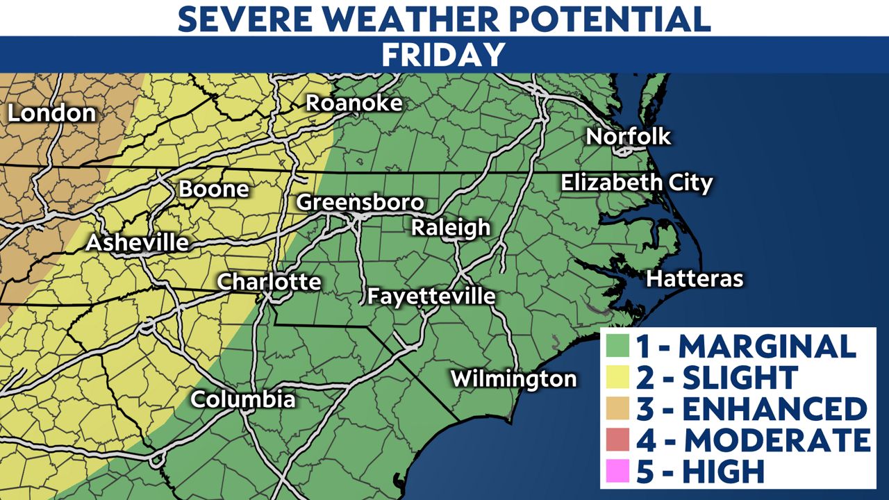
However, the Storm Prediction Central has outlined all of North Carolina for a level 2 to 1 risk for severe storms.

The greatest threat from the storms will come from damaging wind gusts. The strongest storms could produce gusts in exesss of 60 miles per hour.
The threat for a tornado looks low but cannot be completely ruled out this afternoon in western parts of the state.
The storms should arrive in the mountains around mid to late afternoon and move off the coast after midnight.
Sunny weather is forecast for the weekend.
If the National Weather Service issues a Tornado or Severe Thunderstorm Warning for your location, seek shelter in an interior room on the lowest floor of a sturdy building. Basements, hallways, closets and windowless bathrooms provide the best protection during severe weather.
Severe weather can occur anytime of the year in North Carolina, but March marks the start of an active time of the year that continues through April and May for severe storms in our state.
Stay tuned to Spectrum News 1 and the Spectrum News app for updates.


