Everyone in North Carolina needs to stay weather-aware today.
A storm system with a history of producing severe weather will track across the Carolinas.
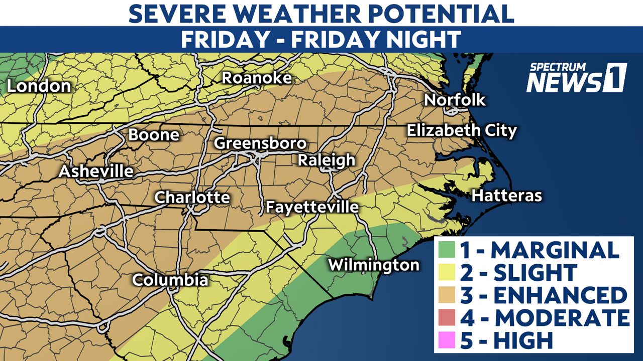
Scattered severe storms are likely across the state starting as early as midday in western North Carolina and continuing into the night in eastern North Carolina.
Due to forecasts of a risk of severe storms and dangerous winds this afternoon, all DPS schools will dismiss two hours early today, Friday, May 6. All after-school programs and extracurricular activities are canceled. pic.twitter.com/PYPijvwPJU
— Durham Public Schools (@DurhamPublicSch) May 6, 2022
The Storm Prediction Center has now highlighted much of the state for an "enhanced risk" for severe storms.

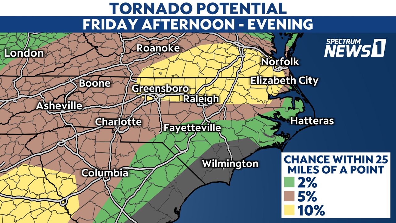
The primary threats from any severe storms will be damaging wind gusts and hail but a few tornadoes are possible too.
The greatest threat for a tornado will come with a warm front lifting across the state this afternoon. We'll especially have to watch storms that may develop around mid afternoon near the Triad and Triangle and northeastern North Carolina for any signs of rotation.

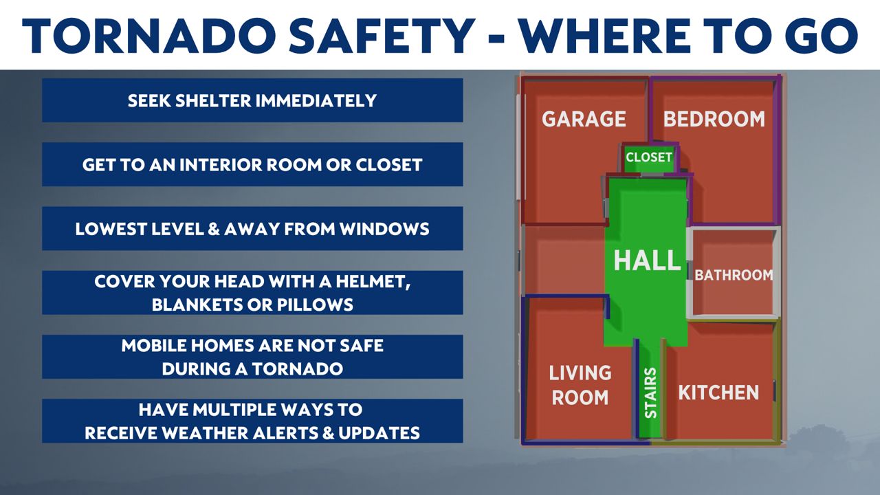
If a Tornado Warning is issued, seek shelter in a small, interior room on the lowest floor of a sturdy building. Basements, closets, hallways and windowless bathrooms often provide the best protection during a severe storm.

The severe weather threat should come to an end in eastern North Carolina by midnight.

Cooler weather is in the forecast across the state for the weekend, although non-severe thunderstorms remain possible in central and eastern portions of the state on Saturday.
Stay tuned to Weather on the 1s on Spectrum News 1 for updates.
Interactive radar | Share your weather photos with the Weather on the 1s team


