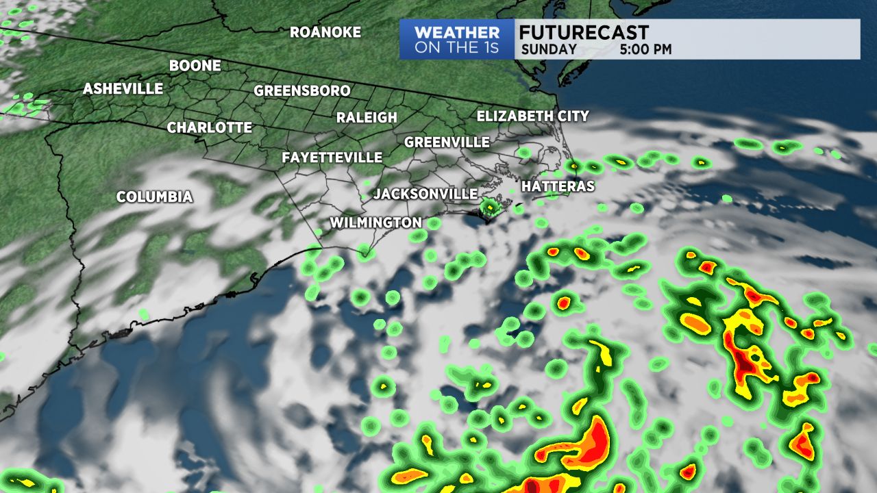
WILMINGTON, N.C. -- Tropical Depression 3 was upgraded Sunday morning by the National Hurricane Center to Tropical Storm Chris.
- Highs Monday will peak in the upper 80s as clouds dominate our skies
- Expect mostly sunny skies Tuesday before clouds grow back in Wednesday
- A cold front will look to slide through the region and this will likely cause scattered storms Wednesday and Thursday
The center of circulation was last located 160 miles south of Cape Hatteras. It has maximum sustained winds of 45 mph with gusts as high as 60 mph.
Over the next few days, Chris is expected to meander just off shore. This will create dangerous rip currents along all of North Carolina’s beaches and keep rain chances elevated for areas east of I-95.
By Tuesday, Chris is expected to turn northeast and continue to strengthen, likely become a category 1 hurricane by early Wednesday.
A North Carolina landfall is not expected, but Chris will impact our weather over the coming days.
Today expect more clouds than sun with spotty showers for areas along the coast Sunday afternoon and evening. Winds will be breezy between 15 to 25 mph with stronger gusts possible.
This weather will repeat itself Monday as Chris remains stationary just offshore. Highs Monday will peak in the upper 80s as clouds dominate our skies. Scattered showers will be possible throughout the day.
Chris will begin to move away from our area late Monday allowing for a brighter Tuesday. Expect mostly sunny skies Tuesday before clouds grow back in Wednesday.
A cold front will look to slide through the region and this will likely cause scattered storms Wednesday and Thursday.
Get the latest news, sports and weather delivered straight to your inbox. Click here to sign up for email and text alerts.
-1)