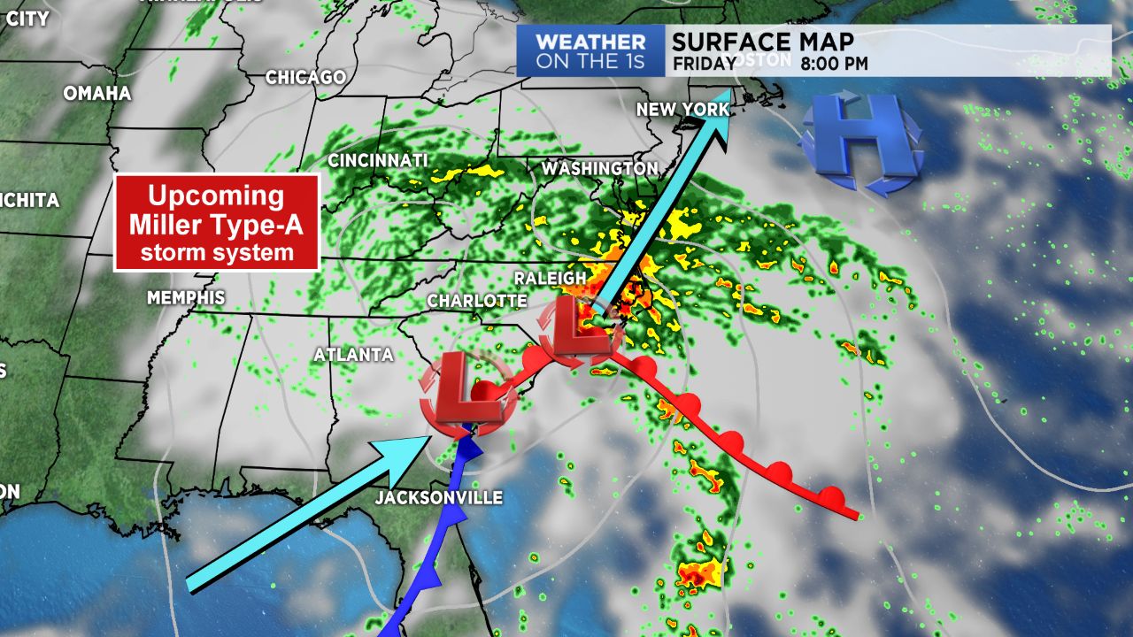
NORTH CAROLINA -- You may have heard that Friday is going to be a day of chilly temperatures and rain. You may have also heard the term “Miller Type-A storm” thrown around in the weather community and in on-air forecasts. This is a term used to describe the system that is on it’s way and to classify types of Nor’easters.
There are two types of Miller classifications: (1) Miller Type-A and (2) Miller Type-B. The different classifications are used to describe the differences in track. The one we will be dealing with is a Miller Type-A storm. In this scenario, one low pressure system develops off the southeast coast or in the Gulf of Mexico — as is the case with our incoming system — and then moves up the East Coast, where it typically strengthens, then eventually turns out to sea.
Miller Type-A storms typically bring a lot of snow to the Mid-Atlantic, which is usually, but not always, the hardest hit area. These storms also tend to have very little mixed precipitation, like freezing rain and sleet, making most of the precipitation definitive rain or snow.
So what will this incoming “Miller Type-A” storm bring to the North Carolina on Friday? Well for snow lovers, this may be a bit of a waste of a Miller Type-A storm as it won’t be bringing us anything in terms of snow, other than maybe a few sloppy snow flakes mixed with rain for the High Country early Friday morning. Overall, we’ll just be dealing with a chilly rain throughout the day as a “Cold Air Damming” scenario also sets up in the meantime. This will prevent temperatures from warming out of the 40s for most. Gear up for a raw, rainy day to end the work week!


)


