CHARLOTTE, N.C. -- Monday will feature yet another day of below average temperatures and dry conditions. A dry cold front moving through Tuesday will bring another shot of cold air for Wednesday before rain chances ramp up Friday into the weekend.
- Below average temperatures will be present for Monday.
- Temperatures will remain cool throughout the day.
- The best chance for rain this week is Friday.
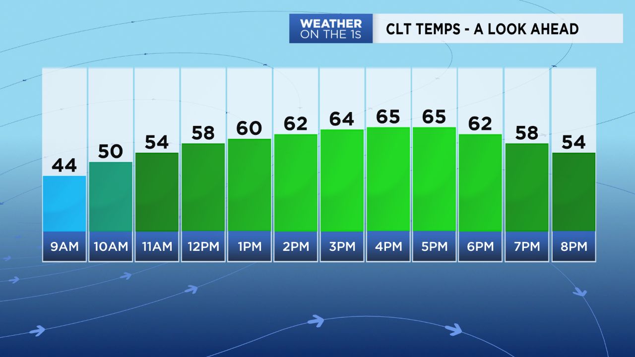
After a morning of Freeze Warnings and Frost Advisories lining up across the Piedmont into the mountains Monday morning, temperatures will remain cooler than normal throughout the day. Expect a November-like afternoon as temperatures top off in the low to mid 60s under lots of sun. Monday night will be chilly, but not as cold as Monday morning with lows expected to drop in the upper 30s to low/mid 40s.
A cold front will pass through the area Tuesday, but shouldn't bring us anything in terms of rain. Other than a few passing clouds, the only noticeable impact this front will bring is another cool down Wednesday. We'll go from highs in the low 70s Tuesday back down into the mid 60s Wednesday with full sunshine returning.
Our next best chance for rain will return Friday and continue into the weekend as a system moves in from the Gulf. Due to the increase in cloud cover this system will bring, expect lows to be milder but highs to be well below average, ranging from the upper 40s to low/mid 50s Friday through Sunday.