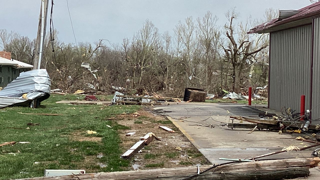
A confirmed tornado touched down near Maeystown, Ill. near Route 3 in Monroe County.
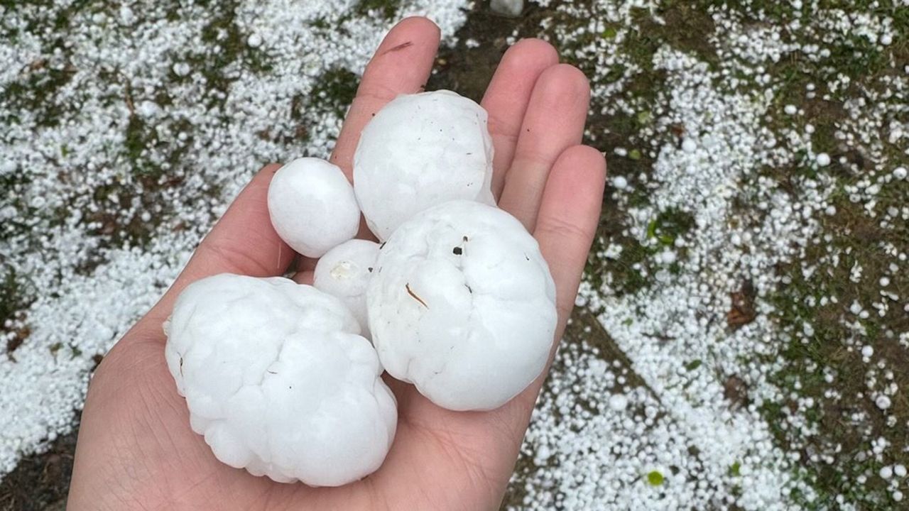
There have been several reports of large hail in the area, some the size of baseballs. It appeared that hail stopped traffic along I-70 and Bryan Road in St. Charles around 4:00 p.m.
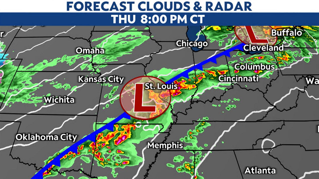
A potent low-pressure system will ride along a cold front approaching Missouri from the southwest. Ahead of the cold front lies warm and moist air.
A Tornado Watch is in effect until 9:00 p.m. Thursday.
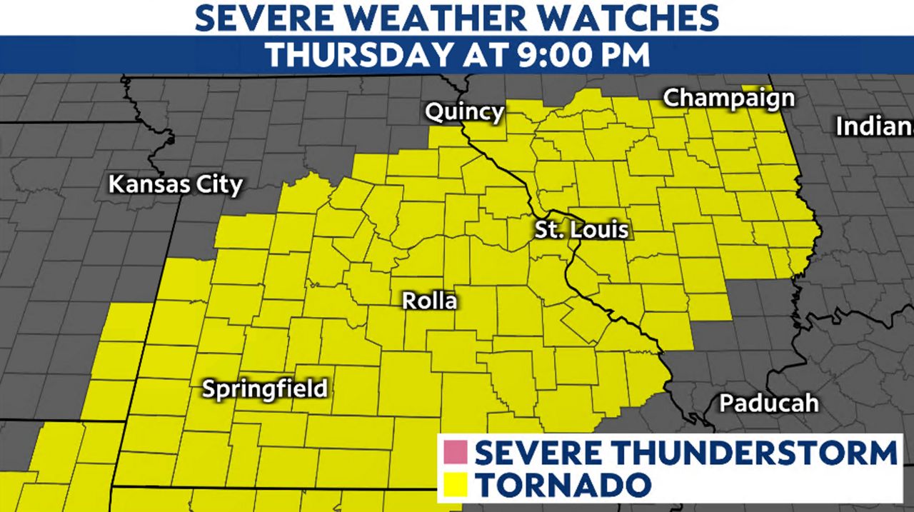
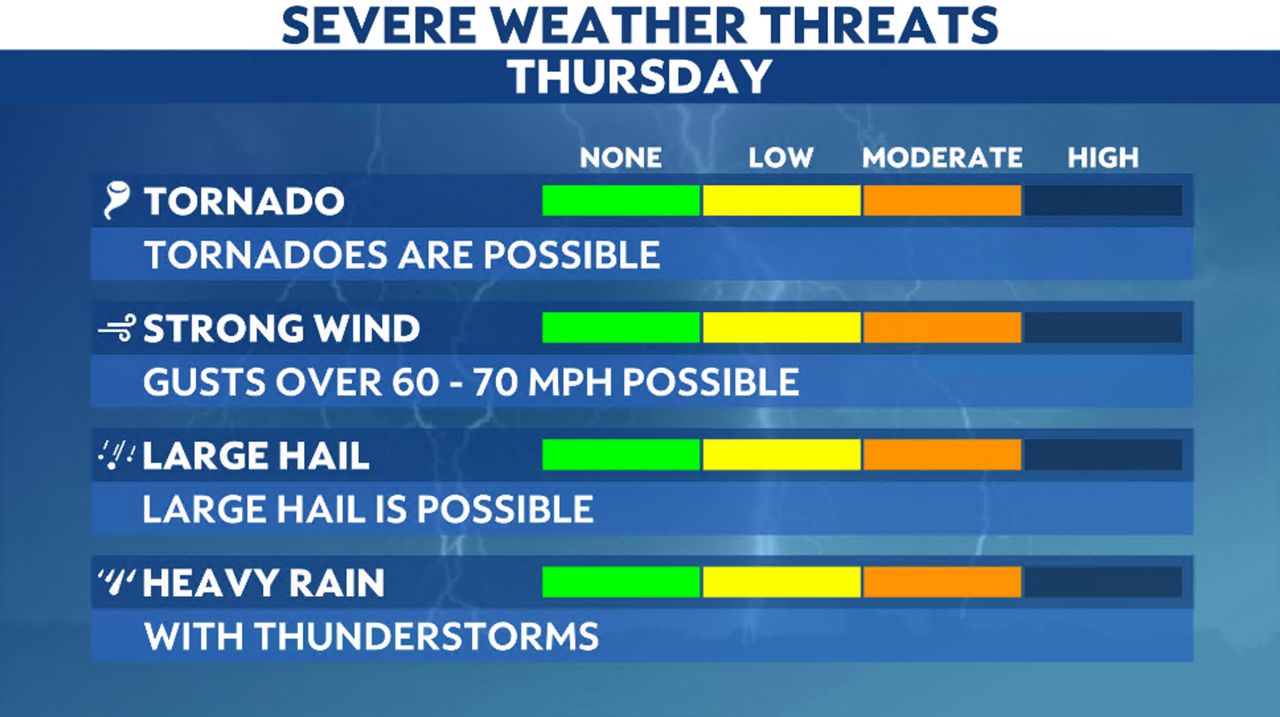
The St. Louis area is under a level 2/5 threat for severe weather.
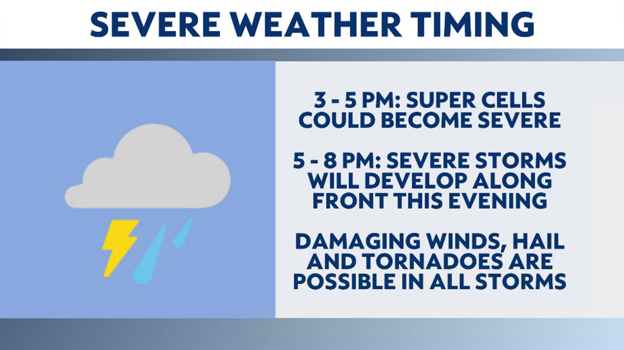
A severe threat exists Thursday afternoon and evening. All of the threats are there with the passage of this system. Damaging winds, large hail and even tornadoes. Make sure you plan accordingly.
With warm air out ahead of the cold front, there will be enough instability to get storms going. The timing looks to be late afternoon into the evening. Anywhere from 3 p.m. through 9 p.m.
By Thursday night, the front will be south and east of St. Louis and any storm activity will wane. Cooler air will flow in behind the front.
Dry conditions will return for the end of the workweek, although clouds will stick around. Highs will be around 60 degrees in both places.
Our team of meteorologists dives deep into the science of weather and breaks down timely weather data and information. To view more weather and climate stories, check out our weather blogs section.