The National Weather Service in St. Louis held a webinar recently on the 2024 Spring Flood Outlook. Senior Service Hydrologist Mark Fuchs hosted.
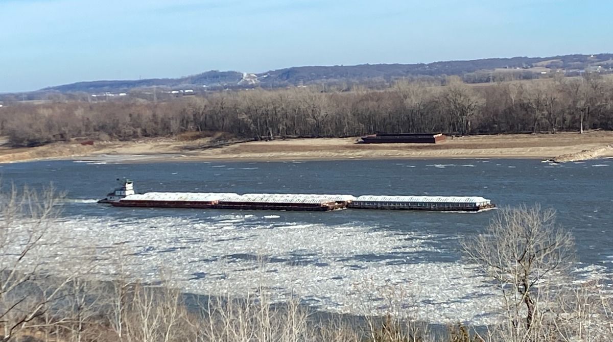
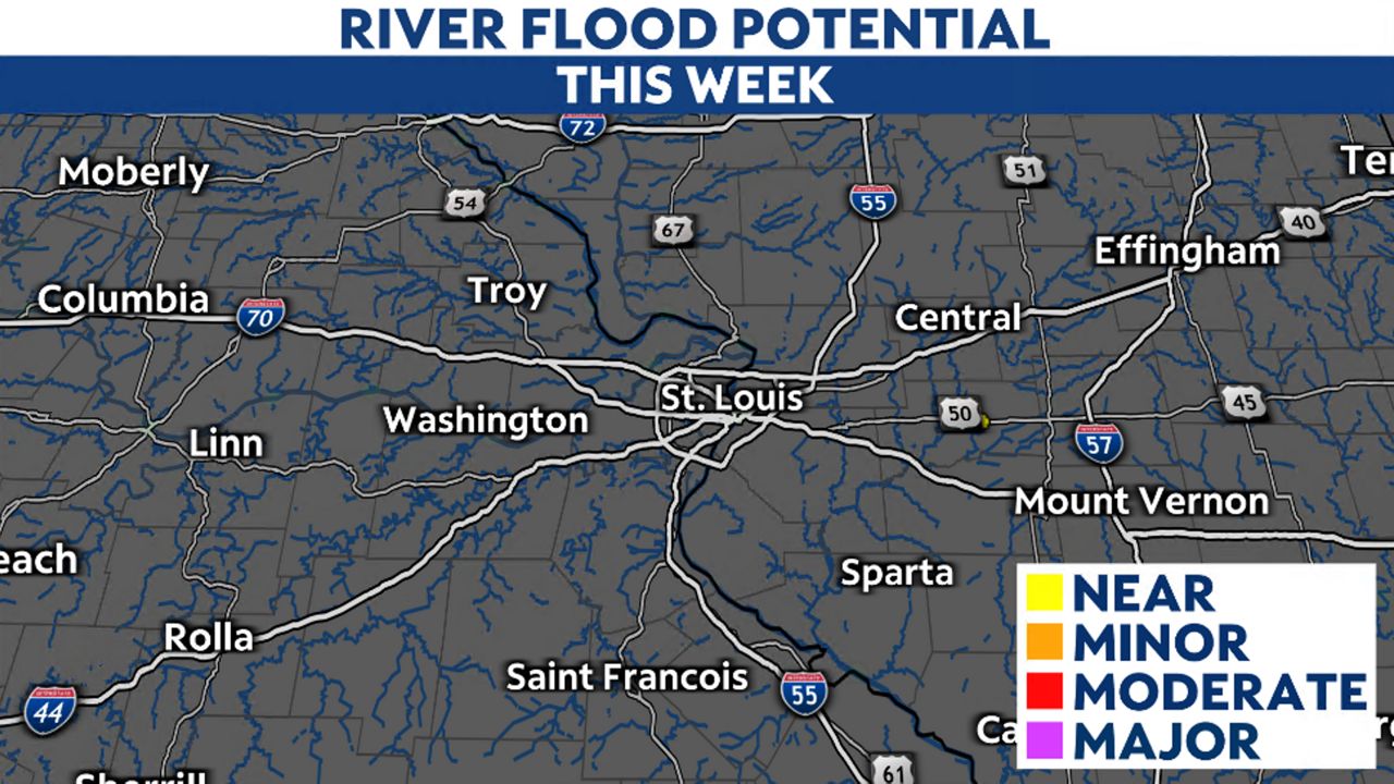
In the St. Louis area, several big rivers like the Mississippi, Missouri and Illinois are monitored for flooding potential and the tributaries that feed into them. Here’s what you need to know about St. Louis’ spring flood risk.
Fuchs and his team used several factors across the St. Louis region and upper Midwest combined with model guidance and historical trends to forecast the upcoming season. Some data included precipitation over the past 90 days, snowpack, soil moisture and the current flow in area rivers.
While December and January received appreciable precipitation, the months preceding were quite dry. Recent rain and snow events were not significant.
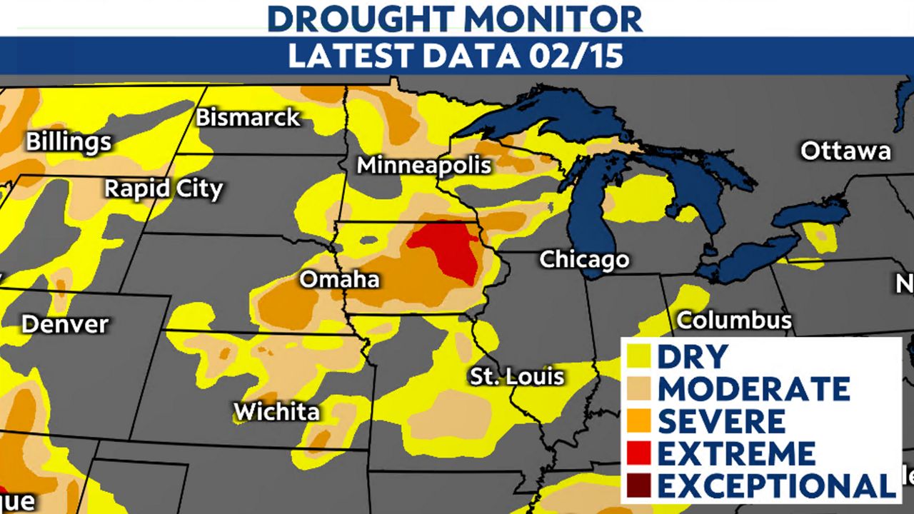
Although drought conditions in Missouri and Illinois have improved over the past few months, further north in Iowa, Minnesota and Wisconsin conditions remain dry. Iowa continues to display a large swath of extreme drought.
While December and January received appreciable precipitation, the months preceding were quite dry. Recent rain and snow events were not significant.
Although drought conditions in Missouri and Illinois have improved over the past few months, further north in Iowa, Minnesota and Wisconsin conditions remain dry. Iowa continues to display a large swath of extreme drought.
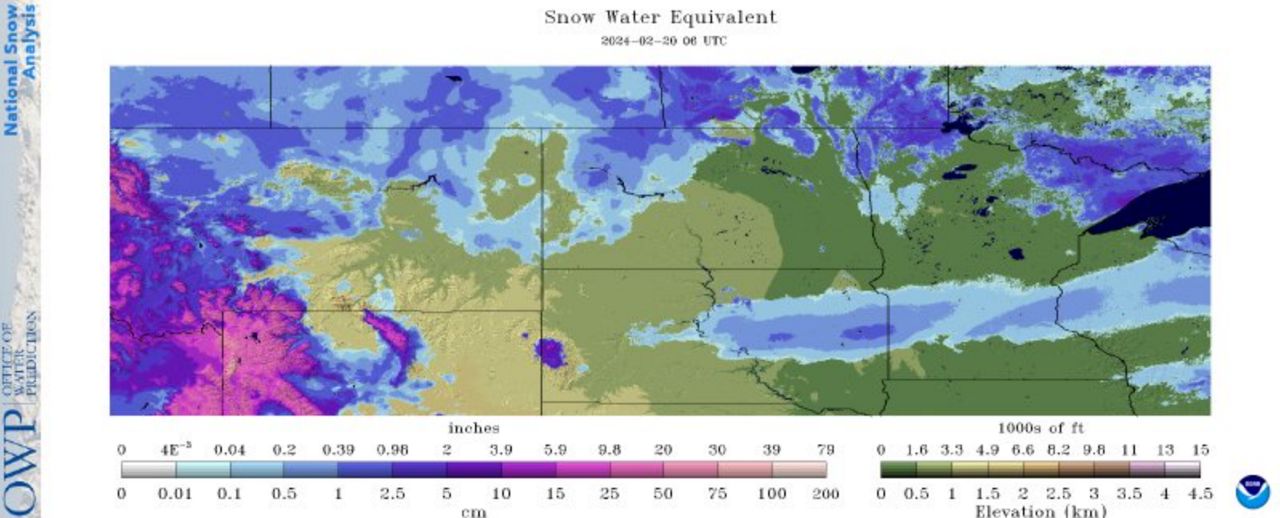
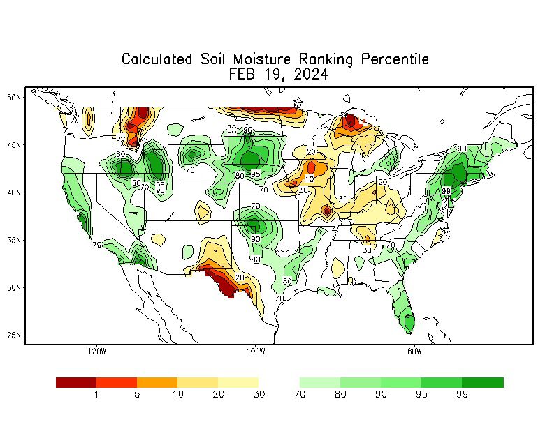
Along with the lack of snowpack and drought conditions, soil moisture remains dry. Some of the driest soil moisture is located just southwest of the St. Louis metro.
Stream flows through January were reflecting normal or slightly above average. However, in the past few weeks, most of the streams have dropped below the 25th percentile in parts of eastern Missouri and southwestern Illinois.
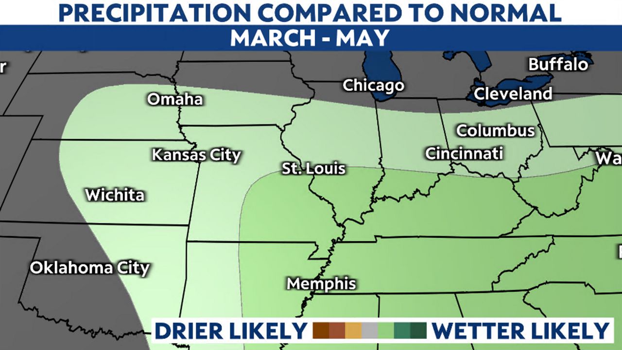
The climate signal for March isn’t clear one way or the other if it will be wetter or drier than normal. As for Meteorological Spring, the signal is showing wetter than normal conditions.
Using historical trends, Fuchs says that minor flooding would likely be the highest level of flooding reached this spring and he’s confident to add, “This does not look like a big year for spring flooding from the rivers and tributaries across the St. Louis region.”
However, he mentions that localized flooding from heavy thunderstorms in the spring is always possible. And adds, “This is just a snapshot of current conditions, and how, statistically, those conditions have played out when 30-60 years of precipitation data applies to those conditions.”
This information will continue to be assessed and spring flood outlooks will be updated every two weeks.
Our team of meteorologists dives deep into the science of weather and breaks down timely weather data and information. To view more weather and climate stories, check out our weather blogs section.
)